Directions to Tax Help Corp (Fairfax County) with public transportation
The following transit lines have routes that pass near Tax Help Corp
 Bus: 321, 322, 401, 402, 310.
- Train: MANASSAS LINE, FREDERICKSBURG LINE.
- Metro: BLUE.
How to get to Tax Help Corp by bus?
Click on the bus route to see step by step directions with maps, line arrival times and updated time schedules.
From The Westin Alexandria Old Town, Alexandria
66 minFrom Seven Corners Center (Seven Corners Shopping Center Falls Church VA), Fairfax County
65 minFrom Inova Fairfax Hospital North Tower Building, Fairfax County
45 minFrom Defense Health Headquarters (DHHQ), Fairfax County
66 minFrom Uspto, Alexandria
87 minFrom Inova Mount Vernon Hospital, Fairfax County
72 minFrom 8260 Willow Oaks Corporate Center, Fairfax County
51 minFrom Eisenhower Avenue Metro Station, Alexandria
62 minFrom Burke, VA, Fairfax County
45 minFrom AMC Theatres-Hoffman Center 22, Alexandria
62 min
How to get to Tax Help Corp by train?
Click on the train route to see step by step directions with maps, line arrival times and updated time schedules.
How to get to Tax Help Corp by metro?
Click on the metro route to see step by step directions with maps, line arrival times and updated time schedules.
Bus stops near Tax Help Corp in Fairfax County
- Commerce St @ Brandon Ave, 5 min walk,VIEW
- Franconia Rd W @ Pioneer Dr, 6 min walk,VIEW
- Amherst Ave @ Springfield Boulevard, 7 min walk,VIEW
- Springfield Hilton, 9 min walk,VIEW
- Springfield Cbc Garage And Tc Bay D, 10 min walk,VIEW
- Springfield Cbc Garage And Tc Bay E, 18 min walk,VIEW
- Springfield Cbc Garage And Tc Bay C, 18 min walk,VIEW
Metro station near Tax Help Corp in Fairfax County
- Franconia-Springfield Metro, 37 min walk,VIEW
Train stations near Tax Help Corp in Fairfax County
Bus lines to Tax Help Corp in Fairfax County
- 401, 401 Tysons West Park,VIEW
- 321, 321 Franconia - Springfield,VIEW
- 402, 402 Franconia- Springfield,VIEW
- 310, 310 Rolling Vly Park & Ride,VIEW
- 322, 322 Franconia- Springfield Via Kingstowne,VIEW
- 350, 350 Springfield Town Center - Hilton,VIEW
- 393, 393 Mark Ctr - Pentagon,VIEW
- 494, 494 Tysons Metro,VIEW
- 396, 396 Springfield,VIEW
What are the closest stations to Tax Help Corp?
The closest stations to Tax Help Corp are:
- Franconia Rd W @ Pioneer Dr is 390 yards away, 6 min walk.
- Commerce St @ Brandon Ave is 392 yards away, 5 min walk.
- Amherst Ave @ Springfield Boulevard is 511 yards away, 7 min walk.
- Springfield Hilton is 665 yards away, 9 min walk.
- Springfield Cbc Garage And Tc Bay D is 783 yards away, 10 min walk.
- Springfield Cbc Garage And Tc Bay E is 1480 yards away, 18 min walk.
- Springfield Cbc Garage And Tc Bay C is 1491 yards away, 18 min walk.
- Franconia-Springfield Metro is 3153 yards away, 37 min walk.
- Franconia-Springfield Vre Station is 3291 yards away, 41 min walk.
- Backlick Road Station is 3785 yards away, 44 min walk.
Which bus lines stop near Tax Help Corp?
These bus lines stop near Tax Help Corp: 321, 322, 401, 402.
Which train line stops near Tax Help Corp?
MANASSAS LINE (Broad Run)
Which metro line stops near Tax Help Corp?
BLUE (Franconia-Springfield)
What’s the nearest bus station to Tax Help Corp in Fairfax County?
The nearest bus station to Tax Help Corp in Fairfax County is Franconia Rd W @ Pioneer Dr. It’s a 6 min walk away.
What time is the first metro to Tax Help Corp in Fairfax County?
The BLUE is the first metro that goes to Tax Help Corp in Fairfax County. It stops nearby at 5:00 AM.
What time is the last metro to Tax Help Corp in Fairfax County?
The BLUE is the last metro that goes to Tax Help Corp in Fairfax County. It stops nearby at 12:44 AM.
What time is the first train to Tax Help Corp in Fairfax County?
The MANASSAS LINE is the first train that goes to Tax Help Corp in Fairfax County. It stops nearby at 5:42 AM.
What time is the last train to Tax Help Corp in Fairfax County?
The MANASSAS LINE is the last train that goes to Tax Help Corp in Fairfax County. It stops nearby at 7:34 PM.
What time is the first bus to Tax Help Corp in Fairfax County?
The 401 is the first bus that goes to Tax Help Corp in Fairfax County. It stops nearby at 3:35 AM.
What time is the last bus to Tax Help Corp in Fairfax County?
The 402 is the last bus that goes to Tax Help Corp in Fairfax County. It stops nearby at 2:23 AM.
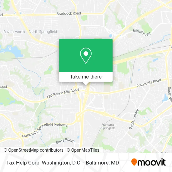
See Tax Help Corp, Fairfax County, on the map
Public Transit to Tax Help Corp in Fairfax County
Wondering how to get to Tax Help Corp in Fairfax County? Moovit helps you find the best way to get to Tax Help Corp with step-by-step directions from the nearest public transit station.
Moovit provides free maps and live directions to help you navigate through your city. View schedules, routes, timetables, and find out how long does it take to get to Tax Help Corp in real time.
Looking for the nearest stop or station to Tax Help Corp? Check out this list of stops closest to your destination: Franconia Rd W @ Pioneer Dr; Commerce St @ Brandon Ave; Amherst Ave @ Springfield Boulevard; Springfield Hilton; Springfield Cbc Garage And Tc Bay D; Springfield Cbc Garage And Tc Bay E; Springfield Cbc Garage And Tc Bay C; Franconia-Springfield Metro; Franconia-Springfield Vre Station; Backlick Road Station.
Bus: 321, 322, 401, 402, 310.Train: MANASSAS LINE, FREDERICKSBURG LINE.Metro: BLUE.
Want to see if there’s another route that gets you there at an earlier time? Moovit helps you find alternative routes or times. Get directions from and directions to Tax Help Corp easily from the Moovit App or Website.
We make riding to Tax Help Corp easy, which is why over 1.7 million users, including users in Fairfax County, trust Moovit as the best app for public transit. You don’t need to download an individual bus app or train app, Moovit is your all-in-one transit app that helps you find the best bus time or train time available.
For information on prices of bus, metro and train, costs and ride fares to Tax Help Corp, please check the Moovit app.
Use the app to navigate to popular places including to the airport, hospital, stadium, grocery store, mall, coffee shop, school, college, and university.
Tax Help Corp Address: 6320 Augusta Dr street in Fairfax County
- Premier Plaza I,
- [I-95] Exit 169 – Franconia / Springfield,
- Talbots Outlet,
- Franconia Old Keene Mill Rd,
- ALDI,
- Purifox,
- Homewood Suites-Springfield (Homewood Suites by Hilton),
- Wingate by Wyndham Springfield,
- Homewood Suites by Hilton Springfield, Va,
- Mike's American Grill,
- Kaiser Permanente - Springfield Medical Center,
- American Legion Post 176,
- Springfield Commuter Garage,
- Springfield Mall,
- Springfield Mall (franconia / Springfield Mall),
- Springfield Plaza,
- Shell Recharge,
- Shell Recharge,
- Yard House,
- Lego Discovery Center Washington, D.C.
Places Near Tax Help Corp (Fairfax County)
- National Zoo, Washington,
- Basilica of the National Shrine, Washington,
- Camden Yards, Baltimore,
- National Museum of African American History and Culture, Washington,
- Westfield Montgomery Mall, Montgomery County,
- Museum Of The Bible, Washington,
- Washington National Cathedral, Washington,
- Pennsylvania Ave NW (3rd st and pennsylvania), Washington,
- The Anthem, Washington,
- Sibley Memorial Hospital, Washington,
- National Theatre, Washington,
- M&T Bank Stadium, Baltimore,
- Washington DC VA Medical Center, Washington,
- Amazon Hq2, Arlington County,
- Warner Theatre, Washington,
- Marriott Marquis Washington, DC, Washington,
- Rock Creek Tennis Center, Washington,
- Capital One Arena, Washington,
- Georgetown, Washington,
- PG Mall, Prince George's County
How to get to popular places in Washington, D.C. - Baltimore, MD with public transit
Get around Fairfax County by public transit!
Traveling around Fairfax County has never been so easy. See step by step directions as you travel to any attraction, street or major public transit station. View bus and train schedules, arrival times, service alerts and detailed routes on a map, so you know exactly how to get to anywhere in Fairfax County.
When traveling to any destination around Fairfax County use Moovit's Live Directions with Get Off Notifications to know exactly where and how far to walk, how long to wait for your line, and how many stops are left. Moovit will alert you when it's time to get off — no need to constantly re-check whether yours is the next stop.
Wondering how to use public transit in Fairfax County or how to pay for public transit in Fairfax County? Moovit public transit app can help you navigate your way with public transit easily, and at minimum cost. It includes public transit fees, ticket prices, and costs. Looking for a map of Fairfax County public transit lines? Moovit public transit app shows all public transit maps in Fairfax County with all Bus, Train, Metro, Light Rail and Ferry routes and stops on an interactive map.
Washington, D.C. - Baltimore, MD has 5 transit type(s), including: Bus, Train, Metro, Light Rail and Ferry, operated by several transit agencies, including WMATA, Montgomery County Ride On, Fairfax Connector, TheBus, PRTC, DASH - Alexandria, Arlington Transit (ART), RTA of Central Maryland, MDOT MTA, MDOT MTA Light RailLink, MDOT MTA Commuter Bus, MDOT MTA Local Bus, FXBGO!, Virginia Railway Express (VRE) and MARC