How to get to Taxiphone Cyber by bus?
Click on the bus route to see step by step directions with maps, line arrival times and updated time schedules.
From Hôpital Robert Ballanger, Villepinte
71 minFrom Orange Stadium, Saint-Denis
76 minFrom Ikea Paris Nord, Sarcelles
29 minFrom La Courneuve, La Courneuve
63 minFrom Studios du Lendit, Saint-Denis
77 minFrom Marché, Sevran
75 minFrom Centre Cardiologique du Nord, Saint-Denis
69 minFrom Hôpital Delafontaine, Saint-Denis
79 minFrom Centre Cardiologique du Nord, Saint-Denis
69 minFrom centre CIFA, Aubervilliers
94 min
Bus stops near Taxiphone Cyber in Sarcelles
RER station near Taxiphone Cyber in Sarcelles
- Villiers-Le-Bel - Gonesse - Arnouville, 14 min walk,VIEW
Bus lines to Taxiphone Cyber in Sarcelles
- 22, Gare De Villiers-Le-Bel Gonesse Arnouville - Gare De Roissypole - Aéroport Cdg 1 (d1),VIEW
- 24, Gare De Villiers-Le-Bel Gonesse Arnouville - Gare De Villiers-Le-Bel Gonesse Arnouville,VIEW
- 24 S, Place Sangnier - Saint Blin (lycée René Cassin),VIEW
- 27, Roissypole - Aéroport Cdg1 (d2) - Puits La Marlière,VIEW
- FILÉO VLB, Puits La Marlière - Roissypole - Aéroport Cdg1 (d2),VIEW
- 370, Villiers Le Bel - Gonesse - Arnouville RER,VIEW
What are the closest stations to Taxiphone Cyber?
The closest stations to Taxiphone Cyber are:
- Place Sangnier is 171 meters away, 3 min walk.
- Rue Scribe is 320 meters away, 5 min walk.
- Square Charles Perrault is 608 meters away, 8 min walk.
- Villiers-Le-Bel - Gonesse - Arnouville is 1086 meters away, 14 min walk.
Which RER line stops near Taxiphone Cyber?
D (Malesherbes/ Melun/ Corbeil-Essonnes /Juvisy)
Which bus lines stop near Taxiphone Cyber?
These bus lines stop near Taxiphone Cyber: 20, 22, 23, 24, 268, 27.
What’s the nearest bus station to Taxiphone Cyber in Sarcelles?
The nearest bus station to Taxiphone Cyber in Sarcelles is Place Sangnier. It’s a 3 min walk away.
What’s the nearest RER station to Taxiphone Cyber in Sarcelles?
The nearest RER station to Taxiphone Cyber in Sarcelles is Villiers-Le-Bel - Gonesse - Arnouville. It’s a 14 min walk away.
What time is the first bus to Taxiphone Cyber in Sarcelles?
The FILÉO VLB is the first bus that goes to Taxiphone Cyber in Sarcelles. It stops nearby at 3:19 AM.
What time is the last bus to Taxiphone Cyber in Sarcelles?
The FILÉO VLB is the last bus that goes to Taxiphone Cyber in Sarcelles. It stops nearby at 2:57 AM.
What time is the first RER to Taxiphone Cyber in Sarcelles?
The D is the first RER that goes to Taxiphone Cyber in Sarcelles. It stops nearby at 5:05 AM.
What time is the last RER to Taxiphone Cyber in Sarcelles?
The D is the last RER that goes to Taxiphone Cyber in Sarcelles. It stops nearby at 11:14 PM.
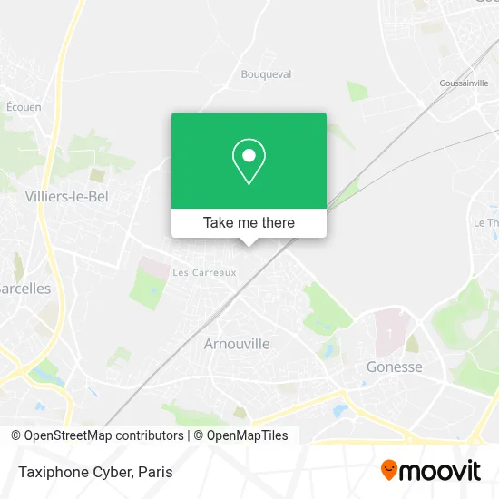
See Taxiphone Cyber, Sarcelles, on the map
Public Transit to Taxiphone Cyber in Sarcelles
Wondering how to get to Taxiphone Cyber in Sarcelles? Moovit helps you find the best way to get to Taxiphone Cyber with step-by-step directions from the nearest public transit station.
Moovit provides free maps and live directions to help you navigate through your city. View schedules, routes, timetables, and find out how long does it take to get to Taxiphone Cyber in real time.
Looking for the nearest stop or station to Taxiphone Cyber? Check out this list of stops closest to your destination: Place Sangnier; Rue Scribe; Square Charles Perrault; Villiers-Le-Bel - Gonesse - Arnouville.
RER: D.Bus: 20, 22, 23, 24, 268, 27, 24 S, FILÉO VLB, 370.
Want to see if there’s another route that gets you there at an earlier time? Moovit helps you find alternative routes or times. Get directions from and directions to Taxiphone Cyber easily from the Moovit App or Website.
We make riding to Taxiphone Cyber easy, which is why over 1.5 million users, including users in Sarcelles, trust Moovit as the best app for public transit. You don’t need to download an individual bus app or train app, Moovit is your all-in-one transit app that helps you find the best bus time or train time available.
For information on prices of bus, RER and light rail, costs and ride fares to Taxiphone Cyber, please check the Moovit app.
Use the app to navigate to popular places including to the airport, hospital, stadium, grocery store, mall, coffee shop, school, college, and university.
Taxiphone Cyber Address: Place de la République street in Sarcelles
- Place de la République,
- 9 Place Aimé Césaire,
- Cinéma Jacques-Prévert,
- Rue Georges Clemenceau,
- 17 Place Marc Sangnier,
- Résidence la Fauconnière,
- Hevel Drive,
- 33 Square des Sports,
- Boutique de la Ressourcerie Imaj,
- Square La Garenne,
- 5 Square Nord,
- Restaurant Scolaire,
- Rouvio Clement,
- Judo Club de Gonesse,
- 6 Avenue du Maréchal Foch,
- Mg Boucherie,
- 23 Rue Scribe,
- 17 Avenue Léon Blum,
- RER Villiers-le-Bel – Gonesse – Arnouville [D],
- Hauroo Harris
Places Near Taxiphone Cyber (Sarcelles)
- Hopital Foch, Suresnes,
- 29 Rue Manin, Paris,
- Hôpital Necker, Paris,
- Hôpital Beaujon, Clichy,
- Hôpital Cochin, Paris,
- Galeries Lafayette Haussmann, Paris,
- Hôpital Henri Mondor, Creteil,
- Marché Saint-Pierre, Paris,
- Hopital Lariboisière, Paris,
- Théâtre Mogador, Paris,
- Hôpital de la Pitié-Salpêtrière, Paris,
- Gare Routière Flixbus, Paris,
- Hôpital Pitié Salpêtrière, Paris,
- Fondation Louis Vuitton, Paris,
- Centre Hospitalier des 15/20, Paris,
- Hôpital Saint-Joseph, Paris,
- Beaugrenelle, Paris,
- Atelier Des Lumieres, Paris,
- Galeries Lafayette, Paris,
- Créteil Soleil, Creteil
How to get to popular places in Paris with public transit
Get around Sarcelles by public transit!
Traveling around Sarcelles has never been so easy. See step by step directions as you travel to any attraction, street or major public transit station. View bus and train schedules, arrival times, service alerts and detailed routes on a map, so you know exactly how to get to anywhere in Sarcelles.
When traveling to any destination around Sarcelles use Moovit's Live Directions with Get Off Notifications to know exactly where and how far to walk, how long to wait for your line, and how many stops are left. Moovit will alert you when it's time to get off — no need to constantly re-check whether yours is the next stop.
Wondering how to use public transit in Sarcelles or how to pay for public transit in Sarcelles? Moovit public transit app can help you navigate your way with public transit easily, and at minimum cost. It includes public transit fees, ticket prices, and costs. Looking for a map of Sarcelles public transit lines? Moovit public transit app shows all public transit maps in Sarcelles with all Bus, Train, Metro, Light Rail, RER, Funicular and Gondola routes and stops on an interactive map.
Paris has 7 transit type(s), including: Bus, Train, Metro, Light Rail, RER, Funicular and Gondola, operated by several transit agencies, including RATP, RER, RER Bus de remplacement, Train, Train Bus de remplacement, Tramway Bus de remplacement, TER, ADP, Magical Shuttle, Argenteuil - Boucles de Seine, Autocars Dominique, Bièvre, Brie et 2 Morin, Le Bus - C.C. du Clermontois and Cœur d’Essonne