How to get to Tcl Towing And Recovery by bus?
Click on the bus route to see step by step directions with maps, line arrival times and updated time schedules.
From St Elizabeths Hospital, Washington
69 minFrom Ballou High School, Washington
71 minFrom I-295 Exit 1 - Naval Research Lab, Washington
67 minFrom THEARC, Washington
61 minFrom Malcolm X Park, Washington
83 minFrom U.S. Census Bureau, Prince George's County
58 minFrom Fort Washington, MD, Prince George's County
63 minFrom The Capital Wheel at the National Harbor, Prince George's County
71 minFrom Oxon Hill Rivertowne, Prince George's County
35 minFrom Iverson Mall, Prince George's County
37 min
Bus stops near Tcl Towing And Recovery in Prince George's County
Bus lines to Tcl Towing And Recovery in Prince George's County
What are the closest stations to Tcl Towing And Recovery?
The closest stations to Tcl Towing And Recovery are:
- Old Alexandria Ferry Road at Malcolm Road is 985 yards away, 12 min walk.
- Old Branch Avenue at Coventry Way is 1377 yards away, 17 min walk.
Which bus lines stop near Tcl Towing And Recovery?
These bus lines stop near Tcl Towing And Recovery: P84, P86.
What’s the nearest bus station to Tcl Towing And Recovery in Prince George's County?
The nearest bus station to Tcl Towing And Recovery in Prince George's County is Old Alexandria Ferry Road at Malcolm Road. It’s a 12 min walk away.
What time is the first bus to Tcl Towing And Recovery in Prince George's County?
The P86 is the first bus that goes to Tcl Towing And Recovery in Prince George's County. It stops nearby at 6:11 AM.
What time is the last bus to Tcl Towing And Recovery in Prince George's County?
The P86 is the last bus that goes to Tcl Towing And Recovery in Prince George's County. It stops nearby at 8:34 PM.
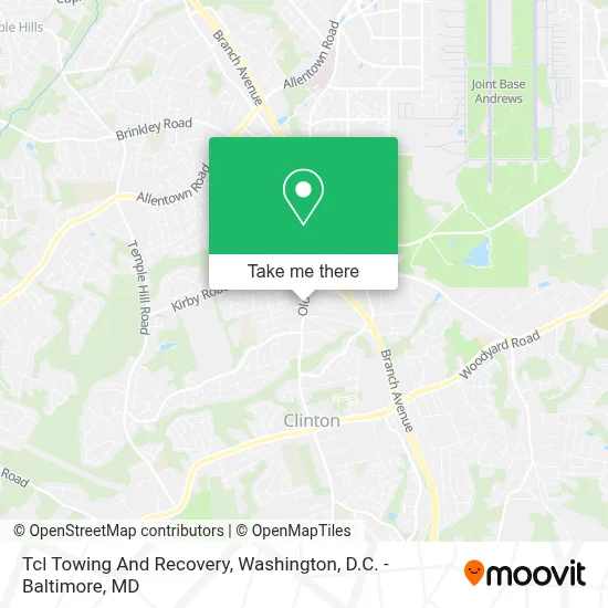
See Tcl Towing And Recovery, Prince George's County, on the map
Public Transit to Tcl Towing And Recovery in Prince George's County
Wondering how to get to Tcl Towing And Recovery in Prince George's County? Moovit helps you find the best way to get to Tcl Towing And Recovery with step-by-step directions from the nearest public transit station.
Moovit provides free maps and live directions to help you navigate through your city. View schedules, routes, timetables, and find out how long does it take to get to Tcl Towing And Recovery in real time.
Looking for the nearest stop or station to Tcl Towing And Recovery? Check out this list of stops closest to your destination: Old Alexandria Ferry Road at Malcolm Road; Old Branch Avenue at Coventry Way.
Bus: P84, P86.
Want to see if there’s another route that gets you there at an earlier time? Moovit helps you find alternative routes or times. Get directions from and directions to Tcl Towing And Recovery easily from the Moovit App or Website.
We make riding to Tcl Towing And Recovery easy, which is why over 1.7 million users, including users in Prince George's County, trust Moovit as the best app for public transit. You don’t need to download an individual bus app or train app, Moovit is your all-in-one transit app that helps you find the best bus time or train time available.
For information on prices of bus and metro, costs and ride fares to Tcl Towing And Recovery, please check the Moovit app.
Use the app to navigate to popular places including to the airport, hospital, stadium, grocery store, mall, coffee shop, school, college, and university.
Tcl Towing And Recovery Address: 7929 Old Branch Ave street in Prince George's County
- Kirby Road @ Old Branch Avenue,
- Virginia Gate Andrews AFB,
- Branch Avenue (MD 5),
- TownePlace Suites by Marriott Clinton at Joint Base Andrews,
- Walmart,
- Walmart Clinton - Branch Ave,
- Vehicle Emissions Inspection Program (VEIP) Station,
- Clinton MD-223,
- B.K. Miller's Meats & Liquors,
- BK Miller Meats & Liquor (Bk Miller Meats And Liquors),
- Clinton, MD,
- Surratt House,
- Super Beauty,
- Supreme Barbeque- Aunteaboba MD,
- Surrattsville High School,
- Clinton Park and Ride Lot & Bus Bay B,
- Clinton Park & Ride,
- The Den (Road Wolves MC Clubhouse),
- Clinton, Maryland,
- Air Force One Hangar (New)
Places Near Tcl Towing And Recovery (Prince George's County)
- Washington DC VA Medical Center, Washington,
- The Anthem, Washington,
- Capital One Arena, Washington,
- National Museum of African American History and Culture, Washington,
- Museum Of The Bible, Washington,
- PG Mall, Prince George's County,
- National Theatre, Washington,
- Pennsylvania Ave NW (3rd st and pennsylvania), Washington,
- M&T Bank Stadium, Baltimore,
- Georgetown, Washington,
- Sibley Memorial Hospital, Washington,
- Marriott Marquis Washington, DC, Washington,
- Washington National Cathedral, Washington,
- Westfield Montgomery Mall, Montgomery County,
- Rock Creek Tennis Center, Washington,
- National Zoo, Washington,
- Basilica of the National Shrine, Washington,
- Amazon Hq2, Arlington County,
- Camden Yards, Baltimore,
- Warner Theatre, Washington
How to get to popular places in Washington, D.C. - Baltimore, MD with public transit
Get around Prince George's County by public transit!
Traveling around Prince George's County has never been so easy. See step by step directions as you travel to any attraction, street or major public transit station. View bus and train schedules, arrival times, service alerts and detailed routes on a map, so you know exactly how to get to anywhere in Prince George's County.
When traveling to any destination around Prince George's County use Moovit's Live Directions with Get Off Notifications to know exactly where and how far to walk, how long to wait for your line, and how many stops are left. Moovit will alert you when it's time to get off — no need to constantly re-check whether yours is the next stop.
Wondering how to use public transit in Prince George's County or how to pay for public transit in Prince George's County? Moovit public transit app can help you navigate your way with public transit easily, and at minimum cost. It includes public transit fees, ticket prices, and costs. Looking for a map of Prince George's County public transit lines? Moovit public transit app shows all public transit maps in Prince George's County with all Bus, Train, Metro, Light Rail and Ferry routes and stops on an interactive map.
Washington, D.C. - Baltimore, MD has 5 transit type(s), including: Bus, Train, Metro, Light Rail and Ferry, operated by several transit agencies, including WMATA, Montgomery County Ride On, Fairfax Connector, TheBus, PRTC, DASH - Alexandria, Arlington Transit (ART), RTA of Central Maryland, MDOT MTA, MDOT MTA Light RailLink, MDOT MTA Commuter Bus, MDOT MTA Local Bus, FXBGO!, Virginia Railway Express (VRE) and MARC