How to get to Teachers College Community Language Program by bus?
Click on the bus route to see step by step directions with maps, line arrival times and updated time schedules.
From Katz's Delicatessen, Manhattan
68 minFrom Resorts World Shuttle Bus, Queens
84 minFrom City Winery, Manhattan
80 minFrom Pier 40, Manhattan
81 minFrom Greene Street, Manhattan
86 minFrom Walmart, Manhattan
77 minFrom Fifth Avenue, Manhattan
52 minFrom Mercury Lounge, Manhattan
69 minFrom 520 E 70th St, Manhattan
54 minFrom Museum Of the Moving Image, Queens
61 min
How to get to Teachers College Community Language Program by train?
Click on the train route to see step by step directions with maps, line arrival times and updated time schedules.
How to get to Teachers College Community Language Program by subway?
Click on the subway route to see step by step directions with maps, line arrival times and updated time schedules.
From Katz's Delicatessen, Manhattan
46 minFrom Resorts World Shuttle Bus, Queens
55 minFrom City Winery, Manhattan
36 minFrom Pier 40, Manhattan
40 minFrom Greene Street, Manhattan
40 minFrom Walmart, Manhattan
39 minFrom Fifth Avenue, Manhattan
39 minFrom Mercury Lounge, Manhattan
47 minFrom 520 E 70th St, Manhattan
48 minFrom Museum Of the Moving Image, Queens
52 min
Bus stops near Teachers College Community Language Program in Manhattan
Subway stations near Teachers College Community Language Program in Manhattan
Bus lines to Teachers College Community Language Program in Manhattan
What are the closest stations to Teachers College Community Language Program?
The closest stations to Teachers College Community Language Program are:
- Broadway/W 120 St is 149 yards away, 2 min walk.
- Amsterdam Av/W 120 St is 198 yards away, 3 min walk.
- Riverside Dr/W 119 St is 398 yards away, 5 min walk.
- 116 St-Columbia University is 442 yards away, 6 min walk.
- 116 St is 1097 yards away, 13 min walk.
- 125 St is 1393 yards away, 17 min walk.
Which bus lines stop near Teachers College Community Language Program?
These bus lines stop near Teachers College Community Language Program: M11, M4, M5, M60-SBS.
Which train lines stop near Teachers College Community Language Program?
These train lines stop near Teachers College Community Language Program: 2, 3.
Which subway line stops near Teachers College Community Language Program?
1 (Uptown & The Bronx)
What’s the nearest subway station to Teachers College Community Language Program in Manhattan?
The nearest subway station to Teachers College Community Language Program in Manhattan is 116 St-Columbia University. It’s a 6 min walk away.
What’s the nearest bus station to Teachers College Community Language Program in Manhattan?
The nearest bus station to Teachers College Community Language Program in Manhattan is Broadway/W 120 St. It’s a 2 min walk away.
What time is the first subway to Teachers College Community Language Program in Manhattan?
The 1 is the first subway that goes to Teachers College Community Language Program in Manhattan. It stops nearby at 3:04 AM.
What time is the last subway to Teachers College Community Language Program in Manhattan?
The A is the last subway that goes to Teachers College Community Language Program in Manhattan. It stops nearby at 4:14 AM.
What time is the first bus to Teachers College Community Language Program in Manhattan?
The M60-SBS is the first bus that goes to Teachers College Community Language Program in Manhattan. It stops nearby at 3:12 AM.
What time is the last bus to Teachers College Community Language Program in Manhattan?
The M60-SBS is the last bus that goes to Teachers College Community Language Program in Manhattan. It stops nearby at 3:14 AM.
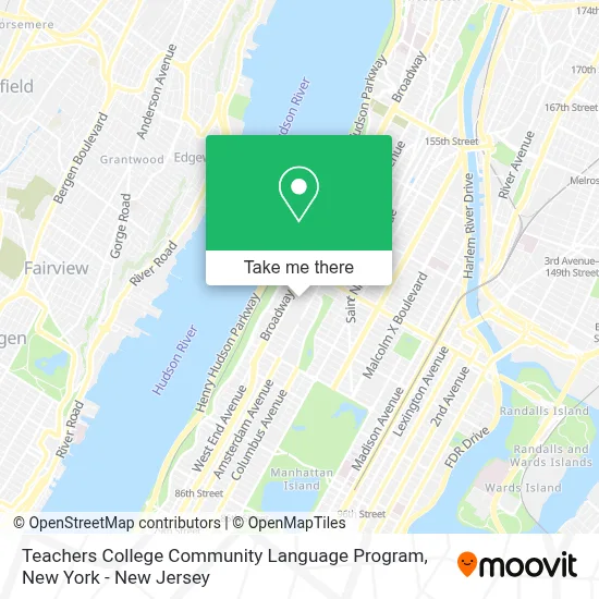
See Teachers College Community Language Program, Manhattan, on the map
Public Transit to Teachers College Community Language Program in Manhattan
Wondering how to get to Teachers College Community Language Program in Manhattan? Moovit helps you find the best way to get to Teachers College Community Language Program with step-by-step directions from the nearest public transit station.
Moovit provides free maps and live directions to help you navigate through your city. View schedules, routes, timetables, and find out how long does it take to get to Teachers College Community Language Program in real time.
Looking for the nearest stop or station to Teachers College Community Language Program? Check out this list of stops closest to your destination: Broadway/W 120 St; Amsterdam Av/W 120 St; Riverside Dr/W 119 St; 116 St-Columbia University; 116 St; 125 St.
Bus: M11, M4, M5, M60-SBS, M104.Train: 2, 3.Subway: 1, A, B, C, D.
Want to see if there’s another route that gets you there at an earlier time? Moovit helps you find alternative routes or times. Get directions from and directions to Teachers College Community Language Program easily from the Moovit App or Website.
We make riding to Teachers College Community Language Program easy, which is why over 1.5 million users, including users in Manhattan, trust Moovit as the best app for public transit. You don’t need to download an individual bus app or train app, Moovit is your all-in-one transit app that helps you find the best bus time or train time available.
For information on prices of subway, bus and train, costs and ride fares to Teachers College Community Language Program, please check the Moovit app.
Use the app to navigate to popular places including to the airport, hospital, stadium, grocery store, mall, coffee shop, school, college, and university.
Teachers College Community Language Program Address: 525 W 120th St street in Manhattan
- Language Program Certificates at Teachers College, Columbia University,
- Singers' Workshops at Tc,
- Center For Educational Equity,
- Department Of Arts and Humanities, Teachers College, Columbia University,
- Graduate Student Life & Development, Teachers College,
- Summer Principals Academy Nyc at Teachers College, Columbia University,
- Coalition Of Latinx Scholars at Teachers College, Columbia University,
- Spirituality Mind Body Institute at Teachers College, Columbia University,
- Peace Corps Fellows Program at Teachers College, Columbia University,
- Morton Deutsch International Center For Cooperation & Conflict Resolution,
- The Hechinger Report,
- Tc Adult Learning and Leadership Program,
- Teachers College Anthropology and Education Program,
- Applied Linguistics and Tesol Program,
- Macy Art Gallery,
- Zankel Hall,
- Dean Hope Center For Educational & Psychological Services,
- Teachers College Office Of Admission,
- Neurorehabilitation Research Laboratory,
- Fluency Stuttering Center
Places Near Teachers College Community Language Program (Manhattan)
- Queens Center Mall, Queens,
- Rockefeller Center, Manhattan,
- Hudson Yards, Manhattan,
- qqqq, Manhattan,
- 376 Hudson Street, Manhattan,
- 3 Stone St, Manhattan,
- Pier 83, Manhattan,
- Wall Street, Manhattan,
- Bellevue Hospital, Manhattan,
- Mountainside Hospital, Glen Ridge,
- 111 Centre New York City Supreme Court, Manhattan,
- 66 John Street, Manhattan,
- Katz's Deli, Manhattan,
- SoHo, Manhattan,
- Times Square, Manhattan,
- 1 Police Plaza, Manhattan,
- Chinatown, Manhattan,
- 911 Memorial, Manhattan,
- 26 Federal Plaza, Manhattan,
- San Gennaro Feast, Manhattan
How to get to popular places in New York - New Jersey with public transit
Get around Manhattan by public transit!
Traveling around Manhattan has never been so easy. See step by step directions as you travel to any attraction, street or major public transit station. View bus and train schedules, arrival times, service alerts and detailed routes on a map, so you know exactly how to get to anywhere in Manhattan.
When traveling to any destination around Manhattan use Moovit's Live Directions with Get Off Notifications to know exactly where and how far to walk, how long to wait for your line, and how many stops are left. Moovit will alert you when it's time to get off — no need to constantly re-check whether yours is the next stop.
Wondering how to use public transit in Manhattan or how to pay for public transit in Manhattan? Moovit public transit app can help you navigate your way with public transit easily, and at minimum cost. It includes public transit fees, ticket prices, and costs. Looking for a map of Manhattan public transit lines? Moovit public transit app shows all public transit maps in Manhattan with all Bus, Train, Subway, Light Rail, Ferry and Cable Car routes and stops on an interactive map.
New York - New Jersey has 6 transit type(s), including: Bus, Train, Subway, Light Rail, Ferry and Cable Car, operated by several transit agencies, including MTA Subway, Metro-North Railroad, LIRR, PATH, MTA New York City Transit - Express routes, MTA Bus, NJ Transit, NYC Ferry, NICE bus, Bee-Line Bus, NJ Transit Rail, Norwalk Transit District, Hartford Line, River Valley Transit and HART