How to get to Techne Dental by bus?
Click on the bus route to see step by step directions with maps, line arrival times and updated time schedules.
From Wheaton, Maryland, Montgomery County
35 minFrom Glenstone Museum, Montgomery County
58 minFrom Pike & Rose (Pike and Rose), Montgomery County
40 minFrom Kentlands, Montgomery County
58 minFrom Montgomery Village, Maryland, Montgomery County
48 minFrom Adventist HealthCare Shady Grove Medical Center, Montgomery County
40 minFrom Kaiser Permanente - Gaithersburg Medical Center, Montgomery County
70 minFrom Westfield Montgomery (Montgomery Mall), Montgomery County
41 minFrom Washington DC Temple, Montgomery County
72 minFrom Westfield Montgomery Mall, Montgomery County
43 min
How to get to Techne Dental by train?
Click on the train route to see step by step directions with maps, line arrival times and updated time schedules.
How to get to Techne Dental by metro?
Click on the metro route to see step by step directions with maps, line arrival times and updated time schedules.
Bus stops near Techne Dental in Montgomery County
Metro station near Techne Dental in Montgomery County
- Twinbrook - Parklawn Dr &Amp; Wicomico Ave, 11 min walk,VIEW
Train station near Techne Dental in Montgomery County
- Rockville - S Stonestreet Ave &Amp; Park Rd, 53 min walk,VIEW
Bus lines to Techne Dental in Montgomery County
What are the closest stations to Techne Dental?
The closest stations to Techne Dental are:
- E Gude Dr & Rothgeb Dr is 265 yards away, 4 min walk.
- Taft St & Lofstrand Ln is 758 yards away, 10 min walk.
- Twinbrook - Parklawn Dr &Amp; Wicomico Ave is 903 yards away, 11 min walk.
- Norbeck Rd & Gude Dr is 1207 yards away, 14 min walk.
- Rockville - S Stonestreet Ave &Amp; Park Rd is 4440 yards away, 53 min walk.
Which bus lines stop near Techne Dental?
These bus lines stop near Techne Dental: 48, 59.
Which train line stops near Techne Dental?
MARC (Outbound - Washington)
Which metro line stops near Techne Dental?
RED (Shady Grove)
What’s the nearest metro station to Techne Dental in Montgomery County?
The nearest metro station to Techne Dental in Montgomery County is Twinbrook - Parklawn Dr &Amp; Wicomico Ave. It’s a 11 min walk away.
What’s the nearest bus station to Techne Dental in Montgomery County?
The nearest bus station to Techne Dental in Montgomery County is E Gude Dr & Rothgeb Dr. It’s a 4 min walk away.
What time is the first metro to Techne Dental in Montgomery County?
The RED is the first metro that goes to Techne Dental in Montgomery County. It stops nearby at 5:00 AM.
What time is the last metro to Techne Dental in Montgomery County?
The RED is the last metro that goes to Techne Dental in Montgomery County. It stops nearby at 12:40 AM.
What time is the first train to Techne Dental in Montgomery County?
The MARC is the first train that goes to Techne Dental in Montgomery County. It stops nearby at 5:39 AM.
What time is the last train to Techne Dental in Montgomery County?
The MARC is the last train that goes to Techne Dental in Montgomery County. It stops nearby at 7:50 PM.
What time is the first bus to Techne Dental in Montgomery County?
The 48 is the first bus that goes to Techne Dental in Montgomery County. It stops nearby at 5:07 AM.
What time is the last bus to Techne Dental in Montgomery County?
The 59 is the last bus that goes to Techne Dental in Montgomery County. It stops nearby at 1:26 AM.
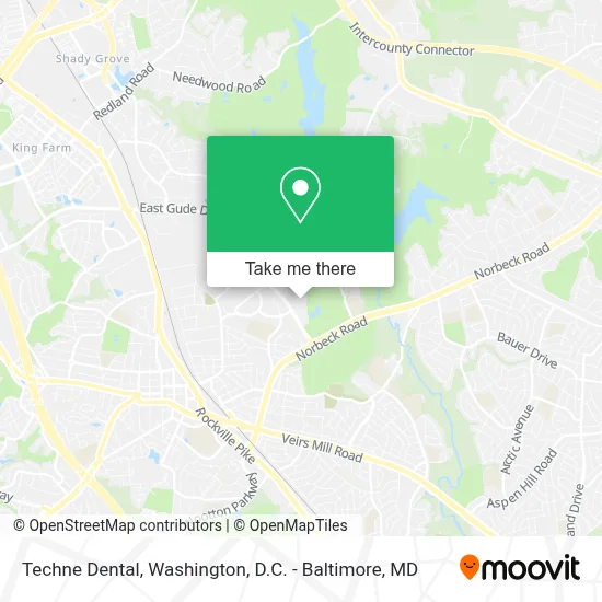
See Techne Dental, Montgomery County, on the map
Public Transit to Techne Dental in Montgomery County
Wondering how to get to Techne Dental in Montgomery County? Moovit helps you find the best way to get to Techne Dental with step-by-step directions from the nearest public transit station.
Moovit provides free maps and live directions to help you navigate through your city. View schedules, routes, timetables, and find out how long does it take to get to Techne Dental in real time.
Looking for the nearest stop or station to Techne Dental? Check out this list of stops closest to your destination: E Gude Dr & Rothgeb Dr; Taft St & Lofstrand Ln; Twinbrook - Parklawn Dr &Amp; Wicomico Ave; Norbeck Rd & Gude Dr; Rockville - S Stonestreet Ave &Amp; Park Rd.
Bus: 48, 59, 49, 52.Train: MARC, FLORIDIAN.Metro: RED.
Want to see if there’s another route that gets you there at an earlier time? Moovit helps you find alternative routes or times. Get directions from and directions to Techne Dental easily from the Moovit App or Website.
We make riding to Techne Dental easy, which is why over 1.7 million users, including users in Montgomery County, trust Moovit as the best app for public transit. You don’t need to download an individual bus app or train app, Moovit is your all-in-one transit app that helps you find the best bus time or train time available.
For information on prices of bus, metro and train, costs and ride fares to Techne Dental, please check the Moovit app.
Use the app to navigate to popular places including to the airport, hospital, stadium, grocery store, mall, coffee shop, school, college, and university.
Techne Dental Address: 4 Taft Ct street in Montgomery County
- El Boqueron 2 Restaurant and Night Club,
- Southlawn E Gude Dr,
- Federal Trade Commission,
- Avery Rd (norbeck rd / avery),
- Zava Zone,
- CCS Towing and Transport,
- Amazon Fulfillment Center-DDC2,
- United Electric Supply Co,
- The F. Scott Fitzgerald Theatre,
- Rockville High School,
- Rock Creek Regional Park,
- nsa,
- Rockville Metro Station,
- Rockville Metro Pedestrian Bridge,
- METRO Q4 Bus to Silver Spring,
- Rockville Metro Kiss & Ride,
- Capital One Bank,
- St Mary's Catholic Church Rockville,
- Frederick MD-355,
- Asian Bakery Cafe 小蜜蜂茶饼店
Places Near Techne Dental (Montgomery County)
- Museum Of The Bible, Washington,
- Capital One Arena, Washington,
- Marriott Marquis Washington, DC, Washington,
- Basilica of the National Shrine, Washington,
- Sibley Memorial Hospital, Washington,
- Westfield Montgomery Mall, Montgomery County,
- Rock Creek Tennis Center, Washington,
- Warner Theatre, Washington,
- National Museum of African American History and Culture, Washington,
- M&T Bank Stadium, Baltimore,
- Washington National Cathedral, Washington,
- National Theatre, Washington,
- Amazon Hq2, Arlington County,
- Camden Yards, Baltimore,
- The Anthem, Washington,
- National Zoo, Washington,
- Washington DC VA Medical Center, Washington,
- PG Mall, Prince George's County,
- Pennsylvania Ave NW (3rd st and pennsylvania), Washington,
- Georgetown, Washington
How to get to popular places in Washington, D.C. - Baltimore, MD with public transit
Get around Montgomery County by public transit!
Traveling around Montgomery County has never been so easy. See step by step directions as you travel to any attraction, street or major public transit station. View bus and train schedules, arrival times, service alerts and detailed routes on a map, so you know exactly how to get to anywhere in Montgomery County.
When traveling to any destination around Montgomery County use Moovit's Live Directions with Get Off Notifications to know exactly where and how far to walk, how long to wait for your line, and how many stops are left. Moovit will alert you when it's time to get off — no need to constantly re-check whether yours is the next stop.
Wondering how to use public transit in Montgomery County or how to pay for public transit in Montgomery County? Moovit public transit app can help you navigate your way with public transit easily, and at minimum cost. It includes public transit fees, ticket prices, and costs. Looking for a map of Montgomery County public transit lines? Moovit public transit app shows all public transit maps in Montgomery County with all Bus, Train, Metro, Light Rail and Ferry routes and stops on an interactive map.
Washington, D.C. - Baltimore, MD has 5 transit type(s), including: Bus, Train, Metro, Light Rail and Ferry, operated by several transit agencies, including WMATA, Montgomery County Ride On, Fairfax Connector, TheBus, PRTC, DASH - Alexandria, Arlington Transit (ART), RTA of Central Maryland, MDOT MTA, MDOT MTA Light RailLink, MDOT MTA Commuter Bus, MDOT MTA Local Bus, FXBGO!, Virginia Railway Express (VRE) and MARC