How to get to Techneorb by bus?
Click on the bus route to see step by step directions with maps, line arrival times and updated time schedules.
From Old Town Alexandria, Alexandria
42 minFrom AMC Theatres-Hoffman Center 22, Alexandria
38 minFrom Oxon Hill, MD, Prince George's County
70 minFrom Sheraton Suites Old Town Alexandria, Alexandria
65 minFrom AMC Hoffman Center 22, Alexandria
38 minFrom Fort Washington, MD, Prince George's County
110 minFrom Courtyard Alexandria Pentagon South, Alexandria
80 minFrom Lorton, VA - Amtrak Auto Train Station (LOR), Fairfax County
68 minFrom Springfield, VA, Fairfax County
63 minFrom Franconia-Springfield Metro Station, Fairfax County
38 min
Bus stops near Techneorb in Fairfax County
Bus lines to Techneorb in Fairfax County
What are the closest stations to Techneorb?
The closest stations to Techneorb are:
- Frye Rd @ Gage Rd is 747 yards away, 9 min walk.
- Richmond Hwy @ Buckman Rd is 753 yards away, 10 min walk.
- Richmond Hwy+Mohawk Ln is 843 yards away, 11 min walk.
Which bus lines stop near Techneorb?
These bus lines stop near Techneorb: 151, 171, 308, F1X.
What’s the nearest bus station to Techneorb in Fairfax County?
The nearest bus station to Techneorb in Fairfax County is Frye Rd @ Gage Rd. It’s a 9 min walk away.
What time is the first bus to Techneorb in Fairfax County?
The 171 is the first bus that goes to Techneorb in Fairfax County. It stops nearby at 3:47 AM.
What time is the last bus to Techneorb in Fairfax County?
The 171 is the last bus that goes to Techneorb in Fairfax County. It stops nearby at 2:02 AM.
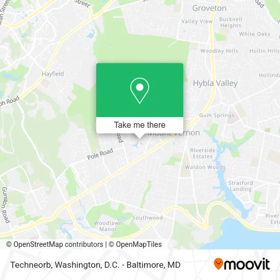
See Techneorb, Fairfax County, on the map
Public Transit to Techneorb in Fairfax County
Wondering how to get to Techneorb in Fairfax County? Moovit helps you find the best way to get to Techneorb with step-by-step directions from the nearest public transit station.
Moovit provides free maps and live directions to help you navigate through your city. View schedules, routes, timetables, and find out how long does it take to get to Techneorb in real time.
Looking for the nearest stop or station to Techneorb? Check out this list of stops closest to your destination: Frye Rd @ Gage Rd; Richmond Hwy @ Buckman Rd; Richmond Hwy+Mohawk Ln.
Bus: 151, 171, 308, F1X, 159.
Want to see if there’s another route that gets you there at an earlier time? Moovit helps you find alternative routes or times. Get directions from and directions to Techneorb easily from the Moovit App or Website.
We make riding to Techneorb easy, which is why over 1.5 million users, including users in Fairfax County, trust Moovit as the best app for public transit. You don’t need to download an individual bus app or train app, Moovit is your all-in-one transit app that helps you find the best bus time or train time available.
For information on prices of bus and metro, costs and ride fares to Techneorb, please check the Moovit app.
Use the app to navigate to popular places including to the airport, hospital, stadium, grocery store, mall, coffee shop, school, college, and university.
Techneorb Address: 8303 Brockham Dr Alexandria, VA 22309 street in Fairfax County
- Creation Decorating Services I,
- 4205 Mains St,
- CRG Technologies,
- Fram Family,
- Coleman Curtissa,
- Appliance Repair Jenn Air Certified Appliance,
- Genoa Health Care,
- Booz Allen Hamilton Holding,
- Sanchez Welding,
- BB Tea Boutique,
- Alfa Financial Services,
- Theeldestgeek,
- Milagros Enterprises,
- Computer Literacy,
- Mi Sol Tortillerra,
- Locksmith Alexandria VA,
- Arm & Arm,
- Psychic Readings by Bianca,
- MCCS,
- Mohamed Soliman
Places Near Techneorb (Fairfax County)
- National Museum of African American History and Culture, Washington,
- Basilica of the National Shrine, Washington,
- Washington DC VA Medical Center, Washington,
- Marriott Marquis Washington, DC, Washington,
- Rock Creek Tennis Center, Washington,
- Sibley Memorial Hospital, Washington,
- PG Mall, Prince George's County,
- Warner Theatre, Washington,
- Amazon Hq2, Arlington County,
- Georgetown, Washington,
- Museum Of The Bible, Washington,
- Westfield Montgomery Mall, Montgomery County,
- National Mall, Washington,
- Capital One Arena, Washington,
- Washington National Cathedral, Washington,
- Pennsylvania Ave NW (3rd st and pennsylvania), Washington,
- National Zoo, Washington,
- M&T Bank Stadium, Baltimore,
- The Anthem, Washington,
- Camden Yards, Baltimore
How to get to popular places in Washington, D.C. - Baltimore, MD with public transit
Get around Fairfax County by public transit!
Traveling around Fairfax County has never been so easy. See step by step directions as you travel to any attraction, street or major public transit station. View bus and train schedules, arrival times, service alerts and detailed routes on a map, so you know exactly how to get to anywhere in Fairfax County.
When traveling to any destination around Fairfax County use Moovit's Live Directions with Get Off Notifications to know exactly where and how far to walk, how long to wait for your line, and how many stops are left. Moovit will alert you when it's time to get off — no need to constantly re-check whether yours is the next stop.
Wondering how to use public transit in Fairfax County or how to pay for public transit in Fairfax County? Moovit public transit app can help you navigate your way with public transit easily, and at minimum cost. It includes public transit fees, ticket prices, and costs. Looking for a map of Fairfax County public transit lines? Moovit public transit app shows all public transit maps in Fairfax County with all Bus, Train, Metro, Light Rail and Ferry routes and stops on an interactive map.
Washington, D.C. - Baltimore, MD has 5 transit type(s), including: Bus, Train, Metro, Light Rail and Ferry, operated by several transit agencies, including WMATA, Montgomery County Ride On, Fairfax Connector, TheBus, PRTC, DASH - Alexandria, Arlington Transit (ART), RTA of Central Maryland, MDOT MTA, MDOT MTA Light RailLink, MDOT MTA Commuter Bus, MDOT MTA Local Bus, FXBGO!, Virginia Railway Express (VRE) and MARC