Directions to Techserv Systems (Fort Lauderdale) with public transportation
The following transit lines have routes that pass near Techserv Systems
 Bus: 01, 101, 40.
- Ferry: WATER TROLLEY.
How to get to Techserv Systems by bus?
Click on the bus route to see step by step directions with maps, line arrival times and updated time schedules.
From Walmart Supercenter, Fort Lauderdale
80 minFrom Yellow Green Farmers Market, Hollywood
72 minFrom Seminole Hard Rock Hotel & Casino Hollywood (Seminole Hard Rock Hollywood Casino), Davie
89 minFrom Walmart, Fort Lauderdale
78 minFrom Hollywood Beach-Broadwalk, Hollywood
69 minFrom I-95, Fort Lauderdale
59 minFrom Joe Dimaggio Children's Hospital at Memorial, Hollywood
68 minFrom E Commercial Blvd, Fort Lauderdale
67 minFrom Downtown Hollywood, Hollywood
40 minFrom Ross, Fort Lauderdale
52 min
Bus stops near Techserv Systems in Fort Lauderdale
Ferry station near Techserv Systems in Fort Lauderdale
- Laura Ward Riverwalk Plaza, 39 min walk,VIEW
Bus lines to Techserv Systems in Fort Lauderdale
What are the closest stations to Techserv Systems?
The closest stations to Techserv Systems are:
- Southeast 17th Street/Cordova Road is 30 yards away, 1 min walk.
- US 1/Southeast 21st Street is 308 yards away, 4 min walk.
- Southeast 17th Street & US 1 is 896 yards away, 11 min walk.
- Laura Ward Riverwalk Plaza is 3270 yards away, 39 min walk.
Which bus lines stop near Techserv Systems?
These bus lines stop near Techserv Systems: 01, 101, 40.
What’s the nearest bus station to Techserv Systems in Fort Lauderdale?
The nearest bus station to Techserv Systems in Fort Lauderdale is Southeast 17th Street/Cordova Road. It’s a 1 min walk away.
What time is the first bus to Techserv Systems in Fort Lauderdale?
The 101 is the first bus that goes to Techserv Systems in Fort Lauderdale. It stops nearby at 4:49 AM.
What time is the last bus to Techserv Systems in Fort Lauderdale?
The 01 is the last bus that goes to Techserv Systems in Fort Lauderdale. It stops nearby at 12:20 AM.
What time is the first ferry to Techserv Systems in Fort Lauderdale?
The WATER TROLLEY is the first ferry that goes to Techserv Systems in Fort Lauderdale. It stops nearby at 10:00 AM.
What time is the last ferry to Techserv Systems in Fort Lauderdale?
The WATER TROLLEY is the last ferry that goes to Techserv Systems in Fort Lauderdale. It stops nearby at 10:20 PM.
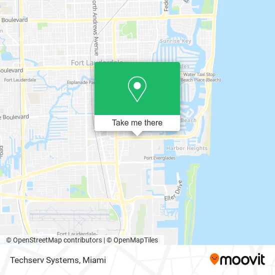
See Techserv Systems, Fort Lauderdale, on the map
Public Transit to Techserv Systems in Fort Lauderdale
Wondering how to get to Techserv Systems in Fort Lauderdale? Moovit helps you find the best way to get to Techserv Systems with step-by-step directions from the nearest public transit station.
Moovit provides free maps and live directions to help you navigate through your city. View schedules, routes, timetables, and find out how long does it take to get to Techserv Systems in real time.
Looking for the nearest stop or station to Techserv Systems? Check out this list of stops closest to your destination: Southeast 17th Street/Cordova Road; US 1/Southeast 21st Street; Southeast 17th Street & US 1; Laura Ward Riverwalk Plaza.
Bus: 01, 101, 40.Ferry: WATER TROLLEY.
Want to see if there’s another route that gets you there at an earlier time? Moovit helps you find alternative routes or times. Get directions from and directions to Techserv Systems easily from the Moovit App or Website.
We make riding to Techserv Systems easy, which is why over 1.5 million users, including users in Fort Lauderdale, trust Moovit as the best app for public transit. You don’t need to download an individual bus app or train app, Moovit is your all-in-one transit app that helps you find the best bus time or train time available.
For information on prices of bus, costs and ride fares to Techserv Systems, please check the Moovit app.
Use the app to navigate to popular places including to the airport, hospital, stadium, grocery store, mall, coffee shop, school, college, and university.
Techserv Systems Address: 1323 SE 17th St Fort Lauderdale, FL 33316 street in Fort Lauderdale
- Salthub Labs,
- The Ocean Marketing,
- Culmin Staffing Group,
- The Industry Standard,
- Permanent Cosmetic Artistry,
- Pura Vida Miami,
- Cary A. Levinson P.A.,
- Bruce Lieb,
- Milva Gilluly,
- Vilma Mansur,
- Jay Aamodt,
- Adt Security Services,
- Nomad Marine,
- FP Enterprises of Fort Lauderdale,
- Nails by Cindy,
- Cheap,
- PNC Bank,
- PNC Mortgage,
- Amazon Locker-Gall,
- Cary A Levinson P. A. - BHHS Florida Realty Buysfl
Places Near Techserv Systems (Fort Lauderdale)
- Miami VA Hospital, Miami,
- Brickell City Centre, Miami,
- Little Havana, Miami,
- Aventura Mall, Miami Beach,
- Aventura Mall, Miami,
- Port of Miami Cruise Terminal, Miami,
- Sawgrass Mall, Miami,
- Bayside Marketplace, Miami,
- Miami-Dade County Courthouse, Miami,
- Miami Design District, Miami,
- Dolphin Mall Bus, Miami,
- Sawgrass mall ( FL ), Miami Beach,
- Miami Freedom Park, Miami,
- Keiser University Flagship Campus, West Palm Beach,
- Dolphin Mall, Miami,
- Zoo Miami, Miami,
- Marlins Park, Miami,
- Hard Rock Stadium, Miami Gardens,
- Wynwood, Miami,
- Richard E. Gerstein Justice Building, Miami
How to get to popular places in Miami with public transit
Get around Fort Lauderdale by public transit!
Traveling around Fort Lauderdale has never been so easy. See step by step directions as you travel to any attraction, street or major public transit station. View bus and train schedules, arrival times, service alerts and detailed routes on a map, so you know exactly how to get to anywhere in Fort Lauderdale.
When traveling to any destination around Fort Lauderdale use Moovit's Live Directions with Get Off Notifications to know exactly where and how far to walk, how long to wait for your line, and how many stops are left. Moovit will alert you when it's time to get off — no need to constantly re-check whether yours is the next stop.
Wondering how to use public transit in Fort Lauderdale or how to pay for public transit in Fort Lauderdale? Moovit public transit app can help you navigate your way with public transit easily, and at minimum cost. It includes public transit fees, ticket prices, and costs. Looking for a map of Fort Lauderdale public transit lines? Moovit public transit app shows all public transit maps in Fort Lauderdale with all Bus, Train, Light Rail and Ferry routes and stops on an interactive map.
Miami has 4 transit type(s), including: Bus, Train, Light Rail and Ferry, operated by several transit agencies, including Broward County Transit, Miami-Dade Transit, Metrorail, Palm Tran, Tri-Rail, Brightline, MARTY, City of Homestead Trolley, Key West Transit, Treasure Coast Connector, GoLine IRT, Amtrak, Greyhound-us, FlixBus-us and Aventura Express Shuttle Bus