Directions to Teksystems (Roanoke) with public transportation
The following transit lines have routes that pass near Teksystems
 Bus: 51, GREYHOUND US0600, 36, TROLLEY, 52.
- Train: NORTHEAST REGIONAL.
How to get to Teksystems by bus?
Click on the bus route to see step by step directions with maps, line arrival times and updated time schedules.
How to get to Teksystems by train?
Click on the train route to see step by step directions with maps, line arrival times and updated time schedules.
Bus stops near Teksystems in Roanoke
- Franklin Wb at Jefferson, 1 min walk,VIEW
- Jefferson & Bullitt, 2 min walk,VIEW
- Jefferson & Luck, 2 min walk,VIEW
- Jefferson Sb at Bullitt, 3 min walk,VIEW
- Elm Wb at Jefferson, 6 min walk,VIEW
- Jefferson Sb at Luck, 6 min walk,VIEW
- Elm Eb at Jefferson (Community Hospital), 6 min walk,VIEW
- Roanoke Campbell Court, 9 min walk,VIEW
- Roanoke, 11 min walk,VIEW
- Campbell Ave at Market, 12 min walk,VIEW
Train station near Teksystems in Roanoke
- Roanoke, 10 min walk,VIEW
Bus lines to Teksystems in Roanoke
- 36, 3rd St Station Slip L,VIEW
- TROLLEY, Downtown Market,VIEW
- 52, 3rd St Station Slip Q,VIEW
- 51, Tanglewood Mall (Barnes And Noble),VIEW
- 42, 3rd St Station Slip K,VIEW
- 35, 35 - Third Street Station To Vinton,VIEW
- 41, 11th Sb at Jamison,VIEW
- SWB, To Roanoke,VIEW
- 22, 3rd St Station Slip H,VIEW
- 26, 3rd St Station Slip A,VIEW
- 32, Westbound,VIEW
- FERRUM EXPRESS, Ferrum College,VIEW
- 31, 31 - Third Street Station To Blue Hills,VIEW
What are the closest stations to Teksystems?
The closest stations to Teksystems are:
- Franklin Wb at Jefferson is 32 yards away, 1 min walk.
- Jefferson & Bullitt is 93 yards away, 2 min walk.
- Jefferson & Luck is 115 yards away, 2 min walk.
- Jefferson Sb at Bullitt is 179 yards away, 3 min walk.
- Elm Wb at Jefferson is 418 yards away, 6 min walk.
- Jefferson Sb at Luck is 431 yards away, 6 min walk.
- Elm Eb at Jefferson (Community Hospital) is 457 yards away, 6 min walk.
- Roanoke Campbell Court is 729 yards away, 9 min walk.
- Roanoke is 736 yards away, 11 min walk.
- Campbell Ave at Market is 1021 yards away, 12 min walk.
Which bus lines stop near Teksystems?
These bus lines stop near Teksystems: 51, GREYHOUND US0600.
Which train line stops near Teksystems?
NORTHEAST REGIONAL (Roanoke)
What’s the nearest train station to Teksystems in Roanoke?
The nearest train station to Teksystems in Roanoke is Roanoke. It’s a 10 min walk away.
What’s the nearest bus station to Teksystems in Roanoke?
The nearest bus station to Teksystems in Roanoke is Franklin Wb at Jefferson. It’s a 1 min walk away.
What time is the first train to Teksystems in Roanoke?
The NORTHEAST REGIONAL is the first train that goes to Teksystems in Roanoke. It stops nearby at 9:35 AM.
What time is the last train to Teksystems in Roanoke?
The NORTHEAST REGIONAL is the last train that goes to Teksystems in Roanoke. It stops nearby at 10:13 PM.
What time is the first bus to Teksystems in Roanoke?
The 36 is the first bus that goes to Teksystems in Roanoke. It stops nearby at 6:04 AM.
What time is the last bus to Teksystems in Roanoke?
The SWB is the last bus that goes to Teksystems in Roanoke. It stops nearby at 9:35 PM.
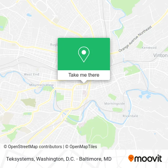
See Teksystems, Roanoke, on the map
Public Transit to Teksystems in Roanoke
Wondering how to get to Teksystems in Roanoke? Moovit helps you find the best way to get to Teksystems with step-by-step directions from the nearest public transit station.
Moovit provides free maps and live directions to help you navigate through your city. View schedules, routes, timetables, and find out how long does it take to get to Teksystems in real time.
Looking for the nearest stop or station to Teksystems? Check out this list of stops closest to your destination: Franklin Wb at Jefferson; Jefferson & Bullitt; Jefferson & Luck; Jefferson Sb at Bullitt; Elm Wb at Jefferson; Jefferson Sb at Luck; Elm Eb at Jefferson (Community Hospital); Roanoke Campbell Court; Roanoke; Campbell Ave at Market.
Bus: 51, GREYHOUND US0600, 36, TROLLEY, 52, 42.Train: NORTHEAST REGIONAL.
Want to see if there’s another route that gets you there at an earlier time? Moovit helps you find alternative routes or times. Get directions from and directions to Teksystems easily from the Moovit App or Website.
We make riding to Teksystems easy, which is why over 1.5 million users, including users in Roanoke, trust Moovit as the best app for public transit. You don’t need to download an individual bus app or train app, Moovit is your all-in-one transit app that helps you find the best bus time or train time available.
For information on prices of bus and train, costs and ride fares to Teksystems, please check the Moovit app.
Use the app to navigate to popular places including to the airport, hospital, stadium, grocery store, mall, coffee shop, school, college, and university.
Teksystems Address: 10 Franklin Rd SE Roanoke, VA 24011 street in Roanoke
- United States Government Goodlatte Bob Congressman,
- Monday Monica T,
- Smith Charles H III,
- Davenport & Company,
- Russell Anthony M,
- Leeson Todd A,
- Suntrust,
- Painewebber,
- David Vernon Hipes - Truist Mortgage Loan Officer,
- Gentry Locke,
- Calton Charles R,
- Gust W William,
- Habeeb Gregory D,
- Paxton W David,
- Maxwell H Wiegard,
- Paul G Klockenbrink,
- Thomas John R,
- Segura Anthony M,
- Scott Insurance,
- O'Keeffe James J
Places Near Teksystems (Roanoke)
- Sibley Memorial Hospital, Washington,
- Camden Yards, Baltimore,
- Rock Creek Tennis Center, Washington,
- Marriott Marquis Washington, DC, Washington,
- The Anthem, Washington,
- Westfield Montgomery Mall, Montgomery County,
- Washington DC VA Medical Center, Washington,
- Amazon Hq2, Arlington County,
- Georgetown, Washington,
- Capital One Arena, Washington,
- M&T Bank Stadium, Baltimore,
- National Mall, Washington,
- National Zoo, Washington,
- Pennsylvania Ave NW (3rd st and pennsylvania), Washington,
- PG Mall, Prince George's County,
- Basilica of the National Shrine, Washington,
- Warner Theatre, Washington,
- National Museum of African American History and Culture, Washington,
- Museum Of The Bible, Washington,
- Washington National Cathedral, Washington
How to get to popular places in Washington, D.C. - Baltimore, MD with public transit
Get around Roanoke by public transit!
Traveling around Roanoke has never been so easy. See step by step directions as you travel to any attraction, street or major public transit station. View bus and train schedules, arrival times, service alerts and detailed routes on a map, so you know exactly how to get to anywhere in Roanoke.
When traveling to any destination around Roanoke use Moovit's Live Directions with Get Off Notifications to know exactly where and how far to walk, how long to wait for your line, and how many stops are left. Moovit will alert you when it's time to get off — no need to constantly re-check whether yours is the next stop.
Wondering how to use public transit in Roanoke or how to pay for public transit in Roanoke? Moovit public transit app can help you navigate your way with public transit easily, and at minimum cost. It includes public transit fees, ticket prices, and costs. Looking for a map of Roanoke public transit lines? Moovit public transit app shows all public transit maps in Roanoke with all Bus, Train, Metro, Light Rail and Ferry routes and stops on an interactive map.
Washington, D.C. - Baltimore, MD has 5 transit type(s), including: Bus, Train, Metro, Light Rail and Ferry, operated by several transit agencies, including WMATA, Montgomery County Ride On, Fairfax Connector, TheBus, PRTC, DASH - Alexandria, Arlington Transit (ART), RTA of Central Maryland, MDOT MTA, MDOT MTA Light RailLink, MDOT MTA Commuter Bus, MDOT MTA Local Bus, FXBGO!, Virginia Railway Express (VRE) and MARC