Directions to Teksystems (Roanoke) with public transportation
The following transit lines have routes that pass near Teksystems
 Bus: GREYHOUND US0600, SWB, 22, 26, 32.
- Train: NORTHEAST REGIONAL.
How to get to Teksystems by bus?
Click on the bus route to see step by step directions with maps, line arrival times and updated time schedules.
How to get to Teksystems by train?
Click on the train route to see step by step directions with maps, line arrival times and updated time schedules.
Bus stops near Teksystems in Roanoke
- Roanoke Campbell Court, 1 min walk,VIEW
- Jefferson & Kirk, 3 min walk,VIEW
- 3rd St Station Slip Q, 5 min walk,VIEW
- 3rd St Station Slip F, 5 min walk,VIEW
- 3rd St Station Slip P, 5 min walk,VIEW
- 3rd St Station Slip G, 5 min walk,VIEW
- 3rd St Station Slip A, 5 min walk,VIEW
- 3rd St Station Slip B, 5 min walk,VIEW
- 3rd St Station Slip H, 5 min walk,VIEW
- Gainsboro at Loudon, 6 min walk,VIEW
- 3rd St at Church Ave, 6 min walk,VIEW
- Gainsboro Sb at Loudon, 6 min walk,VIEW
Train station near Teksystems in Roanoke
- Roanoke, 44 min walk,VIEW
Bus lines to Teksystems in Roanoke
- SWB, 3rd St Station Slip D,VIEW
- 22, 3rd St Station Slip H,VIEW
- 26, 3rd St Station Slip A,VIEW
- 32, Westbound,VIEW
- 36, 3rd St Station Slip L,VIEW
- 52, 3rd St Station Slip Q,VIEW
- TROLLEY, Downtown Market,VIEW
- 11, 11-Third Street Station To Valley View Mall,VIEW
- 85, 85 - Third Street Station To Peters Creek Road,VIEW
- 86, 86 - Peters Creek Road To Third Street Station,VIEW
- 15, 15 - Third Street Station To Valley View Mall,VIEW
- 56, 3rd St Station Slip P,VIEW
- 71, Lewis Gale Medical Center,VIEW
- 72, 72 - Lewis Gale Hospital To Third Street Station,VIEW
- 65, 65 - Third Street Station To Carlton & Grandin,VIEW
- 75, 75 - Third Street Station To Veterans Hospital,VIEW
- 76, 76 - Veterans Hospital To Third Street Station,VIEW
- 61, Red Rock Nb at Brambleton (Shell Station),VIEW
- 21, 21 - Third Street Station To Valley Court,VIEW
- 25, 25 - Third Street Station To Airport,VIEW
What are the closest stations to Teksystems?
The closest stations to Teksystems are:
- Roanoke Campbell Court is 20 yards away, 1 min walk.
- Jefferson & Kirk is 231 yards away, 3 min walk.
- 3rd St Station Slip Q is 331 yards away, 5 min walk.
- 3rd St Station Slip F is 350 yards away, 5 min walk.
- 3rd St Station Slip P is 353 yards away, 5 min walk.
- 3rd St Station Slip G is 377 yards away, 5 min walk.
- 3rd St Station Slip A is 385 yards away, 5 min walk.
- 3rd St Station Slip B is 387 yards away, 5 min walk.
- 3rd St Station Slip H is 408 yards away, 5 min walk.
- Gainsboro at Loudon is 452 yards away, 6 min walk.
- 3rd St at Church Ave is 474 yards away, 6 min walk.
- Gainsboro Sb at Loudon is 478 yards away, 6 min walk.
- Roanoke is 3727 yards away, 44 min walk.
Which bus line stops near Teksystems?
GREYHOUND US0600 (Nashville Bus Station)
Which train line stops near Teksystems?
NORTHEAST REGIONAL (Roanoke)
What’s the nearest bus station to Teksystems in Roanoke?
The nearest bus station to Teksystems in Roanoke is Roanoke Campbell Court. It’s a 1 min walk away.
What time is the first train to Teksystems in Roanoke?
The NORTHEAST REGIONAL is the first train that goes to Teksystems in Roanoke. It stops nearby at 9:35 AM.
What time is the last train to Teksystems in Roanoke?
The NORTHEAST REGIONAL is the last train that goes to Teksystems in Roanoke. It stops nearby at 10:13 PM.
What time is the first bus to Teksystems in Roanoke?
The 16 is the first bus that goes to Teksystems in Roanoke. It stops nearby at 6:04 AM.
What time is the last bus to Teksystems in Roanoke?
The SWB is the last bus that goes to Teksystems in Roanoke. It stops nearby at 10:15 PM.
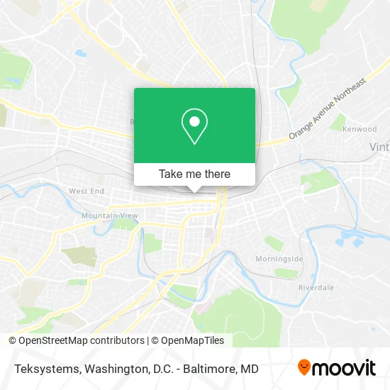
See Teksystems, Roanoke, on the map
Public Transit to Teksystems in Roanoke
Wondering how to get to Teksystems in Roanoke? Moovit helps you find the best way to get to Teksystems with step-by-step directions from the nearest public transit station.
Moovit provides free maps and live directions to help you navigate through your city. View schedules, routes, timetables, and find out how long does it take to get to Teksystems in real time.
Looking for the nearest stop or station to Teksystems? Check out this list of stops closest to your destination: Roanoke Campbell Court; Jefferson & Kirk; 3rd St Station Slip Q; 3rd St Station Slip F; 3rd St Station Slip P; 3rd St Station Slip G; 3rd St Station Slip A; 3rd St Station Slip B; 3rd St Station Slip H; Gainsboro at Loudon; 3rd St at Church Ave; Gainsboro Sb at Loudon; Roanoke.
Bus: GREYHOUND US0600, SWB, 22, 26, 32, 36, TROLLEY, 11, 15, 56, 85, 86.Train: NORTHEAST REGIONAL.
Want to see if there’s another route that gets you there at an earlier time? Moovit helps you find alternative routes or times. Get directions from and directions to Teksystems easily from the Moovit App or Website.
We make riding to Teksystems easy, which is why over 1.5 million users, including users in Roanoke, trust Moovit as the best app for public transit. You don’t need to download an individual bus app or train app, Moovit is your all-in-one transit app that helps you find the best bus time or train time available.
For information on prices of bus and train, costs and ride fares to Teksystems, please check the Moovit app.
Use the app to navigate to popular places including to the airport, hospital, stadium, grocery store, mall, coffee shop, school, college, and university.
Teksystems Address: 119 Norfolk Ave SW Roanoke, VA 24011 street in Roanoke
- American Biosystems,
- Aston Carter,
- Moseley Real Estate Schools,
- Aerotek,
- Becher Agency,
- Tba - Pr + Advertising,
- CR Architecture & Design,
- Roanoke Warehouse Historic District,
- Betty Br Sculptures Studio & Galy,
- Roanoke Historic Warehouse District,
- Terradin,
- Michiehamlett Attorneys at Law,
- HCSC,
- Abs Technology,
- Studiothought,
- Firefli,
- Nest Realty Roanoke,
- Eq Leader,
- Pollard Lot,
- Chris Martin
Places Near Teksystems (Roanoke)
- National Museum of African American History and Culture, Washington,
- The Anthem, Washington,
- Amazon Hq2, Arlington County,
- Washington DC VA Medical Center, Washington,
- PG Mall, Prince George's County,
- Westfield Montgomery Mall, Montgomery County,
- Pennsylvania Ave NW (3rd st and pennsylvania), Washington,
- Washington National Cathedral, Washington,
- Sibley Memorial Hospital, Washington,
- National Zoo, Washington,
- Rock Creek Tennis Center, Washington,
- Georgetown, Washington,
- M&T Bank Stadium, Baltimore,
- Basilica of the National Shrine, Washington,
- National Mall, Washington,
- Warner Theatre, Washington,
- Museum Of The Bible, Washington,
- Marriott Marquis Washington, DC, Washington,
- Capital One Arena, Washington,
- Camden Yards, Baltimore
How to get to popular places in Washington, D.C. - Baltimore, MD with public transit
Get around Roanoke by public transit!
Traveling around Roanoke has never been so easy. See step by step directions as you travel to any attraction, street or major public transit station. View bus and train schedules, arrival times, service alerts and detailed routes on a map, so you know exactly how to get to anywhere in Roanoke.
When traveling to any destination around Roanoke use Moovit's Live Directions with Get Off Notifications to know exactly where and how far to walk, how long to wait for your line, and how many stops are left. Moovit will alert you when it's time to get off — no need to constantly re-check whether yours is the next stop.
Wondering how to use public transit in Roanoke or how to pay for public transit in Roanoke? Moovit public transit app can help you navigate your way with public transit easily, and at minimum cost. It includes public transit fees, ticket prices, and costs. Looking for a map of Roanoke public transit lines? Moovit public transit app shows all public transit maps in Roanoke with all Bus, Train, Metro, Light Rail and Ferry routes and stops on an interactive map.
Washington, D.C. - Baltimore, MD has 5 transit type(s), including: Bus, Train, Metro, Light Rail and Ferry, operated by several transit agencies, including WMATA, Montgomery County Ride On, Fairfax Connector, TheBus, PRTC, DASH - Alexandria, Arlington Transit (ART), RTA of Central Maryland, MDOT MTA, MDOT MTA Light RailLink, MDOT MTA Commuter Bus, MDOT MTA Local Bus, FXBGO!, Virginia Railway Express (VRE) and MARC