How to get to Tenis y Ropa by bus?
Click on the bus route to see step by step directions with maps, line arrival times and updated time schedules.
From CC Altaria, Aguascalientes
46 minFrom San Ignacio, Aguascalientes
63 minFrom DIF Estatal, Aguascalientes
55 minFrom Fraccionamiento Casasolida, Aguascalientes
63 minFrom Potreros del Oeste, Aguascalientes
60 minFrom Fraccionamiento San Marcos, Aguascalientes
52 minFrom Panteon Municipal San Francisco, Aguascalientes
59 minFrom Fracc. José López Portillo, Aguascalientes
59 minFrom Médica San Juan Hospital de Especialidades, Aguascalientes
53 minFrom Villa Sur, Aguascalientes
64 min
Bus stops near Tenis y Ropa in Aguascalientes
Bus lines to Tenis y Ropa in Aguascalientes
What are the closest stations to Tenis y Ropa?
The closest stations to Tenis y Ropa are:
- Cultura Maya, 332 is 338 meters away, 5 min walk.
- Avenida Lomas Del Cardenal, 113 is 393 meters away, 6 min walk.
- Calle Cultura Maya 120, 120_18 is 515 meters away, 7 min walk.
Which bus lines stop near Tenis y Ropa?
These bus lines stop near Tenis y Ropa: RUTA 09, RUTA 16, RUTA 45.
What’s the nearest bus station to Tenis y Ropa in Aguascalientes?
The nearest bus station to Tenis y Ropa in Aguascalientes is Cultura Maya, 332. It’s a 5 min walk away.
What time is the first bus to Tenis y Ropa in Aguascalientes?
The RUTA 42 is the first bus that goes to Tenis y Ropa in Aguascalientes. It stops nearby at 5:51 AM.
What time is the last bus to Tenis y Ropa in Aguascalientes?
The RUTA 45 is the last bus that goes to Tenis y Ropa in Aguascalientes. It stops nearby at 10:25 PM.
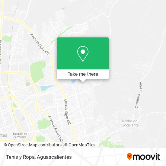
See Tenis y Ropa, Aguascalientes, on the map
Public Transit to Tenis y Ropa in Aguascalientes
Wondering how to get to Tenis y Ropa in Aguascalientes? Moovit helps you find the best way to get to Tenis y Ropa with step-by-step directions from the nearest public transit station.
Moovit provides free maps and live directions to help you navigate through your city. View schedules, routes, timetables, and find out how long does it take to get to Tenis y Ropa in real time.
Looking for the nearest stop or station to Tenis y Ropa? Check out this list of stops closest to your destination: Cultura Maya; Avenida Lomas Del Cardenal; Calle Cultura Maya 120.
Bus: RUTA 09, RUTA 16, RUTA 45, RUTA 42, RUTA 48.
Want to see if there’s another route that gets you there at an earlier time? Moovit helps you find alternative routes or times. Get directions from and directions to Tenis y Ropa easily from the Moovit App or Website.
We make riding to Tenis y Ropa easy, which is why over 1.7 million users, including users in Aguascalientes, trust Moovit as the best app for public transit. You don’t need to download an individual bus app or train app, Moovit is your all-in-one transit app that helps you find the best bus time or train time available.
For information on prices of bus, costs and ride fares to Tenis y Ropa, please check the Moovit app.
Use the app to navigate to popular places including to the airport, hospital, stadium, grocery store, mall, coffee shop, school, college, and university.
Tenis y Ropa Address: Avenida Cultura Tarahumara, Fracc Mirador de las Culturas, 20174 Aguascalientes, Aguascalientes street in Aguascalientes
- Abarrotes Meli Ali,
- Venta de Cena,
- Papeleria Lucero,
- Pozole,
- Rosticería Wiston,
- Abarrotes La Morenita,
- Jugos y Chocos Los Arbolitos,
- Abarrotes a la Goma,
- Papeleria Jardín,
- Menuderia,
- Abarrotes Cristy,
- Cenaduria La China,
- Avenida Cultura Otomí 51,
- Taqueria La Providencia,
- Tacos,
- Boutique Vero,
- Hidro Farmacia,
- Avenida cultura maya 239,
- Fruteria Bedolla,
- Plaza Comunitaria Miradores
Places Near Tenis y Ropa (Aguascalientes)
- Nuevo Hospital Hidalgo, Aguascalientes,
- Centro Comercial Altaria, Aguascalientes,
- Parque Las Tres Centurias, Aguascalientes,
- Villas de Nuestra Señora de la Asunción, Aguascalientes,
- ESPACIOS, Aguascalientes,
- La Isla San Marcos, Aguascalientes,
- Jesús María, Aguascalientes,
- Centro, Aguascalientes,
- Central De Autobuses, Aguascalientes,
- Blvd. Luis Donaldo Colosio, Aguascalientes,
- Villasuncion, Aguascalientes,
- Isla San Marcos, Aguascalientes,
- clinica 3 uaa, Aguascalientes,
- Agropecuario, Aguascalientes,
- Ciudad industrial, Aguascalientes,
- Imss Clinica 1, Aguascalientes,
- Universidad Autónoma de Aguascalientes, Aguascalientes,
- Aeropuerto de Aguascalientes S.A. de C.V., Aguascalientes,
- Terminal De Combis, Aguascalientes,
- Hospital Imss No. 3, Aguascalientes
How to get to popular places in Aguascalientes with public transit
Get around Aguascalientes by public transit!
Traveling around Aguascalientes has never been so easy. See step by step directions as you travel to any attraction, street or major public transit station. View bus and train schedules, arrival times, service alerts and detailed routes on a map, so you know exactly how to get to anywhere in Aguascalientes.
When traveling to any destination around Aguascalientes use Moovit's Live Directions with Get Off Notifications to know exactly where and how far to walk, how long to wait for your line, and how many stops are left. Moovit will alert you when it's time to get off — no need to constantly re-check whether yours is the next stop.
Wondering how to use public transit in Aguascalientes or how to pay for public transit in Aguascalientes? Moovit public transit app can help you navigate your way with public transit easily, and at minimum cost. It includes public transit fees, ticket prices, and costs. Looking for a map of Aguascalientes public transit lines? Moovit public transit app shows all public transit maps in Aguascalientes with all bus routes and stops on an interactive map.
Aguascalientes has 1 transit type(s), including: bus, operated by several transit agencies, including Coordinación General de Movilidad