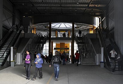
Terminal Matellini - Thursday schedule
| Line | Direction | Time |
|---|---|---|
| L | Terminal Matellini (Chorrillos) - Terminal Naranjal (Independencia) | 3:00 AM |
| L | Terminal Naranjal (Independencia) - Terminal Matellini (Chorrillos) | 3:26 AM |
| L | Terminal Matellini (Chorrillos) - Terminal Naranjal (Independencia) | 3:30 AM |
| L | Terminal Naranjal (Independencia) - Terminal Matellini (Chorrillos) | 3:56 AM |
| L | Terminal Matellini (Chorrillos) - Terminal Naranjal (Independencia) | 4:00 AM |
| L | Terminal Naranjal (Independencia) - Terminal Matellini (Chorrillos) | 4:26 AM |
| EX1 | Terminal Matellini (Chorrillos) - Estación Central (Lima) | 5:00 AM |
| C | Terminal Matellini (Chorrillos) - Estación Ramón Castilla (Centro De Lima) | 5:00 AM |
| EX1 | Terminal Matellini (Chorrillos) - Estación Central (Lima) | 5:08 AM |
| C | Terminal Matellini (Chorrillos) - Estación Ramón Castilla (Centro De Lima) | 5:10 AM |
| EX1 | Terminal Matellini (Chorrillos) - Estación Central (Lima) | 5:16 AM |
| C | Terminal Matellini (Chorrillos) - Estación Ramón Castilla (Centro De Lima) | 5:20 AM |
| EX1 | Terminal Matellini (Chorrillos) - Estación Central (Lima) | 5:24 AM |
| C | Terminal Matellini (Chorrillos) - Estación Ramón Castilla (Centro De Lima) | 5:30 AM |
| EX1 | Terminal Matellini (Chorrillos) - Estación Central (Lima) | 5:32 AM |
| C | Estación Ramón Castilla (Centro De Lima) - Terminal Matellini (Chorrillos) | 5:36 AM |
| EX1 | Terminal Matellini (Chorrillos) - Estación Central (Lima) | 5:40 AM |
| C | Terminal Matellini (Chorrillos) - Estación Ramón Castilla (Centro De Lima) | 5:40 AM |
| C | Estación Ramón Castilla (Centro De Lima) - Terminal Matellini (Chorrillos) | 5:46 AM |
| EX1 | Terminal Matellini (Chorrillos) - Estación Central (Lima) | 5:48 AM |
| C | Terminal Matellini (Chorrillos) - Estación Ramón Castilla (Centro De Lima) | 5:50 AM |
| EX1 | Terminal Matellini (Chorrillos) - Estación Central (Lima) | 5:56 AM |
| EX1 | Estación Central (Lima) - Terminal Matellini (Chorrillos) | 5:56 AM |
| C | Estación Ramón Castilla (Centro De Lima) - Terminal Matellini (Chorrillos) | 5:56 AM |
| C | Terminal Matellini (Chorrillos) - Estación Ramón Castilla (Centro De Lima) | 6:00 AM |
Directions to Terminal Matellini (Chorrillos) with public transportation
The following transit lines have routes that pass near Terminal Matellini
 Bus: 1090, 1091, 1092, 8706, EX1.
How to get to Terminal Matellini by bus?
Click on the bus route to see step by step directions with maps, line arrival times and updated time schedules.
Bus stops near Terminal Matellini in Chorrillos
- Guardia Peruana, 3 min walk,
- Avenida Paseo De La República, 1665, 8 min walk,
- Matellini, 8 min walk,
- Terminal Matellini - Alimentadores, 12 min walk,
Bus lines to Terminal Matellini in Chorrillos
- 1376, Bolichera (Surco) - Cedros de Villa (Chorillos) ,
- 1382, San Genaro (Chorrillos) - Pamplona Alta (San Juan De Miraflores),
- 1400, Chorrillos - V.M.T.,
- 1413, Chorrillos - V.M.T,
- 1470, La Victoria - Chorrillos,
- 7708, S.J.M. - Chorrillos,
- 8706, V.M.T. - Chorrillos,
- 8724, San Genaro (Chorrillos) - Las Palmas (Pachacamac),
- 1091, S.J.M - San Isidro,
- 1396, Hospital De La Solidaridad (Chorrillos) - Antigua Panamericana Sur (Punta Negra),
- 1053, Campoy (San Juan De Lurigancho) - San Genaro (Chorrillos),
- 1055, Campoy (San Juan De Lurigancho) - Delicias De Villa (Chorrillos),
- 1087, Alameda Sur (Chorrillos) - 28 De Julio (Jesús María),
- 1090, Los Horizontes (Chorrillos) - Óvalo Gutiérrez (Miraflores) ,
- 1092, Sebastian Barranca (La Victoria) - San Genaro (Chorrillos),
- 1098, Wiesse (San Juan de Lurigancho) - Sumac Paccha (Lurín),
- 1111, Universitaria (Lima) - San Gabriel (Villa María Del Triunfo),
- 1231, Chorrillos - Carabayllo,
- 1405, Chorrillos - V.M.T,
- 1406, Pachacamac - Chorrillos,
What are the closest stations to Terminal Matellini?
The closest stations to Terminal Matellini are:
- Guardia Peruana stop is 163 meters away, 3 min walk.
- Avenida Paseo De La República, 1665 stop is 579 meters away, 8 min walk.
- Matellini stop is 587 meters away, 8 min walk.
- Terminal Matellini - Alimentadores is 848 meters away, 12 min walk.
Which bus lines stop near Terminal Matellini?
These bus lines stop near Terminal Matellini: 1090, 1091, 1092, 8706, EX1.
What’s the nearest bus station to Terminal Matellini in Chorrillos?
The nearest bus station to Terminal Matellini in Chorrillos is Guardia Peruana. It’s a 3 min walk away.
What time is the first bus to Terminal Matellini in Chorrillos?
The 1090 is the first bus that goes to Terminal Matellini in Chorrillos. It stops nearby at 4:33 AM.
What time is the last bus to Terminal Matellini in Chorrillos?
The 1400 is the last bus that goes to Terminal Matellini in Chorrillos. It stops nearby at 12:01 AM.
See Terminal Matellini, Chorrillos, on the map
Public transit to Terminal Matellini in Chorrillos
Looking for directions to Terminal Matellini in Chorrillos, Peru?
Download the Moovit App to find the current schedule and step-by-step directions for Bus routes that pass through Terminal Matellini.
Looking for the nearest stops closest to Terminal Matellini ? Check out this list of closest stops to your destination: Guardia Peruana; Avenida Paseo De La República; Matellini; Terminal Matellini - Alimentadores.
Bus: 1090, 1091, 1092, 8706, EX1, 1376, 1382, 1400, 1413, 1470, 1053, 1055, 1087, 1396, AS02, AS04, AS07, AS08, SEP.
We make riding on public transit to Terminal Matellini easy, which is why over 1.7 billion users, including users in Chorrillos trust Moovit as the best app for public transit.
Use the app to navigate to popular places including to the airport, hospital, stadium, grocery store, mall, coffee shop, school, college, and university.
The stop has the following entrances: Ariosto Matellini
The first line to this stop is L, at 3:00 AM, and the last line is C at 11:28 PM.
This stop serves Metropolitano’s lines
Metropolitano is a bus rapid transit system serving the city of Lima, Peru. Its construction began in the year 2006.Wiki
Popular routes from Terminal Matellini, Chorrillos
- To Universidad Cesar Vallejo,
- To Universidad Científica Del Sur,
- To Universidad Del Pacífico,
- To Universidad Ricardo Palma,
- To Universidad César Vallejo,
- To Tecsup,
- To Colegio Medico Del Peru,
- To Universidad Peruana Cayetano Heredia - Campo Central,
- To Universidad Nacional Federico Villarreal,
- To Universidad Autónoma Del Perú
- Guardia Peruana,
- Avenida Paseo De La República, 1665,
- Matellini,
- Terminal Matellini - Alimentadores
Bus stops near Terminal Matellini
- Piura,
- Angamos,
- Cine Star,
- Óvalo Chacas - Ancón,
- 12 Octubre/Izaguirre,
- Paradero Orión,
- Carlos Valderrama,
- Jorge Chávez,
- Puente Peatonal Pucusana,
- Presbítero Maestro,
- Salaverry,
- Rinconada De Puruhuay,
- Las Lomas X Mangomarca,
- Carapongo,
- Tomás Valle,
- Brasil,
- Av. A. Belaunde,
- Paradero 2 Canto Grande,
- Bajada Balta
Popular public transit stations in Chorrillos
Get around Chorrillos by public transit!
Traveling around Chorrillos has never been so easy. See step by step directions as you travel to any attraction, street or major public transit station. View bus and train schedules, arrival times, service alerts and detailed routes on a map, so you know exactly how to get to anywhere in Chorrillos.
When traveling to any destination around Chorrillos use Moovit's Live Directions with Get Off Notifications to know exactly where and how far to walk, how long to wait for your line, and how many stops are left. Moovit will alert you when it's time to get off — no need to constantly re-check whether yours is the next stop.
Wondering how to use public transit in Chorrillos or how to pay for public transit in Chorrillos? Moovit public transit app can help you navigate your way with public transit easily, and at minimum cost. It includes public transit fees, ticket prices, and costs. Looking for a map of Chorrillos public transit lines? Moovit public transit app shows all public transit maps in Chorrillos with all Bus, Metro and Ferry routes and stops on an interactive map.
Lima has 3 transit type(s), including: Bus, Metro and Ferry, operated by several transit agencies, including Metro de Lima Línea 2 , Metro de Lima, Corredor Rojo, Metropolitano, Metropolitano - Alimentadores, Corredor Morado, Corredor Azul, Rutas Tradicionales, Transportes y Servicios La Esperanza S.A., Las Flores S.A., Virgen de la Asunción S.A., Transportes y Service Canadá S.A., ETUL4SA, ETUCHISA and Roluesa S.A.C.