Directions to Terminus Cartier (Montreal) with public transportation
The following transit lines have routes that pass near Terminus Cartier
 Bus: 24, 31, 48, 74, 12.
- Train: MA, SJ.
- Metro: LIGNE 2 - ORANGE.
How to get to Terminus Cartier by bus?
Click on the bus route to see step by step directions with maps, line arrival times and updated time schedules.
How to get to Terminus Cartier by train?
Click on the train route to see step by step directions with maps, line arrival times and updated time schedules.
How to get to Terminus Cartier by metro?
Click on the metro route to see step by step directions with maps, line arrival times and updated time schedules.
Bus stops near Terminus Cartier in Montreal
- Métro Cartier Quai: 10, 1 min walk,
- Métro Cartier, 2 min walk,
- Métro Cartier Quai: 2, 2 min walk,
- Laval, 2 min walk,
- Métro Cartier Quai: 9, 2 min walk,
- Métro Cartier Quai: 3, 2 min walk,
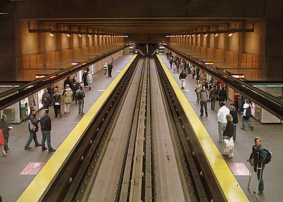
Metro station near Terminus Cartier in Montreal
- Station De La Concorde, 15 min walk,
Train station near Terminus Cartier in Montreal
- Gare De La Concorde, 15 min walk,
Bus lines to Terminus Cartier in Montreal
- 12, Juge-Desnoyers / Face Au 520,
- 58, Terminus Paul-Kane,
- 70, Métro Montmorency,
- 12, Métro Cartier,
- 48, Métro Cartier,
- 58, Métro Cartier,
- 60, Métro Cartier,
- 63, Métro Cartier,
- 70, Métro Cartier,
- 73, Métro Cartier,
- 74, Métro Cartier,
- 901, Métro Cartier,
- 2, Terminus Henri-Bourassa,
- 2, Métro Montmorency,
- 17, Terminus Bienville,
- 31, Terminus 9e Avenue,
- 345, Gare Vimont,
- 345, Terminus Henri-Bourassa,
- BERTHIERVILLE - MONTRÉAL, Montréal,
- MONTRÉAL - BERTHIERVILLE, Berthierville,
What are the closest stations to Terminus Cartier?
The closest stations to Terminus Cartier are:
- Métro Cartier Quai: 10 is 57 meters away, 1 min walk.
- Métro Cartier is 70 meters away, 2 min walk.
- Métro Cartier Quai: 2 is 70 meters away, 2 min walk.
- Laval is 76 meters away, 2 min walk.
- Métro Cartier Quai: 9 is 76 meters away, 2 min walk.
- Métro Cartier Quai: 3 is 91 meters away, 2 min walk.
- Station De La Concorde is 1089 meters away, 15 min walk.
- Gare De La Concorde is 1093 meters away, 15 min walk.
Which bus lines stop near Terminus Cartier?
These bus lines stop near Terminus Cartier: 24, 31, 48, 74.
Which train lines stop near Terminus Cartier?
These train lines stop near Terminus Cartier: MA, SJ.
Which metro line stops near Terminus Cartier?
LIGNE 2 - ORANGE (Station Montmorency -Zone B)
What’s the nearest metro station to Terminus Cartier in Montreal?
The nearest metro station to Terminus Cartier in Montreal is Station De La Concorde. It’s a 15 min walk away.
What’s the nearest train station to Terminus Cartier in Montreal?
The nearest train station to Terminus Cartier in Montreal is Gare De La Concorde. It’s a 15 min walk away.
What’s the nearest bus station to Terminus Cartier in Montreal?
The nearest bus station to Terminus Cartier in Montreal is Métro Cartier Quai: 10. It’s a 1 min walk away.
What time is the first metro to Terminus Cartier in Montreal?
The LIGNE 2 - ORANGE is the first metro that goes to Terminus Cartier in Montreal. It stops nearby at 5:25 AM.
What time is the last metro to Terminus Cartier in Montreal?
The LIGNE 2 - ORANGE is the last metro that goes to Terminus Cartier in Montreal. It stops nearby at 1:17 AM.
What time is the first train to Terminus Cartier in Montreal?
The SJ is the first train that goes to Terminus Cartier in Montreal. It stops nearby at 5:56 AM.
What time is the last train to Terminus Cartier in Montreal?
The SJ is the last train that goes to Terminus Cartier in Montreal. It stops nearby at 11:52 PM.
What time is the first bus to Terminus Cartier in Montreal?
The 345 is the first bus that goes to Terminus Cartier in Montreal. It stops nearby at 4:31 AM.
What time is the last bus to Terminus Cartier in Montreal?
The 2 is the last bus that goes to Terminus Cartier in Montreal. It stops nearby at 3:05 AM.
See Terminus Cartier, Montreal, on the map
Public Transit to Terminus Cartier in Montreal
Wondering how to get to Terminus Cartier in Montreal? Moovit helps you find the best way to get to Terminus Cartier with step-by-step directions from the nearest public transit station.
Moovit provides free maps and live directions to help you navigate through your city. View schedules, routes, timetables, and find out how long does it take to get to Terminus Cartier in real time.
Looking for the nearest stop or station to Terminus Cartier? Check out this list of stops closest to your destination: Métro Cartier Quai: 10; Métro Cartier; Métro Cartier Quai: 2; Laval; Métro Cartier Quai: 9; Métro Cartier Quai: 3; Station De La Concorde; Gare De La Concorde.
Bus: 24, 31, 48, 74, 12, 58, 70, 12, 58, 60, 63, 2, 2, 17, 345, 22, 222, 322.Train: MA, SJ.Metro: LIGNE 2 - ORANGE.
Want to see if there’s another route that gets you there at an earlier time? Moovit helps you find alternative routes or times. Get directions from and directions to Terminus Cartier easily from the Moovit App or Website.
We make riding to Terminus Cartier easy, which is why over 1.5 million users, including users in Montreal, trust Moovit as the best app for public transit. You don’t need to download an individual bus app or train app, Moovit is your all-in-one transit app that helps you find the best bus time or train time available.
For information on prices of metro, bus and train, costs and ride fares to Terminus Cartier, please check the Moovit app.
Use the app to navigate to popular places including to the airport, hospital, stadium, grocery store, mall, coffee shop, school, college, and university.
Terminus Cartier Address: 44, boul. des Laurentides street in Montreal
- Cartier,
- Cartier Station Montreal Metro,
- DHL,
- STM-Cartier,
- Billetterie Terminus C,
- STM Station Cartier,
- Cour Municipale LAVAL,
- Cour Municipale,
- Alta : Association Lavalloise Pour le Transport Adapté Inc.,
- Caserne 1,
- Dr Bulle,
- Groupe Marketing International Inc,
- Jadeloccs,
- Benzita Seo,
- Aréna Cartier,
- Maison du Rembourrage Général Enr,
- Conception Martin Jalbert,
- Soeurs Missionnaires De L'Immaculée Conception,
- Condominiums O'Cartier,
- Mécanique Dlp
Places Near Terminus Cartier (Montreal)
- CHUM - Centre Hospitalier de l'Université de Montréal, Montréal,
- Casino De Montréal, Montréal,
- Jewish General Hospital, Montréal,
- Theatre Rialto, Montréal,
- Bell Centre, Montréal,
- Gare Centrale, Montréal,
- Galeries d'Anjou, Anjou,
- Royalmount, Mont-Royal,
- Mtelus, Montréal,
- Carrefour Laval, Laval,
- Place Bell, Laval,
- Palais Des Congrès De Montréal, Montréal,
- Le Centre Eaton de Montreal, Montréal,
- Place Ville-Marie, Montréal,
- L'Arsenal, Montréal,
- Centre Bell, Montréal,
- Marché Central, Montréal,
- Place Versailles, Montréal,
- Vieux-Port, Montréal,
- Stade Saputo, Montréal
How to get to popular places in Montreal with public transit
Get around Montreal by public transit!
Traveling around Montreal has never been so easy. See step by step directions as you travel to any attraction, street or major public transit station. View bus and train schedules, arrival times, service alerts and detailed routes on a map, so you know exactly how to get to anywhere in Montreal.
When traveling to any destination around Montreal use Moovit's Live Directions with Get Off Notifications to know exactly where and how far to walk, how long to wait for your line, and how many stops are left. Moovit will alert you when it's time to get off — no need to constantly re-check whether yours is the next stop.
Wondering how to use public transit in Montreal or how to pay for public transit in Montreal? Moovit public transit app can help you navigate your way with public transit easily, and at minimum cost. It includes public transit fees, ticket prices, and costs. Looking for a map of Montreal public transit lines? Moovit public transit app shows all public transit maps in Montreal with all Bus, Train, Metro and Shuttle routes and stops on an interactive map.
Montreal has 4 transit type(s), including: Bus, Train, Metro and Shuttle, operated by several transit agencies, including RTL, STM, exo-Réseau de transport métropolitain, exo-Chambly-Richelieu-Carignan, exo-Haut-Saint-Laurent, exo-Laurentides, exo-La Presqu'île, CRT Lanaudière, exo-Le Richelain / Roussillon, exo-Sorel-Varennes, exo-Sud-Ouest, exo-Vallée du Richelieu, exo-L'Assomption, exo-Terrebonne-Mascouche and exo-Sainte-Julie