Terråk stop - Friday schedule
| Line | Direction | Time |
|---|---|---|
| 18-144 | Årsandøy | 14:07 |
| 18-112 | Fuglstad | 14:10 |
| 18-112 | Terråk | 16:16 |
| 18-112 | Fuglstad | 17:20 |
| 18-112 | Terråk | 19:16 |
| 18-112 | Terråk | 21:08 |
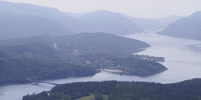
Directions to Terråk (Norway) with public transportation
The following transit lines have routes that pass near Terråk
Ferry stations near Terråk in Norway
- Terråk Hurtigbåtkai, 5 min walk,
Bus stations near Terråk in Norway
- Terråk Skole, 6 min walk,
Bus lines to Terråk in Norway
- 18-112, Årsandøy,
- 18-113, Terråk Skole,
What are the closest stations to Terråk?
The closest stations to Terråk are:
- Terråk Hurtigbåtkai is 373 meters away, 5 min walk.
- Terråk Skole is 451 meters away, 6 min walk.
Which bus line stops near Terråk?
18-112
What’s the nearest bus stop to Terråk in Norway?
The nearest bus stop to Terråk in Norway is Terråk Skole. It’s a 6 min walk away.
What’s the nearest ferry station to Terråk in Norway?
The nearest ferry station to Terråk in Norway is Terråk Hurtigbåtkai. It’s a 5 min walk away.
What time is the first bus to Terråk in Norway?
The 18-112 is the first bus that goes to Terråk in Norway. It stops nearby at 3:41 PM.
What time is the last bus to Terråk in Norway?
The 18-112 is the last bus that goes to Terråk in Norway. It stops nearby at 8:35 PM.
What time is the first ferry to Terråk in Norway?
The 18-111 is the first ferry that goes to Terråk in Norway. It stops nearby at 6:13 PM.
What time is the last ferry to Terråk in Norway?
The 18-111 is the last ferry that goes to Terråk in Norway. It stops nearby at 7:16 PM.
See Terråk, Norway, on the map
Public transit to Terråk stop in Norway
Looking for directions to Terråk in Norway, Norway?
Download the Moovit App to find the current schedule and step-by-step directions for Bus or Train routes that pass through Terråk.
Looking for the nearest stops closest to Terråk ? Check out this list of closest stops to your destination: Terråk Hurtigbåtkai; Terråk Skole.
Bus: 18-112, 18-113.Ferry: 18-111.
We make riding on public transit to Terråk easy, which is why over 1.5 million users, including users in Norway trust Moovit as the best app for public transit.
Use the app to navigate to popular places including to the airport, hospital, stadium, grocery store, mall, coffee shop, school, college, and university.
The first line to this stop is 18-144, at 14:07, and the last line is 18-112 at 21:08.
Oldervikveien 4, Norway
This stop serves Nordland fylkeskommune’s lines
Ferry station near Terråk
Terråk HurtigbåtkaiBus stop near Terråk
Terråk SkolePopular public transit stations in Norway
Omkjøringsveien Nardo,Hosle Senter,Sandefjord Lufthavn Torp,Storebø Båtkai,Sollihøgda,Neslandsvatn Stasjon,Hauaplassen,Revmatismesykehuset,Krossmoen,Halsa,Bryn Kirke,Søvik Ferjekai,Ål Torget,Ekebergparken,Hole Bru,Leistadkrysset,Nordeide Fv. 55,Skien Stasjon,Melfjordbotn Hurtigbåtkai,Gimse SkoleGet around Norway by public transit!
Traveling around Norway has never been so easy. See step by step directions as you travel to any attraction, street or major public transit station. View bus and train schedules, arrival times, service alerts and detailed routes on a map, so you know exactly how to get to anywhere in Norway.
When traveling to any destination around Norway use Moovit's Live Directions with Get Off Notifications to know exactly where and how far to walk, how long to wait for your line, and how many stops are left. Moovit will alert you when it's time to get off — no need to constantly re-check whether yours is the next stop.
Wondering how to use public transit in Norway or how to pay for public transit in Norway? Moovit public transit app can help you navigate your way with public transit easily, and at minimum cost. It includes public transit fees, ticket prices, and costs. Looking for a map of Norway public transit lines? Moovit public transit app shows all public transit maps in Norway with all Bus, Train, Subway, Light Rail, Ferry and Cable Car routes and stops on an interactive map.
Norway has 6 transit type(s), including: Bus, Train, Subway, Light Rail, Ferry and Cable Car, operated by several transit agencies, including Ruter, Skyss, AtB, Vy, Flytoget, Vy Tåg, SJ, Go-Ahead Norge AS, SJ Nord, Vestfold Kollektivtrafikk as, Snelandia, Innlandstrafikk, FRAM, FlixBus, Kolumbus