How to get to Terr Auto World by bus?
Click on the bus route to see step by step directions with maps, line arrival times and updated time schedules.
From Miami Florida, Miami
102 minFrom 19370 Collins Ave, Miami Beach
68 minFrom The Home Depot, Miami
68 minFrom Gulfstream Park, Hallandale Beach
41 minFrom Aventura Hospital ER, Miami
44 minFrom Hollywood Beach-Broadwalk, Hollywood
80 minFrom Tri-Rail Shuttle To FLL Airport, Hollywood
56 minFrom Aventura Station (Brightline), Miami
61 minFrom Golden Beach, Miami Beach
81 minFrom Flamingo Road, Miramar-Pembroke Pines
61 min
Bus stops near Terr Auto World in Hollywood
Bus lines to Terr Auto World in Hollywood
What are the closest stations to Terr Auto World?
The closest stations to Terr Auto World are:
- Pembroke Road/Southwest 63rd Avenue is 104 yards away, 2 min walk.
- Pembroke Road & US 441 is 886 yards away, 11 min walk.
Which bus lines stop near Terr Auto World?
These bus lines stop near Terr Auto World: 05, 18, 441.
What’s the nearest bus station to Terr Auto World in Hollywood?
The nearest bus station to Terr Auto World in Hollywood is Pembroke Road/Southwest 63rd Avenue. It’s a 2 min walk away.
What time is the first bus to Terr Auto World in Hollywood?
The 441 is the first bus that goes to Terr Auto World in Hollywood. It stops nearby at 5:10 AM.
What time is the last bus to Terr Auto World in Hollywood?
The 18 is the last bus that goes to Terr Auto World in Hollywood. It stops nearby at 12:40 AM.
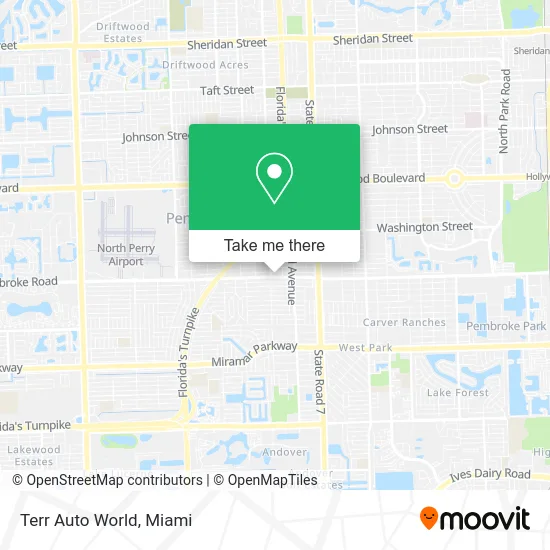
See Terr Auto World, Hollywood, on the map
Public Transit to Terr Auto World in Hollywood
Wondering how to get to Terr Auto World in Hollywood? Moovit helps you find the best way to get to Terr Auto World with step-by-step directions from the nearest public transit station.
Moovit provides free maps and live directions to help you navigate through your city. View schedules, routes, timetables, and find out how long does it take to get to Terr Auto World in real time.
Looking for the nearest stop or station to Terr Auto World? Check out this list of stops closest to your destination: Pembroke Road/Southwest 63rd Avenue; Pembroke Road & US 441.
Bus: 05, 18, 441.
Want to see if there’s another route that gets you there at an earlier time? Moovit helps you find alternative routes or times. Get directions from and directions to Terr Auto World easily from the Moovit App or Website.
We make riding to Terr Auto World easy, which is why over 1.5 million users, including users in Hollywood, trust Moovit as the best app for public transit. You don’t need to download an individual bus app or train app, Moovit is your all-in-one transit app that helps you find the best bus time or train time available.
For information on prices of bus, costs and ride fares to Terr Auto World, please check the Moovit app.
Use the app to navigate to popular places including to the airport, hospital, stadium, grocery store, mall, coffee shop, school, college, and university.
Terr Auto World Address: 6339 Pembroke Rd Hollywood, FL 33023 street in Hollywood
- D2 Contracting,
- Na's Jawn,
- Picnic S Sandwiches To Go,
- Ang Legacy,
- F & F Barber Shop,
- Vodou Holistic Center,
- U-Haul,
- Cathedral of Faith Worship Center,
- MS Visuals & Photos,
- Rodney's Dental Lab,
- Miramar 19th Street Park,
- Alibaba Locks & Keys,
- La Tia Food Truck,
- Faro Sobre la Roca Iglesia,
- DJ Fragance,
- Bless Medical Center,
- Odane James Ministries,
- Potter's Wheel Fellowship & Worship Center,
- Glaser Martin N DMD,
- Smoke in Grill
Places Near Terr Auto World (Hollywood)
- Wynwood, Miami,
- Richard E. Gerstein Justice Building, Miami,
- Sawgrass mall ( FL ), Miami Beach,
- Bayside Marketplace, Miami,
- Little Havana, Miami,
- Sawgrass Mall, Miami,
- Miami-Dade County Courthouse, Miami,
- Miami VA Hospital, Miami,
- Zoo Miami, Miami,
- Hard Rock Stadium, Miami Gardens,
- Port of Miami Cruise Terminal, Miami,
- Aventura Mall, Miami Beach,
- Dolphin Mall, Miami,
- Keiser University Flagship Campus, West Palm Beach,
- Dolphin Mall Bus, Miami,
- Aventura Mall, Miami,
- Miami Design District, Miami,
- Marlins Park, Miami,
- Miami Freedom Park, Miami,
- Brickell City Centre, Miami
How to get to popular places in Miami with public transit
Get around Hollywood by public transit!
Traveling around Hollywood has never been so easy. See step by step directions as you travel to any attraction, street or major public transit station. View bus and train schedules, arrival times, service alerts and detailed routes on a map, so you know exactly how to get to anywhere in Hollywood.
When traveling to any destination around Hollywood use Moovit's Live Directions with Get Off Notifications to know exactly where and how far to walk, how long to wait for your line, and how many stops are left. Moovit will alert you when it's time to get off — no need to constantly re-check whether yours is the next stop.
Wondering how to use public transit in Hollywood or how to pay for public transit in Hollywood? Moovit public transit app can help you navigate your way with public transit easily, and at minimum cost. It includes public transit fees, ticket prices, and costs. Looking for a map of Hollywood public transit lines? Moovit public transit app shows all public transit maps in Hollywood with all Bus, Train, Light Rail and Ferry routes and stops on an interactive map.
Miami has 4 transit type(s), including: Bus, Train, Light Rail and Ferry, operated by several transit agencies, including Broward County Transit, Miami-Dade Transit, Metrorail, Palm Tran, Tri-Rail, Brightline, MARTY, City of Homestead Trolley, Key West Transit, Treasure Coast Connector, GoLine IRT, Amtrak, Greyhound-us, FlixBus-us and Aventura Express Shuttle Bus