How to get to Test & Control by bus?
Click on the bus route to see step by step directions with maps, line arrival times and updated time schedules.
From Av. Benavides - Surco, Santiago D
45 minFrom Av Argentina Las Malvinas, Lima
30 minFrom Centro de Exposiciones Jockey Club, Santiago D
44 minFrom Estadio Miguel Grau, Ventanilla
30 minFrom Estación Nicolás Arriola, La Victori
38 minFrom Av. Primavera, Santiago D
48 minFrom Velatorio Santísimo Nombre De Jesús, San Borja
53 minFrom Mibanco Oficina Principal, Surquillo
40 minFrom Estación Jorge Chavez, Santiago D
44 minFrom Av. Jose Granda, San Martin
41 min
Bus stops near Test & Control in San Miguel
Bus lines to Test & Control in San Miguel
- 1163, Santa Margarita (Ventanilla) - Jockey Plaza (Surco),VIEW
- 1315, Jose Galvez (Pachacamac) - Óvalo Centenario (Callao),VIEW
- IM47, Km. 22 - Faucett - La Marina - Brasil - Caquetá - Km. 22,VIEW
- 201, Ovalo La Perla (Callao) - Ceres (Ate),VIEW
- 206, San Marcos (San Miguel) - Alameda Del Corregidor (La Molina),VIEW
- OM19, Chepen (Villa El Salvador),VIEW
- 204, Manchay (Pachacamac) - Faucett (San Miguel),VIEW
- 209, San Marcos (San Miguel) - Tagore (Ate),VIEW
- 1010, Pte. Piedra - Magdalena - Pte. Piedra,VIEW
- 1012, Comas - Magdalena,VIEW
- 1024, Los Sauces - Cerro Candela,VIEW
- 1111, San Gabriel (Villa María Del Triunfo) - Universitaria (Lima),VIEW
- 1205, El Agustino - San Miguel,VIEW
- 1291, Ventanilla - Chorrillos,VIEW
- 1302, Minka (Callao) - Casablanca (San Juan De Lurigancho),VIEW
- 1475, Campoy (San Juan De Lurigancho) - La Paz (Callao),VIEW
- 1482, Chorrillos - S.M.P.,VIEW
- 1173, La Marina (San Miguel) - Pacasmayo (San Martin de Porres),VIEW
- CR43, Ventanilla - Carabayllo,VIEW
What are the closest stations to Test & Control?
The closest stations to Test & Control are:
- Castilla is 268 meters away, 4 min walk.
- Bartolomé Herrera is 299 meters away, 4 min walk.
- La Marina is 304 meters away, 5 min walk.
- Amazonas is 631 meters away, 9 min walk.
Which bus lines stop near Test & Control?
These bus lines stop near Test & Control: 1024, 1315, 201, 209.
What’s the nearest bus station to Test & Control in San Miguel?
The nearest bus stations to Test & Control in San Miguel are Castilla and Bartolomé Herrera. The closest one is a 4 min walk away.
What time is the first bus to Test & Control in San Miguel?
The 1315 is the first bus that goes to Test & Control in San Miguel. It stops nearby at 4:20 AM.
What time is the last bus to Test & Control in San Miguel?
The 1315 is the last bus that goes to Test & Control in San Miguel. It stops nearby at 1:04 AM.
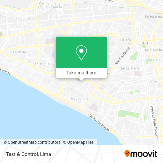
See Test & Control, San Miguel, on the map
Public Transit to Test & Control in San Miguel
Wondering how to get to Test & Control in San Miguel? Moovit helps you find the best way to get to Test & Control with step-by-step directions from the nearest public transit station.
Moovit provides free maps and live directions to help you navigate through your city. View schedules, routes, timetables, and find out how long does it take to get to Test & Control in real time.
Looking for the nearest stop or station to Test & Control? Check out this list of stops closest to your destination: Castilla; Bartolomé Herrera; La Marina; Amazonas.
Bus: 1024, 1315, 201, 209, 1163, IM47, 206, OM19, 204, 1010, 1012, 1111, 1205, 1173.
Want to see if there’s another route that gets you there at an earlier time? Moovit helps you find alternative routes or times. Get directions from and directions to Test & Control easily from the Moovit App or Website.
We make riding to Test & Control easy, which is why over 1.5 million users, including users in San Miguel, trust Moovit as the best app for public transit. You don’t need to download an individual bus app or train app, Moovit is your all-in-one transit app that helps you find the best bus time or train time available.
For information on prices of bus and metro, costs and ride fares to Test & Control, please check the Moovit app.
Use the app to navigate to popular places including to the airport, hospital, stadium, grocery store, mall, coffee shop, school, college, and university.
Test & Control Address: Calle Gerardo Dianderas San Miguelito, 15086 San Miguel street in San Miguel
- Seguros Fernando Villanueva,
- Cortez de la Cruz Pablo Laureano,
- Calle Micaela Bastidas,
- Parque Miguel Alegre,
- Bendezu Riosjesus Martín,
- Mayor FAP Miguel Alegre Rodriguez,
- Hernández Quispe Adonias,
- Rufino Echenique,
- Software-Asesoría-Soporte al Pc S. A. c.,
- Serigrafias-Casa Sagra,
- Calle Mama Runter 226,
- Lozada Matta Arturo Alexander,
- Parque Mayor FAP Miguel Alegre,
- Thorsoft.Info,
- Orlando Decor,
- Manuel Perez Oblitas,
- Bobadilla Bocanegra Liliana Empera,
- International Analytical Services,
- Klingspor,
- Antis Representaciones
Places Near Test & Control (San Miguel)
- Larcomar, Miraflores,
- Av. La Marina, San Miguel,
- Circuito Mágico Del Agua, Lima,
- Plaza San Miguel, San Miguel,
- Pontificia Universidad Católica del Perú - PUCP, San Miguel,
- Gamarra,
- Av. Salaverry, Jesus Mari,
- Real Plaza Puruchuco, Ate,
- Av. Abancay, Lima,
- Barranco, Barranco,
- Aeropuerto Internacional Jorge Chávez, Ventanilla,
- Centro Comercial Plaza Norte, Independen,
- av arequipa, Lima,
- Miraflores, Miraflores,
- Mall Del Sur,
- Parque Kennedy, Miraflores,
- Hospital Edgardo Rebagliati Martins, Jesus Mari,
- Jockey Plaza, Santiago D,
- Paradero Av.Brasil,
- Parque de las Leyendas, San Miguel
How to get to popular places in Lima with public transit
Get around San Miguel by public transit!
Traveling around San Miguel has never been so easy. See step by step directions as you travel to any attraction, street or major public transit station. View bus and train schedules, arrival times, service alerts and detailed routes on a map, so you know exactly how to get to anywhere in San Miguel.
When traveling to any destination around San Miguel use Moovit's Live Directions with Get Off Notifications to know exactly where and how far to walk, how long to wait for your line, and how many stops are left. Moovit will alert you when it's time to get off — no need to constantly re-check whether yours is the next stop.
Wondering how to use public transit in San Miguel or how to pay for public transit in San Miguel? Moovit public transit app can help you navigate your way with public transit easily, and at minimum cost. It includes public transit fees, ticket prices, and costs. Looking for a map of San Miguel public transit lines? Moovit public transit app shows all public transit maps in San Miguel with all Bus, Metro and Ferry routes and stops on an interactive map.
Lima has 3 transit type(s), including: Bus, Metro and Ferry, operated by several transit agencies, including Metro de Lima Línea 2 , Metro de Lima, Corredor Rojo, Metropolitano, Metropolitano - Alimentadores, Corredor Morado, Corredor Azul, Rutas Tradicionales, Transportes y Servicios La Esperanza S.A., Las Flores S.A., Virgen de la Asunción S.A., Consorcio HAM, Transportes y Service Canadá S.A., ETUL4SA and ETUCHISA