How to get to Test Loc Name by bus?
Click on the bus route to see step by step directions with maps, line arrival times and updated time schedules.
From MTA Subway - Lexington Ave/53rd St (E/M/6), Manhattan
42 minFrom Mount Sinai Hospital, Manhattan
43 minFrom Astoria, Queens
86 minFrom 200 Park, Manhattan
31 minFrom Consulado Ecuatoriano en Queens, Queens
68 minFrom The Hotel Edison Nyc, Manhattan
47 minFrom LaGuardia High School, Manhattan
52 minFrom John F Kennedy Blvd, Jersey City
90 minFrom Bayonne, NJ, Bayonne
49 minFrom Walmart Supercenter, Bayonne
67 min
How to get to Test Loc Name by train?
Click on the train route to see step by step directions with maps, line arrival times and updated time schedules.
How to get to Test Loc Name by subway?
Click on the subway route to see step by step directions with maps, line arrival times and updated time schedules.
Subway stations near Test Loc Name in Manhattan
Bus stops near Test Loc Name in Manhattan
- Broadway Between Fulton & Dey St, 4 min walk,VIEW
- Water St/John St, 4 min walk,VIEW
- Broadway/Cortlandt St, 5 min walk,VIEW
- Broadway/Vesey St, 5 min walk,VIEW
- New York - Broadway @ Cortlandt St (Northbound), 5 min walk,VIEW
- Park Row/Beekman St, 5 min walk,VIEW
- Park Row/Spruce St, 6 min walk,VIEW
- Water St & Fulton St, 6 min walk,VIEW
Bus lines to Test Loc Name in Manhattan
- SUBURBAN TRANSIT, New York,VIEW
- QM11, Forest Hills,VIEW
- QM25, Downtown Via Church St Via Water St,VIEW
- SIM4, Annadale Via Richmond Av,VIEW
- SIM4C, Huguenot Via Richmond Av Via Arthur Kill,VIEW
- SIM32, Travis Via N Gannon Av Via Victory Bl,VIEW
- M55, South Ferry,VIEW
- SIM2, Tottenville Via Huguenot Av Via Hylan Bl,VIEW
- SIM34, Mariners Harbor Via Watchogue Rd,VIEW
- 206, Parkway Express - Wall Street Via Jersey City,VIEW
- 314, Parkway Express to Wall Street-Starts Monmouth,VIEW
- 404, Route 9 to Wall Street,VIEW
- SIM15, Eltingville Transit Center Via Richmond,VIEW
- QM65, Laurelton,VIEW
- M103, City Hall Via Lex Av,VIEW
- BXM18, Downtown Wall St Via 5 Av Via Broadway,VIEW
- SIM1, Eltngvlle Trans Ctr Via Hylan Via Rich,VIEW
- SIM1C, Eltngvlle Trans Ctr Via Hylan Via Rich,VIEW
- SIM3C, Pt Rchmnd Via Narrows Rd N Via Watchogue,VIEW
- SIM33C, Mariners Harbor Via N Gannon Av,VIEW
What are the closest stations to Test Loc Name?
The closest stations to Test Loc Name are:
- Wall St is 165 yards away, 3 min walk.
- Fulton St is 184 yards away, 3 min walk.
- Broadway Between Fulton & Dey St is 313 yards away, 4 min walk.
- Water St/John St is 331 yards away, 4 min walk.
- Broadway/Cortlandt St is 338 yards away, 5 min walk.
- Broadway/Vesey St is 367 yards away, 5 min walk.
- New York - Broadway @ Cortlandt St (Northbound) is 374 yards away, 5 min walk.
- Park Row/Beekman St is 382 yards away, 5 min walk.
- Park Row/Spruce St is 414 yards away, 6 min walk.
- Water St & Fulton St is 424 yards away, 6 min walk.
- World Trade Center is 463 yards away, 6 min walk.
- Cortlandt St is 506 yards away, 7 min walk.
Which bus lines stop near Test Loc Name?
These bus lines stop near Test Loc Name: 120, BXM18, M103, M55, QM11.
Which train lines stop near Test Loc Name?
These train lines stop near Test Loc Name: BLU, GRE, RED.
Which subway lines stop near Test Loc Name?
These subway lines stop near Test Loc Name: 3, 4, 5, A.
What’s the nearest subway station to Test Loc Name in Manhattan?
The nearest subway stations to Test Loc Name in Manhattan are Wall St and Fulton St. The closest one is a 3 min walk away.
What’s the nearest bus station to Test Loc Name in Manhattan?
The nearest bus stations to Test Loc Name in Manhattan are Broadway Between Fulton & Dey St and Water St/John St. The closest one is a 4 min walk away.
What time is the first subway to Test Loc Name in Manhattan?
The J is the first subway that goes to Test Loc Name in Manhattan. It stops nearby at 3:00 AM.
What time is the last subway to Test Loc Name in Manhattan?
The 2 is the last subway that goes to Test Loc Name in Manhattan. It stops nearby at 4:12 AM.
What time is the first bus to Test Loc Name in Manhattan?
The M103 is the first bus that goes to Test Loc Name in Manhattan. It stops nearby at 3:35 AM.
What time is the last bus to Test Loc Name in Manhattan?
The M103 is the last bus that goes to Test Loc Name in Manhattan. It stops nearby at 3:35 AM.
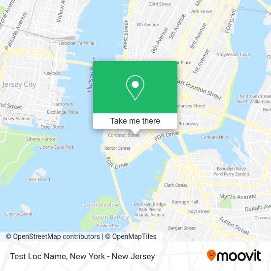
See Test Loc Name, Manhattan, on the map
Public Transit to Test Loc Name in Manhattan
Wondering how to get to Test Loc Name in Manhattan? Moovit helps you find the best way to get to Test Loc Name with step-by-step directions from the nearest public transit station.
Moovit provides free maps and live directions to help you navigate through your city. View schedules, routes, timetables, and find out how long does it take to get to Test Loc Name in real time.
Looking for the nearest stop or station to Test Loc Name? Check out this list of stops closest to your destination: Wall St; Fulton St; Broadway Between Fulton & Dey St; Water St/John St; Broadway/Cortlandt St; Broadway/Vesey St; New York - Broadway @ Cortlandt St (Northbound); Park Row/Beekman St; Park Row/Spruce St; Water St & Fulton St; World Trade Center; Cortlandt St.
Bus: 120, BXM18, M103, M55, QM11, SUBURBAN TRANSIT, QM25.Train: BLU, GRE, RED.Subway: 3, 4, 5, A, 2, C, J, Z, E, N, Q, R, W.
Want to see if there’s another route that gets you there at an earlier time? Moovit helps you find alternative routes or times. Get directions from and directions to Test Loc Name easily from the Moovit App or Website.
We make riding to Test Loc Name easy, which is why over 1.5 million users, including users in Manhattan, trust Moovit as the best app for public transit. You don’t need to download an individual bus app or train app, Moovit is your all-in-one transit app that helps you find the best bus time or train time available.
For information on prices of subway, bus, train and light rail, costs and ride fares to Test Loc Name, please check the Moovit app.
Use the app to navigate to popular places including to the airport, hospital, stadium, grocery store, mall, coffee shop, school, college, and university.
Test Loc Name Address: 123 William St street in Manhattan
- Manhattan Children and Family Services,
- Cmoon Production,
- Social Security Administration,
- 125 William St (William St,125),
- Fulton Street (2,3),
- Pacific College of Oriental Medicine,
- Single Stop,
- D&M Bbq,
- Just,
- New York State Office For New Americans,
- Fedex Staffed,
- Children's Hospital,
- Jhoothi Bewafa,
- Ear Properties,
- Pacific College Of Health and Science,
- Delfin Dental,
- Stack Overflow HQ,
- Berkeley Publishers,
- 19,
- New York Erectile Dysfunction Doctor
Places Near Test Loc Name (Manhattan)
- Queens Center Mall, Queens,
- 26 Federal Plaza, Manhattan,
- Katz's Deli, Manhattan,
- Hudson Yards, Manhattan,
- 111 Centre New York City Supreme Court, Manhattan,
- SoHo, Manhattan,
- 66 John Street, Manhattan,
- San Gennaro Feast, Manhattan,
- Times Square, Manhattan,
- Chinatown, Manhattan,
- 3 Stone St, Manhattan,
- Rockefeller Center, Manhattan,
- Wall Street, Manhattan,
- Mountainside Hospital, Glen Ridge,
- 911 Memorial, Manhattan,
- 1 Police Plaza, Manhattan,
- 376 Hudson Street, Manhattan,
- Bellevue Hospital, Manhattan,
- Pier 83, Manhattan,
- qqqq, Manhattan
How to get to popular places in New York - New Jersey with public transit
Get around Manhattan by public transit!
Traveling around Manhattan has never been so easy. See step by step directions as you travel to any attraction, street or major public transit station. View bus and train schedules, arrival times, service alerts and detailed routes on a map, so you know exactly how to get to anywhere in Manhattan.
When traveling to any destination around Manhattan use Moovit's Live Directions with Get Off Notifications to know exactly where and how far to walk, how long to wait for your line, and how many stops are left. Moovit will alert you when it's time to get off — no need to constantly re-check whether yours is the next stop.
Wondering how to use public transit in Manhattan or how to pay for public transit in Manhattan? Moovit public transit app can help you navigate your way with public transit easily, and at minimum cost. It includes public transit fees, ticket prices, and costs. Looking for a map of Manhattan public transit lines? Moovit public transit app shows all public transit maps in Manhattan with all Bus, Train, Subway, Light Rail, Ferry and Cable Car routes and stops on an interactive map.
New York - New Jersey has 6 transit type(s), including: Bus, Train, Subway, Light Rail, Ferry and Cable Car, operated by several transit agencies, including MTA Subway, Metro-North Railroad, LIRR, PATH, MTA New York City Transit - Express routes, MTA Bus, NJ Transit, NYC Ferry, NICE bus, Bee-Line Bus, NJ Transit Rail, Norwalk Transit District, Hartford Line, River Valley Transit and HART