How to get to Test Me Dna by bus?
Click on the bus route to see step by step directions with maps, line arrival times and updated time schedules.
From IKEA, Prince George's County
36 minFrom IKEA - College Park, Prince George's County
32 minFrom Adventist HealthCare White Oak Medical Center-ER (Adventist White Oak Med Ctr-ER), Montgomery County
56 minFrom Beltsville, Maryland, Prince George's County
33 minFrom Lincoln Tech, Howard County
54 minFrom National Archives at College Park, Prince George's County
92 minFrom Sears Auto Center, Montgomery County
85 minFrom Doctors Community Hospital, Prince George's County
72 minFrom Beltway Plaza Mall, Prince George's County
47 min
Bus stops near Test Me Dna in Prince George's County
Train station near Test Me Dna in Prince George's County
- Laurel Marc Sb, 41 min walk,VIEW
Bus lines to Test Me Dna in Prince George's County
What are the closest stations to Test Me Dna?
The closest stations to Test Me Dna are:
- Van Dusen Rd+Contee Rd is 168 yards away, 3 min walk.
- Cherry Lane And Kalmia Drive is 407 yards away, 5 min walk.
- Van Dusen Rd at Westside Blvd is 512 yards away, 7 min walk.
- Laurel Marc Sb is 3490 yards away, 41 min walk.
Which bus lines stop near Test Me Dna?
These bus lines stop near Test Me Dna: 302, P19.
What’s the nearest bus station to Test Me Dna in Prince George's County?
The nearest bus station to Test Me Dna in Prince George's County is Van Dusen Rd+Contee Rd. It’s a 3 min walk away.
What time is the first train to Test Me Dna in Prince George's County?
The MARC is the first train that goes to Test Me Dna in Prince George's County. It stops nearby at 5:28 AM.
What time is the last train to Test Me Dna in Prince George's County?
The MARC is the last train that goes to Test Me Dna in Prince George's County. It stops nearby at 8:13 PM.
What time is the first bus to Test Me Dna in Prince George's County?
The M52 is the first bus that goes to Test Me Dna in Prince George's County. It stops nearby at 5:05 AM.
What time is the last bus to Test Me Dna in Prince George's County?
The 503 is the last bus that goes to Test Me Dna in Prince George's County. It stops nearby at 8:53 PM.
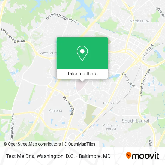
See Test Me Dna, Prince George's County, on the map
Public Transit to Test Me Dna in Prince George's County
Wondering how to get to Test Me Dna in Prince George's County? Moovit helps you find the best way to get to Test Me Dna with step-by-step directions from the nearest public transit station.
Moovit provides free maps and live directions to help you navigate through your city. View schedules, routes, timetables, and find out how long does it take to get to Test Me Dna in real time.
Looking for the nearest stop or station to Test Me Dna? Check out this list of stops closest to your destination: Van Dusen Rd+Contee Rd; Cherry Lane And Kalmia Drive; Van Dusen Rd at Westside Blvd; Laurel Marc Sb.
Bus: 302, P19, M52, 301, 503.Train: MARC.
Want to see if there’s another route that gets you there at an earlier time? Moovit helps you find alternative routes or times. Get directions from and directions to Test Me Dna easily from the Moovit App or Website.
We make riding to Test Me Dna easy, which is why over 1.7 million users, including users in Prince George's County, trust Moovit as the best app for public transit. You don’t need to download an individual bus app or train app, Moovit is your all-in-one transit app that helps you find the best bus time or train time available.
For information on prices of bus, costs and ride fares to Test Me Dna, please check the Moovit app.
Get to Test Me Dna with public transit and pay for the ride in the Moovit app. In addition to all info you may need for your trip to Test Me Dna, including live directions, real-time arrivals and fare prices, you can also buy public transit passes for your rides. No need for cash or paper tickets to get to Test Me Dna - everything you need is accessible in the app with a click of the button.
Use the app to navigate to popular places including to the airport, hospital, stadium, grocery store, mall, coffee shop, school, college, and university.
Test Me Dna Address: 7350 Van Dusen Rd street in Prince George's County
- University of Maryland Medical System UM Laurel Medical Center-ER,
- Laurel Regional Hospital,
- Um Laurel Medical Center-ER,
- Patuxent River Health & Rehabilitation (Autumn Lake Healthcare at Patuxent River),
- Laurel High School,
- Laurel High School-Track & Field,
- I-95 Exit 33 - Laurel / Burtonsville (Sandy Spring Rd / MD 198),
- Dollar Tree,
- DD's Discounts,
- Arbory Clubhouse,
- US-1 (RT-1),
- Carlax,
- DoubleTree by Hilton Hotel Laurel,
- Van Dusen and Old Sandy Spring Rd,
- Towne Centre at Laurel,
- Regal Cinemas Laurel Towne Centre 12,
- Blink Charging,
- Laurel Town Centre,
- 5th Avenue Beauty Discount (5th Ave Beauty Supply),
- Bank Of America
Places Near Test Me Dna (Prince George's County)
- Basilica of the National Shrine, Washington,
- Camden Yards, Baltimore,
- Museum Of The Bible, Washington,
- Marriott Marquis Washington, DC, Washington,
- Westfield Montgomery Mall, Montgomery County,
- National Theatre, Washington,
- Capital One Arena, Washington,
- Georgetown, Washington,
- Amazon Hq2, Arlington County,
- Pennsylvania Ave NW (3rd st and pennsylvania), Washington,
- Washington National Cathedral, Washington,
- Rock Creek Tennis Center, Washington,
- Sibley Memorial Hospital, Washington,
- National Museum of African American History and Culture, Washington,
- The Anthem, Washington,
- Washington DC VA Medical Center, Washington,
- National Zoo, Washington,
- Warner Theatre, Washington,
- M&T Bank Stadium, Baltimore,
- PG Mall, Prince George's County
How to get to popular places in Washington, D.C. - Baltimore, MD with public transit
Get around Prince George's County by public transit!
Traveling around Prince George's County has never been so easy. See step by step directions as you travel to any attraction, street or major public transit station. View bus and train schedules, arrival times, service alerts and detailed routes on a map, so you know exactly how to get to anywhere in Prince George's County.
When traveling to any destination around Prince George's County use Moovit's Live Directions with Get Off Notifications to know exactly where and how far to walk, how long to wait for your line, and how many stops are left. Moovit will alert you when it's time to get off — no need to constantly re-check whether yours is the next stop.
Wondering how to use public transit in Prince George's County or how to pay for public transit in Prince George's County? Moovit public transit app can help you navigate your way with public transit easily, and at minimum cost. It includes public transit fees, ticket prices, and costs. Looking for a map of Prince George's County public transit lines? Moovit public transit app shows all public transit maps in Prince George's County with all Bus, Train, Metro, Light Rail and Ferry routes and stops on an interactive map.
Washington, D.C. - Baltimore, MD has 5 transit type(s), including: Bus, Train, Metro, Light Rail and Ferry, operated by several transit agencies, including WMATA, Montgomery County Ride On, Fairfax Connector, TheBus, PRTC, DASH - Alexandria, Arlington Transit (ART), RTA of Central Maryland, MDOT MTA, MDOT MTA Light RailLink, MDOT MTA Commuter Bus, MDOT MTA Local Bus, FXBGO!, Virginia Railway Express (VRE) and MARC