Directions to Test Strip Exchange (South Valley Stream) with public transportation
The following transit lines have routes that pass near Test Strip Exchange
 Bus: N1, Q87, Q5, Q89, ELFX.
- Train: FAR ROCKAWAY BRANCH, LONG BEACH BRANCH, BABYLON BRANCH.
How to get to Test Strip Exchange by bus?
Click on the bus route to see step by step directions with maps, line arrival times and updated time schedules.
From Garden City, NY, Garden City
89 minFrom Long Island Jewish Hospital, Queens
88 minFrom Roy Wilkins Park, Queens
34 minFrom Queens County Farm Museum, Queens
89 minFrom Far Rockaway, NY, Queens
55 minFrom Resorts World Casino, Rockaway, NY, Queens
57 minFrom Fresh Meadows, Queens
71 minFrom Northwell - Long Island Jewish Medical Center, Queens
87 minFrom Queens Hospital Center, Queens
60 minFrom Howard Beach, Queens
84 min
How to get to Test Strip Exchange by train?
Click on the train route to see step by step directions with maps, line arrival times and updated time schedules.
Bus stops near Test Strip Exchange in South Valley Stream
Train stations near Test Strip Exchange in South Valley Stream
Bus lines to Test Strip Exchange in South Valley Stream
What are the closest stations to Test Strip Exchange?
The closest stations to Test Strip Exchange are:
- Green Acres Rd /Green Acres Mall is 198 yards away, 3 min walk.
- Green Acres Rd / Macy's is 230 yards away, 3 min walk.
- Rosedale is 1608 yards away, 19 min walk.
- Valley Stream is 1856 yards away, 22 min walk.
- Francis Lewis Blvd/147 Dr is 1879 yards away, 23 min walk.
- 147 Av/Francis Lewis Blvd is 2316 yards away, 28 min walk.
Which bus lines stop near Test Strip Exchange?
These bus lines stop near Test Strip Exchange: N1, Q87.
Which train lines stop near Test Strip Exchange?
These train lines stop near Test Strip Exchange: FAR ROCKAWAY BRANCH, LONG BEACH BRANCH.
What’s the nearest train station to Test Strip Exchange in South Valley Stream?
The nearest train station to Test Strip Exchange in South Valley Stream is Rosedale. It’s a 19 min walk away.
What’s the nearest bus station to Test Strip Exchange in South Valley Stream?
The nearest bus stations to Test Strip Exchange in South Valley Stream are Green Acres Rd /Green Acres Mall and Green Acres Rd / Macy's. The closest one is a 3 min walk away.
What time is the first train to Test Strip Exchange in South Valley Stream?
The FAR ROCKAWAY BRANCH is the first train that goes to Test Strip Exchange in South Valley Stream. It stops nearby at 3:02 AM.
What time is the last train to Test Strip Exchange in South Valley Stream?
The FAR ROCKAWAY BRANCH is the last train that goes to Test Strip Exchange in South Valley Stream. It stops nearby at 3:05 AM.
What time is the first bus to Test Strip Exchange in South Valley Stream?
The Q111 is the first bus that goes to Test Strip Exchange in South Valley Stream. It stops nearby at 3:00 AM.
What time is the last bus to Test Strip Exchange in South Valley Stream?
The Q111 is the last bus that goes to Test Strip Exchange in South Valley Stream. It stops nearby at 3:00 AM.
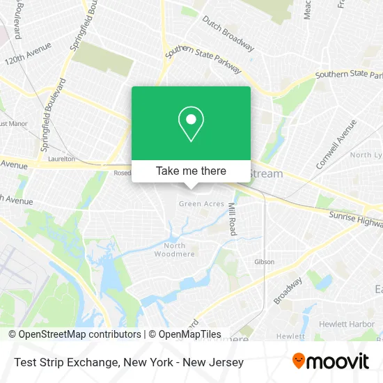
See Test Strip Exchange, South Valley Stream, on the map
Public Transit to Test Strip Exchange in South Valley Stream
Wondering how to get to Test Strip Exchange in South Valley Stream? Moovit helps you find the best way to get to Test Strip Exchange with step-by-step directions from the nearest public transit station.
Moovit provides free maps and live directions to help you navigate through your city. View schedules, routes, timetables, and find out how long does it take to get to Test Strip Exchange in real time.
Looking for the nearest stop or station to Test Strip Exchange? Check out this list of stops closest to your destination: Green Acres Rd /Green Acres Mall; Green Acres Rd / Macy's; Rosedale; Valley Stream; Francis Lewis Blvd/147 Dr; 147 Av/Francis Lewis Blvd.
Bus: N1, Q87, Q5, Q89, ELFX, QM63, Q111.Train: FAR ROCKAWAY BRANCH, LONG BEACH BRANCH, BABYLON BRANCH.
Want to see if there’s another route that gets you there at an earlier time? Moovit helps you find alternative routes or times. Get directions from and directions to Test Strip Exchange easily from the Moovit App or Website.
We make riding to Test Strip Exchange easy, which is why over 1.5 million users, including users in South Valley Stream, trust Moovit as the best app for public transit. You don’t need to download an individual bus app or train app, Moovit is your all-in-one transit app that helps you find the best bus time or train time available.
For information on prices of bus and train, costs and ride fares to Test Strip Exchange, please check the Moovit app.
Use the app to navigate to popular places including to the airport, hospital, stadium, grocery store, mall, coffee shop, school, college, and university.
Test Strip Exchange Address: 2048 Green Acres Mall street in South Valley Stream
- BB by Clique,
- Kohl's Valley Stream,
- Yapona Whisky & Vodka,
- Liquor & Wine Warehouse,
- Hollister,
- Primark,
- Nesberrys Caribbean Ice Cream,
- Snipes,
- Wetzel's Pretzels,
- Charleys Cheesesteaks,
- New York Chiropractic and Scoliosis Center,
- American Eagle,
- Alen Cooper,
- Littman Jewelers,
- Nassau Downs Otb,
- Auntie Anne's Green Acres Mall,
- Asphalt Nyc,
- Jewelry Plaza,
- 22 W Circle Drive Green Acres Mall 11581 Valley Stream,
- New NY Styles Inc
Places Near Test Strip Exchange (South Valley Stream)
- Times Square, Manhattan,
- Queens Center Mall, Queens,
- 66 John Street, Manhattan,
- 376 Hudson Street, Manhattan,
- Wall Street, Manhattan,
- Chinatown, Manhattan,
- 111 Centre New York City Supreme Court, Manhattan,
- Mountainside Hospital, Glen Ridge,
- SoHo, Manhattan,
- 26 Federal Plaza, Manhattan,
- San Gennaro Feast, Manhattan,
- Bellevue Hospital, Manhattan,
- Hudson Yards, Manhattan,
- qqqq, Manhattan,
- 911 Memorial, Manhattan,
- Katz's Deli, Manhattan,
- Pier 83, Manhattan,
- Rockefeller Center, Manhattan,
- 1 Police Plaza, Manhattan,
- 3 Stone St, Manhattan
How to get to popular places in New York - New Jersey with public transit
Get around South Valley Stream by public transit!
Traveling around South Valley Stream has never been so easy. See step by step directions as you travel to any attraction, street or major public transit station. View bus and train schedules, arrival times, service alerts and detailed routes on a map, so you know exactly how to get to anywhere in South Valley Stream.
When traveling to any destination around South Valley Stream use Moovit's Live Directions with Get Off Notifications to know exactly where and how far to walk, how long to wait for your line, and how many stops are left. Moovit will alert you when it's time to get off — no need to constantly re-check whether yours is the next stop.
Wondering how to use public transit in South Valley Stream or how to pay for public transit in South Valley Stream? Moovit public transit app can help you navigate your way with public transit easily, and at minimum cost. It includes public transit fees, ticket prices, and costs. Looking for a map of South Valley Stream public transit lines? Moovit public transit app shows all public transit maps in South Valley Stream with all Bus, Train, Subway, Light Rail, Ferry and Cable Car routes and stops on an interactive map.
New York - New Jersey has 6 transit type(s), including: Bus, Train, Subway, Light Rail, Ferry and Cable Car, operated by several transit agencies, including MTA Subway, Metro-North Railroad, LIRR, PATH, MTA New York City Transit - Express routes, MTA Bus, NJ Transit, NYC Ferry, NICE bus, Bee-Line Bus, NJ Transit Rail, Norwalk Transit District, Hartford Line, River Valley Transit and HART