How to get to Testbed by bus?
Click on the bus route to see step by step directions with maps, line arrival times and updated time schedules.
From Holiday Inn National Airport/Crystal City, Arlington County
49 minFrom Malcolm X Park, Washington
110 minFrom Pentagon City Mall, Arlington County
52 minFrom Cambria Hotel, Washington
117 minFrom Tomb of the Unknown Soldier, Arlington County
61 minFrom East Potomac Park, Washington
135 minFrom Hains Point, Washington
139 minFrom Costco, Arlington County
70 minFrom Residence Inn by Marriott Arlington Capital View, Arlington County
42 minFrom Frederick Douglass Memorial Bridge, Washington
109 min
How to get to Testbed by train?
Click on the train route to see step by step directions with maps, line arrival times and updated time schedules.
From Holiday Inn National Airport/Crystal City, Arlington County
70 minFrom Pentagon City Mall, Arlington County
73 minFrom Tomb of the Unknown Soldier, Arlington County
75 minFrom East Potomac Park, Washington
80 minFrom Costco, Arlington County
72 minFrom Residence Inn by Marriott Arlington Capital View, Arlington County
71 min
How to get to Testbed by metro?
Click on the metro route to see step by step directions with maps, line arrival times and updated time schedules.
From Holiday Inn National Airport/Crystal City, Arlington County
42 minFrom Malcolm X Park, Washington
67 minFrom Pentagon City Mall, Arlington County
35 minFrom Cambria Hotel, Washington
59 minFrom Tomb of the Unknown Soldier, Arlington County
24 minFrom East Potomac Park, Washington
57 minFrom Hains Point, Washington
61 minFrom Costco, Arlington County
48 minFrom Residence Inn by Marriott Arlington Capital View, Arlington County
43 minFrom Frederick Douglass Memorial Bridge, Washington
61 min
Bus stops near Testbed in Fairfax County
Metro station near Testbed in Fairfax County
- Braddock Road Metro, 32 min walk,VIEW
Train station near Testbed in Fairfax County
- Alexandria, 33 min walk,VIEW
Bus lines to Testbed in Fairfax County
What are the closest stations to Testbed?
The closest stations to Testbed are:
- Huntington Ave @ Foley St is 10 yards away, 1 min walk.
- Huntington Av+Laura Mews Pl is 11 yards away, 1 min walk.
- Braddock Road Metro is 2730 yards away, 32 min walk.
- Alexandria is 2802 yards away, 33 min walk.
Which bus lines stop near Testbed?
These bus lines stop near Testbed: 171, A11, F1X.
Which train line stops near Testbed?
MANASSAS LINE (Broad Run)
Which metro line stops near Testbed?
YELLOW (Huntington)
What’s the nearest bus station to Testbed in Fairfax County?
The nearest bus stations to Testbed in Fairfax County are Huntington Ave @ Foley St and Huntington Av+Laura Mews Pl. The closest one is a 1 min walk away.
What time is the first metro to Testbed in Fairfax County?
The YELLOW is the first metro that goes to Testbed in Fairfax County. It stops nearby at 5:00 AM.
What time is the last metro to Testbed in Fairfax County?
The YELLOW is the last metro that goes to Testbed in Fairfax County. It stops nearby at 12:39 AM.
What time is the first train to Testbed in Fairfax County?
The SILVER METEOR is the first train that goes to Testbed in Fairfax County. It stops nearby at 5:54 AM.
What time is the last train to Testbed in Fairfax County?
The SILVER METEOR is the last train that goes to Testbed in Fairfax County. It stops nearby at 5:54 AM.
What time is the first bus to Testbed in Fairfax County?
The 171 is the first bus that goes to Testbed in Fairfax County. It stops nearby at 4:08 AM.
What time is the last bus to Testbed in Fairfax County?
The A11 is the last bus that goes to Testbed in Fairfax County. It stops nearby at 2:10 AM.
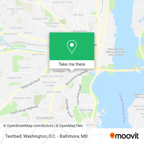
See Testbed, Fairfax County, on the map
Public Transit to Testbed in Fairfax County
Wondering how to get to Testbed in Fairfax County? Moovit helps you find the best way to get to Testbed with step-by-step directions from the nearest public transit station.
Moovit provides free maps and live directions to help you navigate through your city. View schedules, routes, timetables, and find out how long does it take to get to Testbed in real time.
Looking for the nearest stop or station to Testbed? Check out this list of stops closest to your destination: Huntington Ave @ Foley St; Huntington Av+Laura Mews Pl; Braddock Road Metro; Alexandria.
Bus: 171, A11, F1X, 101.Train: MANASSAS LINE, CARDINAL, CAROLINIAN, CRESCENT, FLORIDIAN, NORTHEAST REGIONAL.Metro: YELLOW, BLUE.
Want to see if there’s another route that gets you there at an earlier time? Moovit helps you find alternative routes or times. Get directions from and directions to Testbed easily from the Moovit App or Website.
We make riding to Testbed easy, which is why over 1.5 million users, including users in Fairfax County, trust Moovit as the best app for public transit. You don’t need to download an individual bus app or train app, Moovit is your all-in-one transit app that helps you find the best bus time or train time available.
For information on prices of bus, metro and train, costs and ride fares to Testbed, please check the Moovit app.
Use the app to navigate to popular places including to the airport, hospital, stadium, grocery store, mall, coffee shop, school, college, and university.
Testbed Address: 2089 Laura Mews Pl Alexandria, VA 22303 street in Fairfax County
- Lularoe Ashley Spellma,
- Chiropractic Chiropractors,
- Home Answers Inc,
- Skin Suite,
- District Limo Service,
- WNB Factory,
- Jawa Sandwich Shop,
- Huntington Gateway,
- Capital Properties Services,
- Chemotherapy Pest Control Services Pest Control,
- Huntington Gateway Pool,
- Youneek Tattoos,
- ChargePoint,
- Locksmith Service,
- Charisma Christian Counseling,
- Woofie Walkie,
- Budget Host,
- Mothership Pizza,
- Huntington, Virginia,
- Lock Shop Locksmith
Places Near Testbed (Fairfax County)
- Warner Theatre, Washington,
- Washington DC VA Medical Center, Washington,
- National Mall, Washington,
- National Zoo, Washington,
- Amazon Hq2, Arlington County,
- National Museum of African American History and Culture, Washington,
- Rock Creek Tennis Center, Washington,
- Sibley Memorial Hospital, Washington,
- Marriott Marquis Washington, DC, Washington,
- Camden Yards, Baltimore,
- PG Mall, Prince George's County,
- Museum Of The Bible, Washington,
- The Anthem, Washington,
- Capital One Arena, Washington,
- Pennsylvania Ave NW (3rd st and pennsylvania), Washington,
- Westfield Montgomery Mall, Montgomery County,
- Washington National Cathedral, Washington,
- M&T Bank Stadium, Baltimore,
- Georgetown, Washington,
- Basilica of the National Shrine, Washington
How to get to popular places in Washington, D.C. - Baltimore, MD with public transit
Get around Fairfax County by public transit!
Traveling around Fairfax County has never been so easy. See step by step directions as you travel to any attraction, street or major public transit station. View bus and train schedules, arrival times, service alerts and detailed routes on a map, so you know exactly how to get to anywhere in Fairfax County.
When traveling to any destination around Fairfax County use Moovit's Live Directions with Get Off Notifications to know exactly where and how far to walk, how long to wait for your line, and how many stops are left. Moovit will alert you when it's time to get off — no need to constantly re-check whether yours is the next stop.
Wondering how to use public transit in Fairfax County or how to pay for public transit in Fairfax County? Moovit public transit app can help you navigate your way with public transit easily, and at minimum cost. It includes public transit fees, ticket prices, and costs. Looking for a map of Fairfax County public transit lines? Moovit public transit app shows all public transit maps in Fairfax County with all Bus, Train, Metro, Light Rail and Ferry routes and stops on an interactive map.
Washington, D.C. - Baltimore, MD has 5 transit type(s), including: Bus, Train, Metro, Light Rail and Ferry, operated by several transit agencies, including WMATA, Montgomery County Ride On, Fairfax Connector, TheBus, PRTC, DASH - Alexandria, Arlington Transit (ART), RTA of Central Maryland, MDOT MTA, MDOT MTA Light RailLink, MDOT MTA Commuter Bus, MDOT MTA Local Bus, FXBGO!, Virginia Railway Express (VRE) and MARC