How to get to Testfleck by bus?
Click on the bus route to see step by step directions with maps, line arrival times and updated time schedules.
From MVV Energie Ladestation, Käfertal
79 minFrom Globus Getränkemarkt, Ludwigshafen-Oggersheim
64 minFrom Möbel Höffner, Schwetzingen
79 minFrom GRN-Klinik Schwetzingen, Schwetzingen
122 minFrom Thoraxklinik Heidelberg, Neuenheim
171 minFrom Globus Getränkecenter, Ludwigshafen-Oggersheim
63 minFrom FH 1863, Neckarstadt-Ost/Wohlgelegen
68 minFrom Marie-Baum-Schule Heidelberg, Wieblingen
169 minFrom Friedhof Käfertal, Käfertal
91 min
How to get to Testfleck by train?
Click on the train route to see step by step directions with maps, line arrival times and updated time schedules.
Bus stops near Testfleck in Ludwigshafen-Südliche-Innenstadt
Light Rail stations near Testfleck in Ludwigshafen-Südliche-Innenstadt
Bus lines to Testfleck in Ludwigshafen-Südliche-Innenstadt
- E, Valentin-Bauer-Siedlung - Ostringplatz,VIEW
- E, Oppau, Fritz-Haber-Straße BASF Tor 12+13 - Valentin-Bauer-Siedlung,VIEW
- E, Hans-Warsch-Platz - Valentin-Bauer-Siedlung,VIEW
- E, Valentin-Bauer-Siedlung - Maudach Kleestraße,VIEW
- E, Abteistraße - Goerdelerplatz,VIEW
- 96, Berliner Platz,VIEW
- 74, Berliner Platz Bf LU Mitte – Am Schwanen – Marienkrankenhaus – Niederfeld – Valentin-Bauer-Siedlung – LU Hauptbahnhof – LU Rathaus,VIEW
- 94, Berliner Platz Bf LU Mitte - Am Schwanen - Marienkrankenhaus - Niederfeld,VIEW
- E, Maudach Kleestraße - Berliner Platz, Bf LU Mitte,VIEW
- E, Von-Kieffer-Straße - Berliner Platz, Bf LU Mitte,VIEW
- 95, Berliner Platz,VIEW
- 75, Rheingönheim,VIEW
- 75E, Lu Hauptbahnhof,VIEW
- 76, Maudach,VIEW
- 78, Basf Süd,VIEW
- 80, Basf,VIEW
- 80E, Bbs Franz-Zang-Str,VIEW
- E, Maudach,VIEW
- 4, Hans-Warsch-Platz - LU Hauptbahnhof,VIEW
- 4, LU Hauptbahnhof - FT Industriegebiet Am Römig,VIEW
What are the closest stations to Testfleck?
The closest stations to Testfleck are:
- Valentin-Bauer-Siedlung is 239 meters away, 4 min walk.
- Mundenheim Nord is 461 meters away, 6 min walk.
- Valentin-Bauer-Siedlung Süd is 545 meters away, 8 min walk.
- Stifterstraße is 595 meters away, 8 min walk.
- Mundenheim, Stifterstraße is 629 meters away, 9 min walk.
- Lu Hauptbahnhof is 783 meters away, 11 min walk.
Which train lines stop near Testfleck?
These train lines stop near Testfleck: S3, S6.
Which light rail lines stop near Testfleck?
These light rail lines stop near Testfleck: 4A, S6.
Which bus lines stop near Testfleck?
These bus lines stop near Testfleck: 60, 710, 74, RNV 60.
What’s the nearest light rail station to Testfleck in Ludwigshafen-Südliche-Innenstadt?
The nearest light rail station to Testfleck in Ludwigshafen-Südliche-Innenstadt is Stifterstraße. It’s a 8 min walk away.
What’s the nearest bus station to Testfleck in Ludwigshafen-Südliche-Innenstadt?
The nearest bus station to Testfleck in Ludwigshafen-Südliche-Innenstadt is Valentin-Bauer-Siedlung. It’s a 4 min walk away.
What time is the first light rail to Testfleck in Ludwigshafen-Südliche-Innenstadt?
The E is the first light rail that goes to Testfleck in Ludwigshafen-Südliche-Innenstadt. It stops nearby at 3:53 AM.
What time is the last light rail to Testfleck in Ludwigshafen-Südliche-Innenstadt?
The E is the last light rail that goes to Testfleck in Ludwigshafen-Südliche-Innenstadt. It stops nearby at 1:35 AM.
What time is the first bus to Testfleck in Ludwigshafen-Südliche-Innenstadt?
The 90E is the first bus that goes to Testfleck in Ludwigshafen-Südliche-Innenstadt. It stops nearby at 4:22 AM.
What time is the last bus to Testfleck in Ludwigshafen-Südliche-Innenstadt?
The 95 is the last bus that goes to Testfleck in Ludwigshafen-Südliche-Innenstadt. It stops nearby at 12:40 AM.
See Testfleck, Ludwigshafen-Südliche-Innenstadt, on the map
Public Transit to Testfleck in Ludwigshafen-Südliche-Innenstadt
Wondering how to get to Testfleck in Ludwigshafen-Südliche-Innenstadt? Moovit helps you find the best way to get to Testfleck with step-by-step directions from the nearest public transit station.
Moovit provides free maps and live directions to help you navigate through your city. View schedules, routes, timetables, and find out how long does it take to get to Testfleck in real time.
Looking for the nearest stop or station to Testfleck? Check out this list of stops closest to your destination: Valentin-Bauer-Siedlung; Mundenheim Nord; Valentin-Bauer-Siedlung Süd; Stifterstraße; Mundenheim; Lu Hauptbahnhof.
Train: S3, S6.Light Rail: 4A, S6.Bus: 60, 710, 74, RNV 60, E, E, E, E, E, 96, 94, E, E, E, 95, 75, 75E, 76, 78, 80.
Want to see if there’s another route that gets you there at an earlier time? Moovit helps you find alternative routes or times. Get directions from and directions to Testfleck easily from the Moovit App or Website.
We make riding to Testfleck easy, which is why over 1.5 million users, including users in Ludwigshafen-Südliche-Innenstadt, trust Moovit as the best app for public transit. You don’t need to download an individual bus app or train app, Moovit is your all-in-one transit app that helps you find the best bus time or train time available.
For information on prices of bus, train and light rail, costs and ride fares to Testfleck, please check the Moovit app.
Use the app to navigate to popular places including to the airport, hospital, stadium, grocery store, mall, coffee shop, school, college, and university.
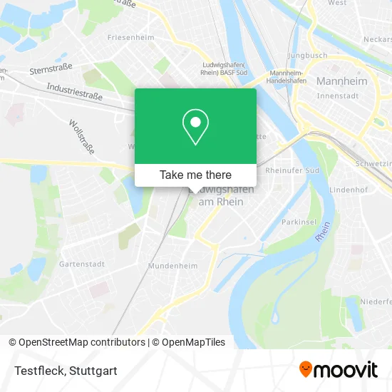
Testfleck Address: Georg-Büchner-Straße 5 Mitte, 67061 Ludwigshafen am Rhein street in Ludwigshafen-Südliche-Innenstadt
- Maschinen-Schlosser,
- Cameroon Sustainable Agriculture,
- Einfachlernen Lernstudio - Nachhilfe in Ludwigshafen - Mathe und Mehr,
- Albert-Schweitzer-Schule,
- Kindertagesstättealbert-Schweitzer,
- Esv-Gaststätte,
- ESV-Sportzentrum,
- DB Casino Ludwigshafen,
- Esv,
- Eisenbahner Sportverein 1927,
- Prävention24,
- Ludwigshafen (Rhein) Hbf,
- Event-Connection E. K.,
- Biebinger Johann, Renate Künstlervermittlung,
- Özlem Büyükcanayakin,
- Mz Krankenfahrdienst Mathes,
- Kleingartenanlage Schöngewanne,
- Georgs Grill im Gärtnerheim,
- Gemeinnütziger Kleingartenbauverein Süd-Schöngewann,
- Genkidama Restaurant Eventlocation
Places Near Testfleck (Ludwigshafen-Südliche-Innenstadt)
- Mercedes-Benz Museum, Bad Cannstatt,
- Waldfriedhof, Degerloch,
- Geilhaus Haus 33a, Reutlingen-Betzingen,
- Pariser Platz Stuttgart, Stuttgart-Mitte,
- FlixBus Haltestelle, Stuttgart,
- Hanns-Martin-Schleyer-Halle (Stuttgart Hans-Martin-Schleyerhalle), Bad Cannstatt,
- Mercedes-Benz Museum (Mercedes Museum Stuttgart), Bad Cannstatt,
- Hauptbahnhof Stuttgart, Stuttgart-Mitte,
- Gleis 101/102 (tief), Stuttgart-Mitte,
- Porsche-Arena, Bad Cannstatt,
- Schleyerhalle, Bad Cannstatt,
- Mettingen Eros-Center Puff Laufhaus, Esslingen Am Neckar,
- Hanns-Martin-Schleyer-Halle, Bad Cannstatt,
- Im Wizemann (Halle), Bad Cannstatt,
- Porsche Museum, Zuffenhausen,
- Gasometer Pforzheim, Pforzheim,
- Klinikum Stuttgart - Katharinenhospital, Stuttgart-Mitte,
- Marmorsaal Im Weissenburgpark, Stuttgart-Süd,
- SI-Centrum, Möhringen,
- Wilhelma (U-Bahn Wilhelma), Bad Cannstatt
How to get to popular places in Stuttgart with public transit
Get around Ludwigshafen-Südliche-Innenstadt by public transit!
Traveling around Ludwigshafen-Südliche-Innenstadt has never been so easy. See step by step directions as you travel to any attraction, street or major public transit station. View bus and train schedules, arrival times, service alerts and detailed routes on a map, so you know exactly how to get to anywhere in Ludwigshafen-Südliche-Innenstadt.
When traveling to any destination around Ludwigshafen-Südliche-Innenstadt use Moovit's Live Directions with Get Off Notifications to know exactly where and how far to walk, how long to wait for your line, and how many stops are left. Moovit will alert you when it's time to get off — no need to constantly re-check whether yours is the next stop.
Wondering how to use public transit in Ludwigshafen-Südliche-Innenstadt or how to pay for public transit in Ludwigshafen-Südliche-Innenstadt? Moovit public transit app can help you navigate your way with public transit easily, and at minimum cost. It includes public transit fees, ticket prices, and costs. Looking for a map of Ludwigshafen-Südliche-Innenstadt public transit lines? Moovit public transit app shows all public transit maps in Ludwigshafen-Südliche-Innenstadt with all Bus, Train, Subway, Light Rail, Ferry, S-Bahn and Funicular routes and stops on an interactive map.
Stuttgart has 7 transit type(s), including: Bus, Train, Subway, Light Rail, Ferry, S-Bahn and Funicular, operated by several transit agencies, including SSB - Stadtbahn, SSB, SSB - Seilbahn / Zacke, S-Bahn Stuttgart, Rhein-Neckar-Verkehr GmbH (rnv), Karlsruher Verkehrsverbund, DB AG, DB Regiobus BW, Arverio Baden-Württemberg GmbH, DB RegioNetz Verkehrs GmbH Westfrankenbahn, DB Regio AG Baden-Württemberg, Südwestdeutsche Verkehrs-AG, DB Regio AG Mitte Region Hessen, DB and Bodensee-Oberschwaben-Bahn
Public transit lines with stations closest to Testfleck in Ludwigshafen-Südliche-Innenstadt
Bus lines with stations closest to Testfleck in Ludwigshafen-Südliche-Innenstadt
Mundenheim Nord
 74Berliner Platz Bf LU Mitte – Am Schwanen – Marienkrankenhaus – Niederfeld – Valentin-Bauer-Siedlung – LU Hauptbahnhof – LU Rathaus
- 94Berliner Platz Bf LU Mitte - Am Schwanen - Marienkrankenhaus - Niederfeld
- EMaudach Kleestraße - Berliner Platz, Bf LU Mitte
- EVon-Kieffer-Straße - Berliner Platz, Bf LU Mitte
Valentin-Bauer-Siedlung Süd
- 75Berliner Platz Bf LU Mitte – LU Hauptbahnhof – LU Hochschule – Marienkrankenhaus – Rheingönheim Bf – Rheingönheim Neubruch
- 75EBerliner Platz Bf LU Mitte – LU Hauptbahnhof – LU Hochschule – Marienkrankenhaus – Rheingönheim Bf – Rheingönheim Neubruch
- 76Berliner Platz Bf LU Mitte – Rhein-Galerie – LU Hochschule – Marienkrankenhaus – Maudach Kleestraße
- 78BASF Süd (Tor 1+7) – LU Hauptbahnhof – LU Hochschule – Kallstadter Str. – Maudach Kleestraße
- 80BASF Süd (Tor 1+7) – BASF (Tor 1+2) – Goerdelerplatz – Marienkirche – Rohrlachstraße – Valentin-Bauer-Siedlung – LU Hochschule – Mundenheim Bf