How to get to Thaisons by bus?
Click on the bus route to see step by step directions with maps, line arrival times and updated time schedules.
From Nova- Alexandria Campus, Alexandria
63 minFrom Thomas Jefferson Community Center & Theatre, Arlington County
67 minFrom Mt Vernon Campus Of GWU, Washington
99 minFrom Oakton, Virginia, Fairfax County
59 minFrom Kreeger Museum, Washington
105 minFrom Sibley Memorial Hospital, Washington
124 minFrom George H.W. Bush Center For Intelligence (CIA Headquarters), Fairfax County
67 minFrom Wilson Blvd, Arlington County
57 minFrom Hyatt Place-Arlington Courthouse Plaza (Hyatt Place Arlington/Courthouse Plaza), Arlington County
57 minFrom FSI, Arlington County
74 min
How to get to Thaisons by metro?
Click on the metro route to see step by step directions with maps, line arrival times and updated time schedules.
Bus stops near Thaisons in Fairfax County
Metro stations near Thaisons in Fairfax County
What are the closest stations to Thaisons?
The closest stations to Thaisons are:
- Leesburg Pk+Pimmit Dr is 91 yards away, 2 min walk.
- Pimmit @ Leesburg is 139 yards away, 3 min walk.
- Tysons Corner Metro is 3515 yards away, 42 min walk.
- West Falls Church-Vt is 5241 yards away, 61 min walk.
Which bus lines stop near Thaisons?
These bus lines stop near Thaisons: 703, F20.
Which metro line stops near Thaisons?
ORANGE (Vienna)
What’s the nearest bus station to Thaisons in Fairfax County?
The nearest bus station to Thaisons in Fairfax County is Leesburg Pk+Pimmit Dr. It’s a 2 min walk away.
What time is the first metro to Thaisons in Fairfax County?
The ORANGE is the first metro that goes to Thaisons in Fairfax County. It stops nearby at 5:04 AM.
What time is the last metro to Thaisons in Fairfax County?
The SILVER is the last metro that goes to Thaisons in Fairfax County. It stops nearby at 12:41 AM.
What time is the first bus to Thaisons in Fairfax County?
The F20 is the first bus that goes to Thaisons in Fairfax County. It stops nearby at 5:04 AM.
What time is the last bus to Thaisons in Fairfax County?
The F20 is the last bus that goes to Thaisons in Fairfax County. It stops nearby at 2:00 AM.
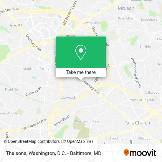
See Thaisons, Fairfax County, on the map
Public Transit to Thaisons in Fairfax County
Wondering how to get to Thaisons in Fairfax County? Moovit helps you find the best way to get to Thaisons with step-by-step directions from the nearest public transit station.
Moovit provides free maps and live directions to help you navigate through your city. View schedules, routes, timetables, and find out how long does it take to get to Thaisons in real time.
Looking for the nearest stop or station to Thaisons? Check out this list of stops closest to your destination: Leesburg Pk+Pimmit Dr; Pimmit @ Leesburg; Tysons Corner Metro; West Falls Church-Vt.
Bus: 703, F20.Metro: ORANGE, SILVER.
Want to see if there’s another route that gets you there at an earlier time? Moovit helps you find alternative routes or times. Get directions from and directions to Thaisons easily from the Moovit App or Website.
We make riding to Thaisons easy, which is why over 1.5 million users, including users in Fairfax County, trust Moovit as the best app for public transit. You don’t need to download an individual bus app or train app, Moovit is your all-in-one transit app that helps you find the best bus time or train time available.
For information on prices of bus and metro, costs and ride fares to Thaisons, please check the Moovit app.
Use the app to navigate to popular places including to the airport, hospital, stadium, grocery store, mall, coffee shop, school, college, and university.
Thaisons Address: 7501 Leesburg Pike Falls Church, VA 22043 street in Fairfax County
- STARBUCKS,
- Halal Bowl,
- Two - Guys - Garage - Door - Service,
- Chicken Salad Chick,
- Oakley,
- Spaisnan Elliot,
- Ahmed al-Sayyad, Od,
- Range Repair Appliance Service,
- Amazon Counter at Whole Foods Market,
- Veterinary Emergency Group,
- Taim,
- Blazin Chicken & Gyro,
- Fairfax Kwik Dry Total Cleaning,
- Dulces Delicias Bakery,
- eaves Fairfax Towers,
- Miyu Beauty & Wellbeing,
- Jaime's Lawn Service,
- Locks Repaired,
- Credit Union 1,
- Geriatric Care Management
Places Near Thaisons (Fairfax County)
- Rock Creek Tennis Center, Washington,
- Pennsylvania Ave NW (3rd st and pennsylvania), Washington,
- Sibley Memorial Hospital, Washington,
- Museum Of The Bible, Washington,
- National Museum of African American History and Culture, Washington,
- Amazon Hq2, Arlington County,
- National Theatre, Washington,
- Basilica of the National Shrine, Washington,
- PG Mall, Prince George's County,
- Camden Yards, Baltimore,
- The Anthem, Washington,
- Warner Theatre, Washington,
- Washington DC VA Medical Center, Washington,
- Washington National Cathedral, Washington,
- Capital One Arena, Washington,
- M&T Bank Stadium, Baltimore,
- National Zoo, Washington,
- Marriott Marquis Washington, DC, Washington,
- Georgetown, Washington,
- Westfield Montgomery Mall, Montgomery County
How to get to popular places in Washington, D.C. - Baltimore, MD with public transit
Get around Fairfax County by public transit!
Traveling around Fairfax County has never been so easy. See step by step directions as you travel to any attraction, street or major public transit station. View bus and train schedules, arrival times, service alerts and detailed routes on a map, so you know exactly how to get to anywhere in Fairfax County.
When traveling to any destination around Fairfax County use Moovit's Live Directions with Get Off Notifications to know exactly where and how far to walk, how long to wait for your line, and how many stops are left. Moovit will alert you when it's time to get off — no need to constantly re-check whether yours is the next stop.
Wondering how to use public transit in Fairfax County or how to pay for public transit in Fairfax County? Moovit public transit app can help you navigate your way with public transit easily, and at minimum cost. It includes public transit fees, ticket prices, and costs. Looking for a map of Fairfax County public transit lines? Moovit public transit app shows all public transit maps in Fairfax County with all Bus, Train, Metro, Light Rail and Ferry routes and stops on an interactive map.
Washington, D.C. - Baltimore, MD has 5 transit type(s), including: Bus, Train, Metro, Light Rail and Ferry, operated by several transit agencies, including WMATA, Montgomery County Ride On, Fairfax Connector, TheBus, PRTC, DASH - Alexandria, Arlington Transit (ART), RTA of Central Maryland, MDOT MTA, MDOT MTA Light RailLink, MDOT MTA Commuter Bus, MDOT MTA Local Bus, FXBGO!, Virginia Railway Express (VRE) and MARC