Directions to The Bar @ Center Pointe (Las Vegas) with public transportation
The following transit lines have routes that pass near The Bar @ Center Pointe
 Bus: 206.
How to get to The Bar @ Center Pointe by bus?
Click on the bus route to see step by step directions with maps, line arrival times and updated time schedules.
From Indian Springs, Las Vegas
66 minFrom Jones @ Smoke Ranch (N), Las Vegas
52 minFrom Rang's, Las Vegas
28 minFrom Trader Joe's, Las Vegas
50 minFrom Southern Hills Hospital & Medical Center - Main Entrance, Spring Valley
50 minFrom Happy Ending Massage Parlor, Spring Valley
62 minFrom S Tenaya Way / W Charleston Blvd, Las Vegas
19 minFrom Cheyenne Exit off the 95, Las Vegas
56 minFrom Clark County Library, Las Vegas
27 minFrom Southern Nevada Health District, Las Vegas
57 min
Bus stop near The Bar @ Center Pointe in Las Vegas
- Sb Pavilion Center After Charleston, 4 min walk,VIEW
Bus lines to The Bar @ Center Pointe in Las Vegas
- 206, 206 Charleston Eastbound,VIEW
What are the closest stations to The Bar @ Center Pointe?
The closest stations to The Bar @ Center Pointe are:
- Sb Pavilion Center After Charleston is 260 yards away, 4 min walk.
Which bus line stops near The Bar @ Center Pointe?
206 (206 Charleston Westbound)
What’s the nearest bus station to The Bar @ Center Pointe in Las Vegas?
The nearest bus station to The Bar @ Center Pointe in Las Vegas is Sb Pavilion Center After Charleston. It’s a 4 min walk away.
What time is the first bus to The Bar @ Center Pointe in Las Vegas?
The 206 is the first bus that goes to The Bar @ Center Pointe in Las Vegas. It stops nearby at 3:21 AM.
What time is the last bus to The Bar @ Center Pointe in Las Vegas?
The 206 is the last bus that goes to The Bar @ Center Pointe in Las Vegas. It stops nearby at 4:05 AM.
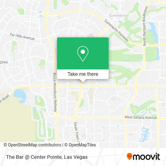
See The Bar @ Center Pointe, Las Vegas, on the map
Public Transit to The Bar @ Center Pointe in Las Vegas
Wondering how to get to The Bar @ Center Pointe in Las Vegas? Moovit helps you find the best way to get to The Bar @ Center Pointe with step-by-step directions from the nearest public transit station.
Moovit provides free maps and live directions to help you navigate through your city. View schedules, routes, timetables, and find out how long does it take to get to The Bar @ Center Pointe in real time.
Looking for the nearest stop or station to The Bar @ Center Pointe? Check out this list of stops closest to your destination: Sb Pavilion Center After Charleston.
Bus: 206.
Want to see if there’s another route that gets you there at an earlier time? Moovit helps you find alternative routes or times. Get directions from and directions to The Bar @ Center Pointe easily from the Moovit App or Website.
We make riding to The Bar @ Center Pointe easy, which is why over 1.7 million users, including users in Las Vegas, trust Moovit as the best app for public transit. You don’t need to download an individual bus app or train app, Moovit is your all-in-one transit app that helps you find the best bus time or train time available.
For information on prices of bus, costs and ride fares to The Bar @ Center Pointe, please check the Moovit app.
Use the app to navigate to popular places including to the airport, hospital, stadium, grocery store, mall, coffee shop, school, college, and university.
The Bar @ Center Pointe Address: 10300 W Charleston Blvd street in Las Vegas
- S Hualapai Way / W Charleston Blvd,
- Faith Lutheran Middle School & High School,
- T Leany Productions,
- Poised & Proper,
- The Vets - at Home Pet Care in Vegas,
- Costco Gas,
- City National Arena,
- Red Rock East Parking Garage,
- Costco,
- Sand Bar @ Red Rock Casino.,
- VIP Services Red Rock Hotel And Casino,
- Red Rock Pavilion Ballroom,
- Red Rock Canyon Casino and Spa,
- Red Rock Casino Resort & Spa,
- LOTUS of Siam - Red Rock Resort,
- Marshalls,
- The Home Depot,
- Regal Cinemas Red Rock 16 & IMAX,
- Red Rock,
- Fogo de Chão Brazilian Steakhouse
Places Near The Bar @ Center Pointe (Las Vegas)
- Zak Bagans Haunted Museum, Las Vegas,
- Las Vegas South Premium Outlets, Enterprise,
- Meow Wolf - Las Vegas (Meow Wolf's Omega Mart), Las Vegas,
- Welcome To Fabulous Las Vegas Sign, Paradise,
- The Deuce Bus Stop at Fremont St, Las Vegas,
- Walmart Supercenter, Las Vegas,
- Koolsville Tattoos, Las Vegas,
- Las Vegas Premium Outlets-North, Enterprise,
- Gold & Silver Pawn Shop, Las Vegas,
- Arte Museum Las Vegas, Paradise,
- Omega Mart, Las Vegas,
- Area15, Las Vegas,
- Allegiant Stadium, Paradise,
- Lee Canyon, Las Vegas,
- The Neon Museum, Las Vegas,
- The Palms Casino Resort, Paradise,
- Las Vegas North Premium Outlets, Las Vegas,
- Trump International Hotel Las Vegas, Paradise,
- Walmart, Las Vegas,
- Town Square, Enterprise
How to get to popular places in Las Vegas with public transit
Get around Las Vegas by public transit!
Traveling around Las Vegas has never been so easy. See step by step directions as you travel to any attraction, street or major public transit station. View bus and train schedules, arrival times, service alerts and detailed routes on a map, so you know exactly how to get to anywhere in Las Vegas.
When traveling to any destination around Las Vegas use Moovit's Live Directions with Get Off Notifications to know exactly where and how far to walk, how long to wait for your line, and how many stops are left. Moovit will alert you when it's time to get off — no need to constantly re-check whether yours is the next stop.
Wondering how to use public transit in Las Vegas or how to pay for public transit in Las Vegas? Moovit public transit app can help you navigate your way with public transit easily, and at minimum cost. It includes public transit fees, ticket prices, and costs. Looking for a map of Las Vegas public transit lines? Moovit public transit app shows all public transit maps in Las Vegas with all Bus and Monorail routes and stops on an interactive map.
Las Vegas has 2 transit type(s), including: Bus and Monorail, operated by several transit agencies, including RTCSNV, City of Las Vegas, Alvand Transportation, Vegas Airporter, Las Vegas Monorail, FlixBus-us and Greyhound-us