How to get to The Big Learning Tree 2 by bus?
Click on the bus route to see step by step directions with maps, line arrival times and updated time schedules.
From Uptons Famous Pet Training Center, Indianapolis City (Balance)
81 minFrom 46th Street and Shadeland Ave., Lawrence
50 minFrom Major General Emmett J Bean Federal Center, Lawrence
44 minFrom Shortridge Rd & Kickapoo Trail, Indianapolis City (Balance)
49 minFrom CBC-Nedho, Indianapolis City (Balance)
25 minFrom PLS Financial Services (PLS Check Cashing Store), Indianapolis City (Balance)
51 minFrom 82 N Denny St, Indianapolis City (Balance)
53 minFrom Brookville Rd / S Sherman Dr, Indianapolis City (Balance)
56 minFrom 21st St & Spencer Ave, Indianapolis City (Balance)
29 min
Bus stops near The Big Learning Tree 2 in Indianapolis City (Balance)
Bus lines to The Big Learning Tree 2 in Indianapolis City (Balance)
What are the closest stations to The Big Learning Tree 2?
The closest stations to The Big Learning Tree 2 are:
- Mitthoefer Rd & Hawkins Ct is 492 yards away, 6 min walk.
- 21st St & Mitthoefer Rd is 666 yards away, 8 min walk.
Which bus lines stop near The Big Learning Tree 2?
These bus lines stop near The Big Learning Tree 2: 21, 87.
What’s the nearest bus station to The Big Learning Tree 2 in Indianapolis City (Balance)?
The nearest bus station to The Big Learning Tree 2 in Indianapolis City (Balance) is Mitthoefer Rd & Hawkins Ct. It’s a 6 min walk away.
What time is the first bus to The Big Learning Tree 2 in Indianapolis City (Balance)?
The 87 is the first bus that goes to The Big Learning Tree 2 in Indianapolis City (Balance). It stops nearby at 4:51 AM.
What time is the last bus to The Big Learning Tree 2 in Indianapolis City (Balance)?
The 21 is the last bus that goes to The Big Learning Tree 2 in Indianapolis City (Balance). It stops nearby at 10:09 PM.
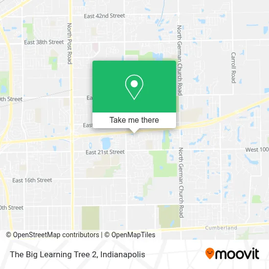
See The Big Learning Tree 2, Indianapolis City (Balance), on the map
Public Transit to The Big Learning Tree 2 in Indianapolis City (Balance)
Wondering how to get to The Big Learning Tree 2 in Indianapolis City (Balance)? Moovit helps you find the best way to get to The Big Learning Tree 2 with step-by-step directions from the nearest public transit station.
Moovit provides free maps and live directions to help you navigate through your city. View schedules, routes, timetables, and find out how long does it take to get to The Big Learning Tree 2 in real time.
Looking for the nearest stop or station to The Big Learning Tree 2? Check out this list of stops closest to your destination: Mitthoefer Rd & Hawkins Ct; 21st St & Mitthoefer Rd.
Bus: 21, 87.
Want to see if there’s another route that gets you there at an earlier time? Moovit helps you find alternative routes or times. Get directions from and directions to The Big Learning Tree 2 easily from the Moovit App or Website.
We make riding to The Big Learning Tree 2 easy, which is why over 1.5 million users, including users in Indianapolis City (Balance), trust Moovit as the best app for public transit. You don’t need to download an individual bus app or train app, Moovit is your all-in-one transit app that helps you find the best bus time or train time available.
For information on prices of bus, costs and ride fares to The Big Learning Tree 2, please check the Moovit app.
Use the app to navigate to popular places including to the airport, hospital, stadium, grocery store, mall, coffee shop, school, college, and university.
The Big Learning Tree 2 Address: 2321 Gable Dr street in Indianapolis City (Balance)
- Amazing Garage Doors,
- ATM,
- Indiana's Goodwill Ambassador,
- Qwik Mart,
- Hooks Fish and Chicken Plus,
- Sunrise Staffing Employment Services,
- M&M Cleaning Services,
- Lake Marina Apartments,
- Warren Branch Indianapolis Public Library,
- Robert Helm,
- Warren Township Schools,
- Baker Specialty and Supply Company,
- Kurtz Electric,
- Indy Club Hopper,
- bp,
- Turning Point Family Worship Center,
- P-M & Associates,
- E 30th St / N Mitthoeffer Pl,
- Warren Central High School Football Field,
- Indiana Home Solutions
Places Near The Big Learning Tree 2 (Indianapolis City (Balance))
- Jersey Barn, Indianapolis City (Balance),
- Lilly Corporate Center (Eli Lilly & Co), Indianapolis City (Balance),
- Cotter's Massage Parlor With Happy Endings, Indianapolis City (Balance),
- Indianapolis Airport Zone 2, Indianapolis City (Balance),
- Methodist Hospital of Indianapolis, Indianapolis City (Balance),
- Plainfield, IN, Plainfield,
- Indiana, Indianapolis City (Balance),
- THE BALT, Indianapolis City (Balance),
- Gainbridge Fieldhouse, Indianapolis City (Balance),
- Indiana Convention Center, Indianapolis City (Balance),
- I U Health Methodist Hospital, Indianapolis City (Balance),
- I-465 / I-65 Interchange, Indianapolis City (Balance),
- Indianapolis Motor Speedway, Speedway,
- Eskenazi Hospital, Indianapolis City (Balance),
- 119 W 19th St Parking, Indianapolis City (Balance),
- Lucas Oil Stadium, Indianapolis City (Balance),
- St. Vincent Hospital - Indianapolis, Indianapolis City (Balance),
- St. Vincent entrance #1, Indianapolis City (Balance),
- Castleton Square Mall, Indianapolis,
- Train Ride At Castleton Mall, Indianapolis City (Balance)
How to get to popular places in Indianapolis with public transit
Get around Indianapolis City (Balance) by public transit!
Traveling around Indianapolis City (Balance) has never been so easy. See step by step directions as you travel to any attraction, street or major public transit station. View bus and train schedules, arrival times, service alerts and detailed routes on a map, so you know exactly how to get to anywhere in Indianapolis City (Balance).
When traveling to any destination around Indianapolis City (Balance) use Moovit's Live Directions with Get Off Notifications to know exactly where and how far to walk, how long to wait for your line, and how many stops are left. Moovit will alert you when it's time to get off — no need to constantly re-check whether yours is the next stop.
Wondering how to use public transit in Indianapolis City (Balance) or how to pay for public transit in Indianapolis City (Balance)? Moovit public transit app can help you navigate your way with public transit easily, and at minimum cost. It includes public transit fees, ticket prices, and costs. Looking for a map of Indianapolis City (Balance) public transit lines? Moovit public transit app shows all public transit maps in Indianapolis City (Balance) with all bus routes and stops on an interactive map.
Indianapolis has 1 transit type(s), including: bus, operated by several transit agencies, including IndyGo, FlixBus-us and Greyhound-us