Directions to The Breast Cancer Research Foundation (Fairfax County) with public transportation
The following transit lines have routes that pass near The Breast Cancer Research Foundation
 Bus: 310, 334, 350, 401, 402.
- Train: FREDERICKSBURG LINE, MANASSAS LINE.
- Metro: BLUE.
How to get to The Breast Cancer Research Foundation by bus?
Click on the bus route to see step by step directions with maps, line arrival times and updated time schedules.
From Uspto, Alexandria
67 minFrom Baileys Crossroads, Fairfax County
48 minFrom The Westin Alexandria Old Town, Alexandria
59 minFrom United States Patent & Trademark Office (USPTO), Alexandria
65 minFrom Department of State SA 34, Fairfax County
60 minFrom Northern Virginia Community College - Annandale Campus, Fairfax County
55 minFrom Inova employee Shuttle, Fairfax County
56 minFrom Nova- Alexandria Campus, Alexandria
66 minFrom Inova Fairfax Hospital North Tower Building, Fairfax County
49 minFrom Inova Mount Vernon Hospital, Fairfax County
59 min
How to get to The Breast Cancer Research Foundation by train?
Click on the train route to see step by step directions with maps, line arrival times and updated time schedules.
How to get to The Breast Cancer Research Foundation by metro?
Click on the metro route to see step by step directions with maps, line arrival times and updated time schedules.
Bus stops near The Breast Cancer Research Foundation in Fairfax County
Metro station near The Breast Cancer Research Foundation in Fairfax County
- Franconia-Springfield Metro, 25 min walk,VIEW
Train stations near The Breast Cancer Research Foundation in Fairfax County
Bus lines to The Breast Cancer Research Foundation in Fairfax County
What are the closest stations to The Breast Cancer Research Foundation?
The closest stations to The Breast Cancer Research Foundation are:
- Loisdale Rd @ Loisdale Ct is 281 yards away, 4 min walk.
- Springfield Hilton is 311 yards away, 4 min walk.
- Franconia Rd W @ Pioneer Dr is 336 yards away, 5 min walk.
- Commerce St @ Bowie Dr is 425 yards away, 6 min walk.
- Frontier Dr @ Buckskin St is 682 yards away, 9 min walk.
- Frontier Dr @ Franconia Rd is 703 yards away, 9 min walk.
- Franconia-Springfield Metro is 2080 yards away, 25 min walk.
- Franconia-Springfield Vre Station is 2264 yards away, 29 min walk.
- Backlick Road Station is 3214 yards away, 38 min walk.
Which bus lines stop near The Breast Cancer Research Foundation?
These bus lines stop near The Breast Cancer Research Foundation: 310, 334, 350, 401, 402.
Which train line stops near The Breast Cancer Research Foundation?
FREDERICKSBURG LINE (Spotsylvania)
Which metro line stops near The Breast Cancer Research Foundation?
BLUE (Franconia-Springfield)
What’s the nearest metro station to The Breast Cancer Research Foundation in Fairfax County?
The nearest metro station to The Breast Cancer Research Foundation in Fairfax County is Franconia-Springfield Metro. It’s a 25 min walk away.
What’s the nearest train station to The Breast Cancer Research Foundation in Fairfax County?
The nearest train station to The Breast Cancer Research Foundation in Fairfax County is Franconia-Springfield Vre Station. It’s a 29 min walk away.
What’s the nearest bus station to The Breast Cancer Research Foundation in Fairfax County?
The nearest bus stations to The Breast Cancer Research Foundation in Fairfax County are Loisdale Rd @ Loisdale Ct and Springfield Hilton. The closest one is a 4 min walk away.
What time is the first metro to The Breast Cancer Research Foundation in Fairfax County?
The BLUE is the first metro that goes to The Breast Cancer Research Foundation in Fairfax County. It stops nearby at 5:00 AM.
What time is the last metro to The Breast Cancer Research Foundation in Fairfax County?
The BLUE is the last metro that goes to The Breast Cancer Research Foundation in Fairfax County. It stops nearby at 12:44 AM.
What time is the first train to The Breast Cancer Research Foundation in Fairfax County?
The MANASSAS LINE is the first train that goes to The Breast Cancer Research Foundation in Fairfax County. It stops nearby at 5:42 AM.
What time is the last train to The Breast Cancer Research Foundation in Fairfax County?
The MANASSAS LINE is the last train that goes to The Breast Cancer Research Foundation in Fairfax County. It stops nearby at 7:34 PM.
What time is the first bus to The Breast Cancer Research Foundation in Fairfax County?
The 322 is the first bus that goes to The Breast Cancer Research Foundation in Fairfax County. It stops nearby at 4:15 AM.
What time is the last bus to The Breast Cancer Research Foundation in Fairfax County?
The 402 is the last bus that goes to The Breast Cancer Research Foundation in Fairfax County. It stops nearby at 2:25 AM.
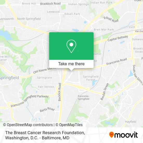
See The Breast Cancer Research Foundation, Fairfax County, on the map
Public Transit to The Breast Cancer Research Foundation in Fairfax County
Wondering how to get to The Breast Cancer Research Foundation in Fairfax County? Moovit helps you find the best way to get to The Breast Cancer Research Foundation with step-by-step directions from the nearest public transit station.
Moovit provides free maps and live directions to help you navigate through your city. View schedules, routes, timetables, and find out how long does it take to get to The Breast Cancer Research Foundation in real time.
Looking for the nearest stop or station to The Breast Cancer Research Foundation? Check out this list of stops closest to your destination: Loisdale Rd @ Loisdale Ct; Springfield Hilton; Franconia Rd W @ Pioneer Dr; Commerce St @ Bowie Dr; Frontier Dr @ Buckskin St; Frontier Dr @ Franconia Rd; Franconia-Springfield Metro; Franconia-Springfield Vre Station; Backlick Road Station.
Bus: 310, 334, 350, 401, 402, 321.Train: FREDERICKSBURG LINE, MANASSAS LINE.Metro: BLUE.
Want to see if there’s another route that gets you there at an earlier time? Moovit helps you find alternative routes or times. Get directions from and directions to The Breast Cancer Research Foundation easily from the Moovit App or Website.
We make riding to The Breast Cancer Research Foundation easy, which is why over 1.5 million users, including users in Fairfax County, trust Moovit as the best app for public transit. You don’t need to download an individual bus app or train app, Moovit is your all-in-one transit app that helps you find the best bus time or train time available.
For information on prices of bus, metro and train, costs and ride fares to The Breast Cancer Research Foundation, please check the Moovit app.
Use the app to navigate to popular places including to the airport, hospital, stadium, grocery store, mall, coffee shop, school, college, and university.
The Breast Cancer Research Foundation Address: 6506 Loisdale Rd Springfield, VA 20598 street in Fairfax County
- The Clapham Group,
- Nancy Shaw,
- Lizano's Floor Services,
- Tesla,
- Wu Loraine MD - Loraine Eng Wu MD, MD,
- Brown, Dishaunta,
- Velasco, Luis,
- Kaiser Permanente - Springfield Medical Center,
- Target Optical,
- Electrify America,
- FedEx,
- Spring Mall Building,
- A Leader in Professional Services Recruiting and Job Placement,
- VANS,
- Wingate by Wyndham Springfield,
- Springfield Mall,
- Springfield Mall (franconia / Springfield Mall),
- Budget,
- Good Bop,
- Motherhood Maternity
Places Near The Breast Cancer Research Foundation (Fairfax County)
- Pennsylvania Ave NW (3rd st and pennsylvania), Washington,
- Amazon Hq2, Arlington County,
- National Mall, Washington,
- Warner Theatre, Washington,
- Rock Creek Tennis Center, Washington,
- The Anthem, Washington,
- M&T Bank Stadium, Baltimore,
- Marriott Marquis Washington, DC, Washington,
- Washington National Cathedral, Washington,
- Basilica of the National Shrine, Washington,
- Sibley Memorial Hospital, Washington,
- Washington DC VA Medical Center, Washington,
- Museum Of The Bible, Washington,
- Westfield Montgomery Mall, Montgomery County,
- Capital One Arena, Washington,
- Georgetown, Washington,
- Camden Yards, Baltimore,
- PG Mall, Prince George's County,
- National Museum of African American History and Culture, Washington,
- National Zoo, Washington
How to get to popular places in Washington, D.C. - Baltimore, MD with public transit
Get around Fairfax County by public transit!
Traveling around Fairfax County has never been so easy. See step by step directions as you travel to any attraction, street or major public transit station. View bus and train schedules, arrival times, service alerts and detailed routes on a map, so you know exactly how to get to anywhere in Fairfax County.
When traveling to any destination around Fairfax County use Moovit's Live Directions with Get Off Notifications to know exactly where and how far to walk, how long to wait for your line, and how many stops are left. Moovit will alert you when it's time to get off — no need to constantly re-check whether yours is the next stop.
Wondering how to use public transit in Fairfax County or how to pay for public transit in Fairfax County? Moovit public transit app can help you navigate your way with public transit easily, and at minimum cost. It includes public transit fees, ticket prices, and costs. Looking for a map of Fairfax County public transit lines? Moovit public transit app shows all public transit maps in Fairfax County with all Bus, Train, Metro, Light Rail and Ferry routes and stops on an interactive map.
Washington, D.C. - Baltimore, MD has 5 transit type(s), including: Bus, Train, Metro, Light Rail and Ferry, operated by several transit agencies, including WMATA, Montgomery County Ride On, Fairfax Connector, TheBus, PRTC, DASH - Alexandria, Arlington Transit (ART), RTA of Central Maryland, MDOT MTA, MDOT MTA Light RailLink, MDOT MTA Commuter Bus, MDOT MTA Local Bus, FXBGO!, Virginia Railway Express (VRE) and MARC