How to get to The Chas Foundation by bus?
Click on the bus route to see step by step directions with maps, line arrival times and updated time schedules.
Bus stops near The Chas Foundation in Norfolk
Light Rail stations near The Chas Foundation in Norfolk
- Evmc Fort Norfolk Station, 27 min walk,VIEW
What are the closest stations to The Chas Foundation?
The closest stations to The Chas Foundation are:
- Hampton & Bolling is 373 yards away, 5 min walk.
- 49th & Quarantine is 782 yards away, 10 min walk.
- Evmc Fort Norfolk Station is 2275 yards away, 27 min walk.
Which bus line stops near The Chas Foundation?
002 (Dntc)
What’s the nearest light rail station to The Chas Foundation in Norfolk?
The nearest light rail station to The Chas Foundation in Norfolk is Evmc Fort Norfolk Station. It’s a 27 min walk away.
What’s the nearest bus station to The Chas Foundation in Norfolk?
The nearest bus station to The Chas Foundation in Norfolk is Hampton & Bolling. It’s a 5 min walk away.
What time is the first light rail to The Chas Foundation in Norfolk?
The 800 is the first light rail that goes to The Chas Foundation in Norfolk. It stops nearby at 5:27 AM.
What time is the last light rail to The Chas Foundation in Norfolk?
The 800 is the last light rail that goes to The Chas Foundation in Norfolk. It stops nearby at 11:30 PM.
What time is the first bus to The Chas Foundation in Norfolk?
The 002 is the first bus that goes to The Chas Foundation in Norfolk. It stops nearby at 5:29 AM.
What time is the last bus to The Chas Foundation in Norfolk?
The 002 is the last bus that goes to The Chas Foundation in Norfolk. It stops nearby at 12:38 AM.
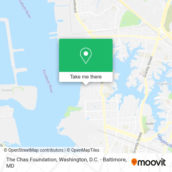
See The Chas Foundation, Norfolk, on the map
Public Transit to The Chas Foundation in Norfolk
Wondering how to get to The Chas Foundation in Norfolk? Moovit helps you find the best way to get to The Chas Foundation with step-by-step directions from the nearest public transit station.
Moovit provides free maps and live directions to help you navigate through your city. View schedules, routes, timetables, and find out how long does it take to get to The Chas Foundation in real time.
Looking for the nearest stop or station to The Chas Foundation? Check out this list of stops closest to your destination: Hampton & Bolling; 49th & Quarantine; Evmc Fort Norfolk Station.
Bus: 002, 004.
Want to see if there’s another route that gets you there at an earlier time? Moovit helps you find alternative routes or times. Get directions from and directions to The Chas Foundation easily from the Moovit App or Website.
We make riding to The Chas Foundation easy, which is why over 1.7 million users, including users in Norfolk, trust Moovit as the best app for public transit. You don’t need to download an individual bus app or train app, Moovit is your all-in-one transit app that helps you find the best bus time or train time available.
For information on prices of bus, costs and ride fares to The Chas Foundation, please check the Moovit app.
Use the app to navigate to popular places including to the airport, hospital, stadium, grocery store, mall, coffee shop, school, college, and university.
The Chas Foundation Address: 5426 Powhatan Ave street in Norfolk
- Boushs Bluff,
- Canterbury Center For Protestant Episcopal Campus Ministry,
- Governor's School For the Arts Administration,
- Monterey House,
- Al-Iman Islamic School,
- Jacobson House,
- Tidewater Consortium For Higher Education,
- Baptist Collegiate Ministry,
- Crittenton Hall - Naval Reserve Officers Training Corps,
- William B. Spong Jr. Hall,
- Old Dominion University-North,
- Wesley House,
- Kornblau Field at S.B. Ballard Stadium,
- Redbox,
- Alfred Brooks Rollins, Junior, Hall,
- Presbyterian Ministry,
- Catholic Student Center,
- Lot 35,
- Kornblau Field,
- Edgewater Haven
Places Near The Chas Foundation (Norfolk)
- Warner Theatre, Washington,
- National Theatre, Washington,
- Washington DC VA Medical Center, Washington,
- Camden Yards, Baltimore,
- M&T Bank Stadium, Baltimore,
- Rock Creek Tennis Center, Washington,
- Marriott Marquis Washington, DC, Washington,
- PG Mall, Prince George's County,
- Amazon Hq2, Arlington County,
- Pennsylvania Ave NW (3rd st and pennsylvania), Washington,
- Capital One Arena, Washington,
- Georgetown, Washington,
- Sibley Memorial Hospital, Washington,
- Westfield Montgomery Mall, Montgomery County,
- The Anthem, Washington,
- Basilica of the National Shrine, Washington,
- National Museum of African American History and Culture, Washington,
- Museum Of The Bible, Washington,
- Washington National Cathedral, Washington,
- National Zoo, Washington
How to get to popular places in Washington, D.C. - Baltimore, MD with public transit
Get around Norfolk by public transit!
Traveling around Norfolk has never been so easy. See step by step directions as you travel to any attraction, street or major public transit station. View bus and train schedules, arrival times, service alerts and detailed routes on a map, so you know exactly how to get to anywhere in Norfolk.
When traveling to any destination around Norfolk use Moovit's Live Directions with Get Off Notifications to know exactly where and how far to walk, how long to wait for your line, and how many stops are left. Moovit will alert you when it's time to get off — no need to constantly re-check whether yours is the next stop.
Wondering how to use public transit in Norfolk or how to pay for public transit in Norfolk? Moovit public transit app can help you navigate your way with public transit easily, and at minimum cost. It includes public transit fees, ticket prices, and costs. Looking for a map of Norfolk public transit lines? Moovit public transit app shows all public transit maps in Norfolk with all Bus, Train, Metro, Light Rail and Ferry routes and stops on an interactive map.
Washington, D.C. - Baltimore, MD has 5 transit type(s), including: Bus, Train, Metro, Light Rail and Ferry, operated by several transit agencies, including WMATA, Montgomery County Ride On, Fairfax Connector, TheBus, PRTC, DASH - Alexandria, Arlington Transit (ART), RTA of Central Maryland, MDOT MTA, MDOT MTA Light RailLink, MDOT MTA Commuter Bus, MDOT MTA Local Bus, FXBGO!, Virginia Railway Express (VRE) and MARC