How to get to The Cheese Course by bus?
Click on the bus route to see step by step directions with maps, line arrival times and updated time schedules.
From SW 137 Ave. & SW 8 St., Kendale Lakes-Tamiami
84 minFrom The Salvation Army, Miami
56 minFrom SW 137th Ave & SW 8th St, Kendale Lakes-Tamiami
84 minFrom Imater Academy Charter Middle/High School, Hialeah
70 minFrom Biltmore Hotel Miami Coral Gables, Miami
78 minFrom N Le Jeune Rd / SW 42nd Ave, Miami
59 minFrom Macy's- Dadeland Mall, Miami
52 minFrom Miami Dade Waste Disposal Center 2400 Sw 117 Ave, Kendale Lakes-Tamiami
83 minFrom Coral Gables, Miami
58 minFrom Northside Station, Miami
84 min
Bus stops near The Cheese Course in North Westside
Bus lines to The Cheese Course in North Westside
What are the closest stations to The Cheese Course?
The closest stations to The Cheese Course are:
- Nw 36 St & Op # 8365 is 222 yards away, 3 min walk.
- Nw 87 Av & # 3737 is 877 yards away, 11 min walk.
Which bus lines stop near The Cheese Course?
These bus lines stop near The Cheese Course: 132, 36, 87, DLOOP2.
What’s the nearest bus station to The Cheese Course in North Westside?
The nearest bus station to The Cheese Course in North Westside is Nw 36 St & Op # 8365. It’s a 3 min walk away.
What time is the first bus to The Cheese Course in North Westside?
The 87 is the first bus that goes to The Cheese Course in North Westside. It stops nearby at 5:59 AM.
What time is the last bus to The Cheese Course in North Westside?
The 87 is the last bus that goes to The Cheese Course in North Westside. It stops nearby at 11:05 PM.
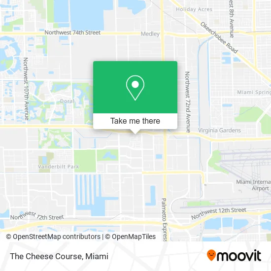
See The Cheese Course, North Westside, on the map
Public Transit to The Cheese Course in North Westside
Wondering how to get to The Cheese Course in North Westside? Moovit helps you find the best way to get to The Cheese Course with step-by-step directions from the nearest public transit station.
Moovit provides free maps and live directions to help you navigate through your city. View schedules, routes, timetables, and find out how long does it take to get to The Cheese Course in real time.
Looking for the nearest stop or station to The Cheese Course? Check out this list of stops closest to your destination: Nw 36 St & Op # 8365; Nw 87 Av & # 3737.
Bus: 132, 36, 87, DLOOP2, 95.
Want to see if there’s another route that gets you there at an earlier time? Moovit helps you find alternative routes or times. Get directions from and directions to The Cheese Course easily from the Moovit App or Website.
We make riding to The Cheese Course easy, which is why over 1.5 million users, including users in North Westside, trust Moovit as the best app for public transit. You don’t need to download an individual bus app or train app, Moovit is your all-in-one transit app that helps you find the best bus time or train time available.
For information on prices of bus and train, costs and ride fares to The Cheese Course, please check the Moovit app.
Use the app to navigate to popular places including to the airport, hospital, stadium, grocery store, mall, coffee shop, school, college, and university.
The Cheese Course Address: 3530 NW 83rd Ave Doral, FL 33166 street in North Westside
- LS Panarea Fka Agua Be,
- City Place Doral,
- Dharma Digital Marketing Agency,
- Tap 42 Doral,
- Tipsy Salonbar Doral,
- 4ever Young Anti Aging Solutions,
- Libertyx Bitcoin ATM,
- Yarelie Cruz D.MD,
- Asthma & Allergy Assoc of Fl,
- Ada M Barreto P A,
- The Team Surgery Center,
- Miami Skin Dr,
- Secure Title and Trust,
- GPG Holding,
- Global Dreams USA,
- Cityplace Doral (Cityplace Doral Shopping Mall),
- Novecento,
- Iberostar Hotels & Resorts (Visit Us, Inc.),
- South Florida Honors Alliance,
- Flamingo Beauty Supply
Places Near The Cheese Course (North Westside)
- Miami-Dade County Courthouse, Miami,
- Bayside Marketplace, Miami,
- Miami Freedom Park, Miami,
- Wynwood, Miami,
- Little Havana, Miami,
- Dolphin Mall, Miami,
- Sawgrass Mall, Miami,
- Richard E. Gerstein Justice Building, Miami,
- Dolphin Mall Bus, Miami,
- Aventura Mall, Miami,
- Hard Rock Stadium, Miami Gardens,
- Aventura Mall, Miami Beach,
- Marlins Park, Miami,
- Zoo Miami, Miami,
- Port of Miami Cruise Terminal, Miami,
- Miami VA Hospital, Miami,
- Miami Design District, Miami,
- Keiser University Flagship Campus, West Palm Beach,
- Brickell City Centre, Miami,
- Sawgrass mall ( FL ), Miami Beach
How to get to popular places in Miami with public transit
Get around North Westside by public transit!
Traveling around North Westside has never been so easy. See step by step directions as you travel to any attraction, street or major public transit station. View bus and train schedules, arrival times, service alerts and detailed routes on a map, so you know exactly how to get to anywhere in North Westside.
When traveling to any destination around North Westside use Moovit's Live Directions with Get Off Notifications to know exactly where and how far to walk, how long to wait for your line, and how many stops are left. Moovit will alert you when it's time to get off — no need to constantly re-check whether yours is the next stop.
Wondering how to use public transit in North Westside or how to pay for public transit in North Westside? Moovit public transit app can help you navigate your way with public transit easily, and at minimum cost. It includes public transit fees, ticket prices, and costs. Looking for a map of North Westside public transit lines? Moovit public transit app shows all public transit maps in North Westside with all Bus, Train, Light Rail and Ferry routes and stops on an interactive map.
Miami has 4 transit type(s), including: Bus, Train, Light Rail and Ferry, operated by several transit agencies, including Broward County Transit, Miami-Dade Transit, Metrorail, Palm Tran, Tri-Rail, Brightline, MARTY, City of Homestead Trolley, Key West Transit, Treasure Coast Connector, GoLine IRT, Amtrak, Greyhound-us, FlixBus-us and Aventura Express Shuttle Bus