Directions to The Chef's Table (Lynbrook) with public transportation
The following transit lines have routes that pass near The Chef's Table
 Bus: N25, N31X/M, N4, N4X, N31.
- Train: BABYLON BRANCH, LONG BEACH BRANCH, WEST HEMPSTEAD BRANCH.
How to get to The Chef's Table by bus?
Click on the bus route to see step by step directions with maps, line arrival times and updated time schedules.
From Long island Jewish Hospital, Queens
62 minFrom Social Security Office, Queens
46 minFrom Queens Village, Queens
59 minFrom Springfield Gardens, NY, Queens
38 minFrom Walmart, Queens
38 minFrom jetBlue Terminal 5 JFK Int'l Airport NY, Queens
96 minFrom Uniondale, NY, Uniondale
60 minFrom Saint Albans, NY, Queens
46 minFrom JFK Terminal 5/Air Train Station, Queens
98 minFrom JFK International Airport Terminal 4, Queens
89 min
How to get to The Chef's Table by train?
Click on the train route to see step by step directions with maps, line arrival times and updated time schedules.
Bus stops near The Chef's Table in Lynbrook
Train stations near The Chef's Table in Lynbrook
Bus lines to The Chef's Table in Lynbrook
What are the closest stations to The Chef's Table?
The closest stations to The Chef's Table are:
- Denton Av / Merrick is 132 yards away, 2 min walk.
- Hemp Av / Merrick is 596 yards away, 8 min walk.
- Merrick Rd / Broadway is 741 yards away, 9 min walk.
- Hempstead Ave + Blake Ave is 781 yards away, 10 min walk.
- Centre Avenue is 1167 yards away, 14 min walk.
- Rockville Centre is 1837 yards away, 22 min walk.
- Westwood is 3571 yards away, 42 min walk.
Which bus lines stop near The Chef's Table?
These bus lines stop near The Chef's Table: N25, N31X/M, N4.
Which train lines stop near The Chef's Table?
These train lines stop near The Chef's Table: BABYLON BRANCH, LONG BEACH BRANCH.
What’s the nearest train station to The Chef's Table in Lynbrook?
The nearest train station to The Chef's Table in Lynbrook is Centre Avenue. It’s a 14 min walk away.
What’s the nearest bus station to The Chef's Table in Lynbrook?
The nearest bus station to The Chef's Table in Lynbrook is Denton Av / Merrick. It’s a 2 min walk away.
What time is the first train to The Chef's Table in Lynbrook?
The BABYLON BRANCH is the first train that goes to The Chef's Table in Lynbrook. It stops nearby at 3:23 AM.
What time is the last train to The Chef's Table in Lynbrook?
The BABYLON BRANCH is the last train that goes to The Chef's Table in Lynbrook. It stops nearby at 3:23 AM.
What time is the first bus to The Chef's Table in Lynbrook?
The N4 is the first bus that goes to The Chef's Table in Lynbrook. It stops nearby at 3:08 AM.
What time is the last bus to The Chef's Table in Lynbrook?
The N4 is the last bus that goes to The Chef's Table in Lynbrook. It stops nearby at 3:11 AM.
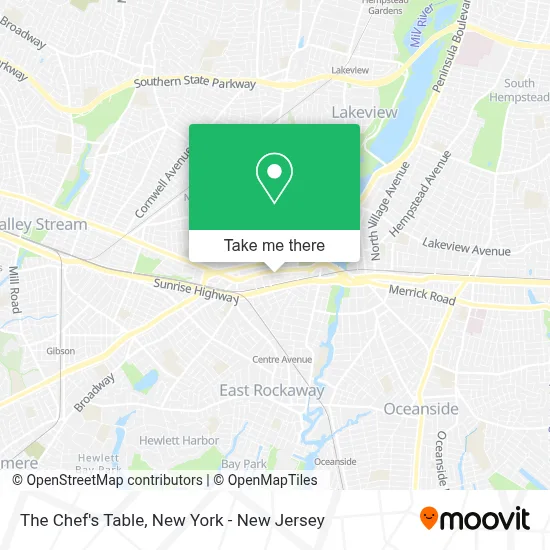
See The Chef's Table, Lynbrook, on the map
Public Transit to The Chef's Table in Lynbrook
Wondering how to get to The Chef's Table in Lynbrook? Moovit helps you find the best way to get to The Chef's Table with step-by-step directions from the nearest public transit station.
Moovit provides free maps and live directions to help you navigate through your city. View schedules, routes, timetables, and find out how long does it take to get to The Chef's Table in real time.
Looking for the nearest stop or station to The Chef's Table? Check out this list of stops closest to your destination: Denton Av / Merrick; Hemp Av / Merrick; Merrick Rd / Broadway; Hempstead Ave + Blake Ave; Centre Avenue; Rockville Centre; Westwood.
Bus: N25, N31X/M, N4, N4X, N31, N32.Train: BABYLON BRANCH, LONG BEACH BRANCH, WEST HEMPSTEAD BRANCH.
Want to see if there’s another route that gets you there at an earlier time? Moovit helps you find alternative routes or times. Get directions from and directions to The Chef's Table easily from the Moovit App or Website.
We make riding to The Chef's Table easy, which is why over 1.5 million users, including users in Lynbrook, trust Moovit as the best app for public transit. You don’t need to download an individual bus app or train app, Moovit is your all-in-one transit app that helps you find the best bus time or train time available.
For information on prices of bus, train and light rail, costs and ride fares to The Chef's Table, please check the Moovit app.
Use the app to navigate to popular places including to the airport, hospital, stadium, grocery store, mall, coffee shop, school, college, and university.
The Chef's Table Address: 12 Watkins St street in Lynbrook
- Chefs Table,
- Merrick Rd and Lynbrook,
- Little Minds Montessori,
- Neil Soskel, Do,
- Vineyard Church,
- Creative Water, Inc.,
- United Church Of God Seventh Day,
- Mount Sinai Doctors-Lynbrook, Family Medicine,
- Dr. Norma Weinreb,
- Perfect Smile Dental Arts,
- Michael Schmutter, Pt, Dpt,
- Olivia Bolen, Pt, Dpt, Ocs, Cscs,
- Mitsubishi Ductless Air Conditioning,
- Beyond Frontiers Rhythmics,
- Kedis Enterprises Llc,
- Infiniti Of Lynbrook Service and Parts,
- Lynbrook Firehouse,
- Mel Geller Electronic Security Systems Inc.,
- Kingdom Life Bible Institute,
- Cecy's Dely Cafe
Places Near The Chef's Table (Lynbrook)
- SoHo, Manhattan,
- Queens Center Mall, Queens,
- Pier 83, Manhattan,
- 26 Federal Plaza, Manhattan,
- Mountainside Hospital, Glen Ridge,
- qqqq, Manhattan,
- San Gennaro Feast, Manhattan,
- Wall Street, Manhattan,
- 3 Stone St, Manhattan,
- Times Square, Manhattan,
- 111 Centre New York City Supreme Court, Manhattan,
- 911 Memorial, Manhattan,
- Hudson Yards, Manhattan,
- 376 Hudson Street, Manhattan,
- Katz's Deli, Manhattan,
- 1 Police Plaza, Manhattan,
- Bellevue Hospital, Manhattan,
- Chinatown, Manhattan,
- Rockefeller Center, Manhattan,
- 66 John Street, Manhattan
How to get to popular places in New York - New Jersey with public transit
Get around Lynbrook by public transit!
Traveling around Lynbrook has never been so easy. See step by step directions as you travel to any attraction, street or major public transit station. View bus and train schedules, arrival times, service alerts and detailed routes on a map, so you know exactly how to get to anywhere in Lynbrook.
When traveling to any destination around Lynbrook use Moovit's Live Directions with Get Off Notifications to know exactly where and how far to walk, how long to wait for your line, and how many stops are left. Moovit will alert you when it's time to get off — no need to constantly re-check whether yours is the next stop.
Wondering how to use public transit in Lynbrook or how to pay for public transit in Lynbrook? Moovit public transit app can help you navigate your way with public transit easily, and at minimum cost. It includes public transit fees, ticket prices, and costs. Looking for a map of Lynbrook public transit lines? Moovit public transit app shows all public transit maps in Lynbrook with all Bus, Train, Subway, Light Rail, Ferry and Cable Car routes and stops on an interactive map.
New York - New Jersey has 6 transit type(s), including: Bus, Train, Subway, Light Rail, Ferry and Cable Car, operated by several transit agencies, including MTA Subway, Metro-North Railroad, LIRR, PATH, MTA New York City Transit - Express routes, MTA Bus, NJ Transit, NYC Ferry, NICE bus, Bee-Line Bus, NJ Transit Rail, Norwalk Transit District, Hartford Line, River Valley Transit and HART