How to get to The Chocolate Factory by bus?
Click on the bus route to see step by step directions with maps, line arrival times and updated time schedules.
From Colegio Alfonso Ugarte @ Paseo de la Republica cdra 34, San Isidro
45 minFrom Estación Naranjal - Metropolitano, Independen
55 minFrom Avenida 28 de Julio & Jr. Gamarra, La Victori
46 minFrom Polideportivo Limatambo, San Borja
59 minFrom Av. Reducto, Miraflores
49 minFrom Av LOS ALISOS 1700 SAN MARTIN DE PORRES LIMA PERU, San Martin
64 minFrom Circuito de playas chorrillos, Miraflores
51 minFrom ovalo huandoy, Los Olivos
60 minFrom Camal de Yerbateros, San Luis
51 minFrom Av Rivera Navarrete, San Isidro
46 min
Bus stops near The Chocolate Factory in San Miguel
Bus lines to The Chocolate Factory in San Miguel
- 1138, Carabayllo - Caquetá - Faucett - Carabayllo,VIEW
- 1163, Jockey Plaza (Surco) - Santa Margarita (Ventanilla),VIEW
- 1173, La Marina (San Miguel) - Pacasmayo (San Martin de Porres),VIEW
- 1203, Portón (San Juan De Lurigancho) - Plaza Norte (San Martin De Porres) - Portón (San Juan De Lurigancho),VIEW
- 1228, Ovalo La Perla (Callao) - Huaycán (Ate),VIEW
- 1253, San José (San Bartolo) - Precursores (San Miguel),VIEW
- 1254, Precursores (San Miguel) - Manuel Scorza (Pucusana),VIEW
- 1258, Minka (Callao) - Jicamarca (San Juan De Lurigancho),VIEW
- 1276, Puente Benavides (Surco),VIEW
- 1286, San Diego (S.M. Porres) - Mariategui (S.J. Lurigancho),VIEW
- 1291, Ventanilla - Chorrillos,VIEW
- 1293, José Gálvez (Pachacamac) - Mi Perú (Ventanilla),VIEW
- 1300, San Juan De Lurigancho - Ventanilla,VIEW
- 1304, Pachacamac - Callao,VIEW
- 1316, Pachacútec/Mi Perú (Ventanilla) - Mariátegui (San Juan de Lurigancho),VIEW
- 1317, Manchay (Pachacamac) - Miguel Grau (Callao),VIEW
- 1482, Chorrillos - S.M.P.,VIEW
- 1491, Puente Benavides (Surco) - Pacasmayo (Callao),VIEW
- CR62, Carabayllo - Lima - Carabayllo,VIEW
- IM47, Km. 22 - Caquetá - Brasil - La Marina - Faucett - Km. 22,VIEW
What are the closest stations to The Chocolate Factory?
The closest stations to The Chocolate Factory are:
- Parque De Las Leyendas is 956 meters away, 13 min walk.
- Cesar Lopez Rojas is 1113 meters away, 15 min walk.
- Avenida De Los Precursores 196 is 1132 meters away, 15 min walk.
- Precursores is 1448 meters away, 19 min walk.
- Hospital Naval is 2492 meters away, 32 min walk.
- Liceo is 2789 meters away, 36 min walk.
Which bus lines stop near The Chocolate Factory?
These bus lines stop near The Chocolate Factory: 1163, 1173, 1203, 1258, 1286, 1300, 1317, 1491.
What’s the nearest bus station to The Chocolate Factory in San Miguel?
The nearest bus station to The Chocolate Factory in San Miguel is Parque De Las Leyendas. It’s a 13 min walk away.
What time is the first bus to The Chocolate Factory in San Miguel?
The 1319 is the first bus that goes to The Chocolate Factory in San Miguel. It stops nearby at 3:01 AM.
What time is the last bus to The Chocolate Factory in San Miguel?
The 1319 is the last bus that goes to The Chocolate Factory in San Miguel. It stops nearby at 4:45 AM.
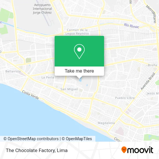
See The Chocolate Factory, San Miguel, on the map
Public Transit to The Chocolate Factory in San Miguel
Wondering how to get to The Chocolate Factory in San Miguel? Moovit helps you find the best way to get to The Chocolate Factory with step-by-step directions from the nearest public transit station.
Moovit provides free maps and live directions to help you navigate through your city. View schedules, routes, timetables, and find out how long does it take to get to The Chocolate Factory in real time.
Looking for the nearest stop or station to The Chocolate Factory? Check out this list of stops closest to your destination: Parque De Las Leyendas; Cesar Lopez Rojas; Avenida De Los Precursores 196; Precursores; Hospital Naval; Liceo.
Bus: 1163, 1173, 1203, 1258, 1286, 1300, 1317, 1491, 1138, 1228, CR62, IM47, 1275, IM18, 1007, 1218, 1223, 1234, 1319, 1448.
Want to see if there’s another route that gets you there at an earlier time? Moovit helps you find alternative routes or times. Get directions from and directions to The Chocolate Factory easily from the Moovit App or Website.
We make riding to The Chocolate Factory easy, which is why over 1.5 million users, including users in San Miguel, trust Moovit as the best app for public transit. You don’t need to download an individual bus app or train app, Moovit is your all-in-one transit app that helps you find the best bus time or train time available.
For information on prices of bus, costs and ride fares to The Chocolate Factory, please check the Moovit app.
Use the app to navigate to popular places including to the airport, hospital, stadium, grocery store, mall, coffee shop, school, college, and university.
The Chocolate Factory Address: Maranga 7ma Etapa, 15088 San Miguel street in San Miguel
- Laguna Recreativa,
- Ecolodge Majestic Sky Domes by Ipt,
- Laberinto,
- Jardín botánico,
- Wong San Miguel,
- 15088,
- Parque de las Leyendas - Municipalidad Metropolitana de Lima,
- Av. Las Leyendas 580 - 582 - 586,
- Jardin Botanico Parque de las Leyendas,
- Casa de la Juventud - Pueblo Libre,
- Balneario la Punta,
- Huaca 43,
- calle julian arce Urb Las Leyendas maranga,
- Calle Alberto Barton 167 San Miguel Urbanizacion Las Leyendas,
- AV RAFAEL ESCARDO 968 DPTO 404,
- Cirujano Plástico-Huiman Lazo Victor Ramón,
- Av. Rafael Escardo / av. Precursores,
- Calle Fortunato Quezada,
- Atv (Andina de Radiodifusión) Canal 9,
- Gonzales Mogrovejo Mileydi
Places Near The Chocolate Factory (San Miguel)
- Larcomar, Miraflores,
- Av. Salaverry, Jesus Mari,
- Mall Del Sur,
- Aeropuerto Internacional Jorge Chávez, Ventanilla,
- Circuito Mágico Del Agua, Lima,
- Real Plaza Puruchuco, Ate,
- Gamarra,
- Parque Kennedy, Miraflores,
- Parque de las Leyendas, San Miguel,
- Av. La Marina, San Miguel,
- av arequipa, Lima,
- Plaza San Miguel, San Miguel,
- Pontificia Universidad Católica del Perú - PUCP, San Miguel,
- Av. Abancay, Lima,
- Paradero Av.Brasil,
- Hospital Edgardo Rebagliati Martins, Jesus Mari,
- Centro Comercial Plaza Norte, Independen,
- Jockey Plaza, Santiago D,
- Barranco, Barranco,
- Miraflores, Miraflores
How to get to popular places in Lima with public transit
Get around San Miguel by public transit!
Traveling around San Miguel has never been so easy. See step by step directions as you travel to any attraction, street or major public transit station. View bus and train schedules, arrival times, service alerts and detailed routes on a map, so you know exactly how to get to anywhere in San Miguel.
When traveling to any destination around San Miguel use Moovit's Live Directions with Get Off Notifications to know exactly where and how far to walk, how long to wait for your line, and how many stops are left. Moovit will alert you when it's time to get off — no need to constantly re-check whether yours is the next stop.
Wondering how to use public transit in San Miguel or how to pay for public transit in San Miguel? Moovit public transit app can help you navigate your way with public transit easily, and at minimum cost. It includes public transit fees, ticket prices, and costs. Looking for a map of San Miguel public transit lines? Moovit public transit app shows all public transit maps in San Miguel with all Bus, Metro and Ferry routes and stops on an interactive map.
Lima has 3 transit type(s), including: Bus, Metro and Ferry, operated by several transit agencies, including Metro de Lima Línea 2 , Metro de Lima, Corredor Rojo, Metropolitano, Metropolitano - Alimentadores, Corredor Morado, Corredor Azul, Rutas Tradicionales, Transportes y Servicios La Esperanza S.A., Las Flores S.A., Virgen de la Asunción S.A., Consorcio HAM, Transportes y Service Canadá S.A., ETUL4SA and ETUCHISA