Directions to The Clean Up Group (Seaford) with public transportation
The following transit lines have routes that pass near The Clean Up Group
 Bus: N19, N80.
- Train: BABYLON BRANCH.
How to get to The Clean Up Group by bus?
Click on the bus route to see step by step directions with maps, line arrival times and updated time schedules.
From Woodbury Long Island, Woodbury
101 minFrom Uniondale, NY, Uniondale
69 minFrom Baxter Pavillion @ Good Sam, West Islip
102 minFrom Roosevelt Field Mall Bus Terminal, East Garden City
93 minFrom East Meadow, NY, East Meadow
95 minFrom Plainview, NY, Plainview
101 minFrom Mercy Hospital, Rockville Centre
114 minFrom Westbury, NY, Westbury
96 minFrom Garden City, NY, Garden City
81 minFrom Plattduetsche Park, Franklin Square
107 min
How to get to The Clean Up Group by train?
Click on the train route to see step by step directions with maps, line arrival times and updated time schedules.
Train station near The Clean Up Group in Seaford
- Wantagh, 29 min walk,VIEW
What are the closest stations to The Clean Up Group?
The closest stations to The Clean Up Group are:
- Wantagh is 2454 yards away, 29 min walk.
Which bus lines stop near The Clean Up Group?
These bus lines stop near The Clean Up Group: N19, N80.
Which train line stops near The Clean Up Group?
BABYLON BRANCH (New York)
What’s the nearest train station to The Clean Up Group in Seaford?
The nearest train station to The Clean Up Group in Seaford is Wantagh. It’s a 29 min walk away.
What time is the first train to The Clean Up Group in Seaford?
The BABYLON BRANCH is the first train that goes to The Clean Up Group in Seaford. It stops nearby at 3:26 AM.
What time is the last train to The Clean Up Group in Seaford?
The BABYLON BRANCH is the last train that goes to The Clean Up Group in Seaford. It stops nearby at 3:43 AM.
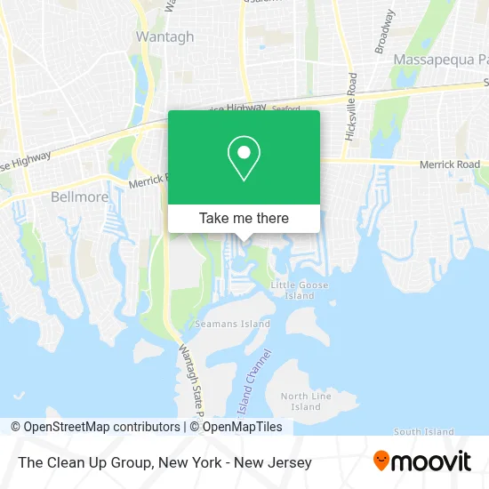
See The Clean Up Group, Seaford, on the map
Public Transit to The Clean Up Group in Seaford
Wondering how to get to The Clean Up Group in Seaford? Moovit helps you find the best way to get to The Clean Up Group with step-by-step directions from the nearest public transit station.
Moovit provides free maps and live directions to help you navigate through your city. View schedules, routes, timetables, and find out how long does it take to get to The Clean Up Group in real time.
Looking for the nearest stop or station to The Clean Up Group? Check out this list of stops closest to your destination: Wantagh.
Bus: N19, N80.Train: BABYLON BRANCH.
Want to see if there’s another route that gets you there at an earlier time? Moovit helps you find alternative routes or times. Get directions from and directions to The Clean Up Group easily from the Moovit App or Website.
We make riding to The Clean Up Group easy, which is why over 1.5 million users, including users in Seaford, trust Moovit as the best app for public transit. You don’t need to download an individual bus app or train app, Moovit is your all-in-one transit app that helps you find the best bus time or train time available.
For information on prices of bus and train, costs and ride fares to The Clean Up Group, please check the Moovit app.
Use the app to navigate to popular places including to the airport, hospital, stadium, grocery store, mall, coffee shop, school, college, and university.
The Clean Up Group Address: 2689 Riverside Ave street in Seaford
- Seamans Neck Park,
- 2578 Kevin Road, Seaford,
- Liwinedad,
- Seamans Neck Park,
- Stick’M Up Designs,
- Black Bottom Fishing Charters,
- Gold Coast Tag Sales, Inc.,
- "The Harbor House" Station No. 3,
- Above & Beyond Events,
- The White Whale,
- Stellar Decks,
- All Stars Pizza & Deli,
- Pizza Italia Nyc,
- 360 Realty Group,
- Catfish Max,
- Stillwaters,
- Jetmore Jetski Inc.,
- Simpson Bathroom Remodeling,
- Ez Dock Of Long Island,
- Seaford Family Chiropractic
Places Near The Clean Up Group (Seaford)
- Times Square, Manhattan,
- Rockefeller Center, Manhattan,
- 111 Centre New York City Supreme Court, Manhattan,
- 1 Police Plaza, Manhattan,
- 66 John Street, Manhattan,
- Wall Street, Manhattan,
- Hudson Yards, Manhattan,
- 26 Federal Plaza, Manhattan,
- 911 Memorial, Manhattan,
- Bellevue Hospital, Manhattan,
- Mountainside Hospital, Glen Ridge,
- 376 Hudson Street, Manhattan,
- qqqq, Manhattan,
- SoHo, Manhattan,
- Pier 83, Manhattan,
- Katz's Deli, Manhattan,
- San Gennaro Feast, Manhattan,
- Chinatown, Manhattan,
- 3 Stone St, Manhattan,
- Queens Center Mall, Queens
How to get to popular places in New York - New Jersey with public transit
Get around Seaford by public transit!
Traveling around Seaford has never been so easy. See step by step directions as you travel to any attraction, street or major public transit station. View bus and train schedules, arrival times, service alerts and detailed routes on a map, so you know exactly how to get to anywhere in Seaford.
When traveling to any destination around Seaford use Moovit's Live Directions with Get Off Notifications to know exactly where and how far to walk, how long to wait for your line, and how many stops are left. Moovit will alert you when it's time to get off — no need to constantly re-check whether yours is the next stop.
Wondering how to use public transit in Seaford or how to pay for public transit in Seaford? Moovit public transit app can help you navigate your way with public transit easily, and at minimum cost. It includes public transit fees, ticket prices, and costs. Looking for a map of Seaford public transit lines? Moovit public transit app shows all public transit maps in Seaford with all Bus, Train, Subway, Light Rail, Ferry and Cable Car routes and stops on an interactive map.
New York - New Jersey has 6 transit type(s), including: Bus, Train, Subway, Light Rail, Ferry and Cable Car, operated by several transit agencies, including MTA Subway, Metro-North Railroad, LIRR, PATH, MTA New York City Transit - Express routes, MTA Bus, NJ Transit, NYC Ferry, NICE bus, Bee-Line Bus, NJ Transit Rail, Norwalk Transit District, Hartford Line, River Valley Transit and HART