Directions to The Coffee Trappe (Talbot County) with public transportation
The following transit lines have routes that pass near The Coffee Trappe
 Bus: 9.
How to get to The Coffee Trappe by bus?
Click on the bus route to see step by step directions with maps, line arrival times and updated time schedules.
Bus stop near The Coffee Trappe in Talbot County
- Post Office Sb, 3 min walk,VIEW
Bus lines to The Coffee Trappe in Talbot County
- 9, Easton,VIEW
What are the closest stations to The Coffee Trappe?
The closest stations to The Coffee Trappe are:
- Post Office Sb is 222 yards away, 3 min walk.
Which bus line stops near The Coffee Trappe?
9 (Cambridge)
What’s the nearest bus station to The Coffee Trappe in Talbot County?
The nearest bus station to The Coffee Trappe in Talbot County is Post Office Sb. It’s a 3 min walk away.
What time is the first bus to The Coffee Trappe in Talbot County?
The 9 is the first bus that goes to The Coffee Trappe in Talbot County. It stops nearby at 6:14 AM.
What time is the last bus to The Coffee Trappe in Talbot County?
The 9 is the last bus that goes to The Coffee Trappe in Talbot County. It stops nearby at 6:20 PM.
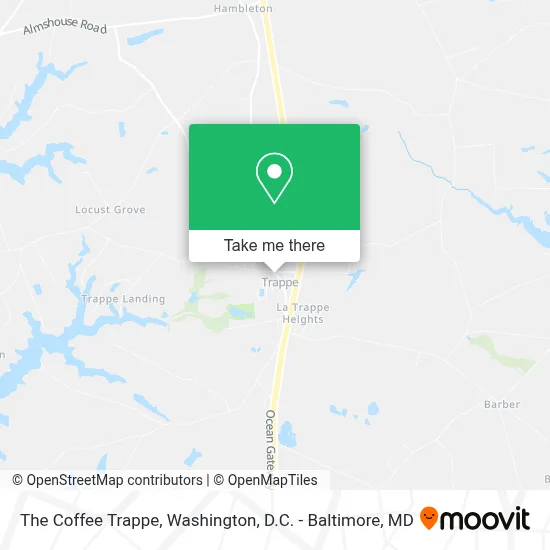
See The Coffee Trappe, Talbot County, on the map
Public Transit to The Coffee Trappe in Talbot County
Wondering how to get to The Coffee Trappe in Talbot County? Moovit helps you find the best way to get to The Coffee Trappe with step-by-step directions from the nearest public transit station.
Moovit provides free maps and live directions to help you navigate through your city. View schedules, routes, timetables, and find out how long does it take to get to The Coffee Trappe in real time.
Looking for the nearest stop or station to The Coffee Trappe? Check out this list of stops closest to your destination: Post Office Sb.
Bus: 9.
Want to see if there’s another route that gets you there at an earlier time? Moovit helps you find alternative routes or times. Get directions from and directions to The Coffee Trappe easily from the Moovit App or Website.
We make riding to The Coffee Trappe easy, which is why over 1.7 million users, including users in Talbot County, trust Moovit as the best app for public transit. You don’t need to download an individual bus app or train app, Moovit is your all-in-one transit app that helps you find the best bus time or train time available.
For information on prices of bus, costs and ride fares to The Coffee Trappe, please check the Moovit app.
Use the app to navigate to popular places including to the airport, hospital, stadium, grocery store, mall, coffee shop, school, college, and university.
The Coffee Trappe Address: 4016 Main St street in Talbot County
- Town of Trappe, Maryland,
- 3836 The Park Ln,
- Climate Engineering,
- Trappe Landing,
- Dr. Aaron Michael Williams, DC,
- Joseph A Balderson Builder,
- E S Diefenderfer Excavating,
- Readly Cemetery,
- Readly Cemetery,
- Locust Grove,
- 4306 Grove Rd,
- Health Center Of Cambridge,
- Elite Plumbing Svc,
- White World,
- Locust Grove Cemetery,
- Lowry Cove,
- Lowry Cove,
- Connolly Point Farms,
- 4990 Easton Trappe Rd,
- Connolly Cove
Places Near The Coffee Trappe (Talbot County)
- National Zoo, Washington,
- National Theatre, Washington,
- National Museum of African American History and Culture, Washington,
- Museum Of The Bible, Washington,
- Amazon Hq2, Arlington County,
- Georgetown, Washington,
- Westfield Montgomery Mall, Montgomery County,
- Washington DC VA Medical Center, Washington,
- PG Mall, Prince George's County,
- Marriott Marquis Washington, DC, Washington,
- Warner Theatre, Washington,
- Camden Yards, Baltimore,
- Pennsylvania Ave NW (3rd st and pennsylvania), Washington,
- Capital One Arena, Washington,
- M&T Bank Stadium, Baltimore,
- Rock Creek Tennis Center, Washington,
- Basilica of the National Shrine, Washington,
- The Anthem, Washington,
- Sibley Memorial Hospital, Washington,
- Washington National Cathedral, Washington
How to get to popular places in Washington, D.C. - Baltimore, MD with public transit
Get around Talbot County by public transit!
Traveling around Talbot County has never been so easy. See step by step directions as you travel to any attraction, street or major public transit station. View bus and train schedules, arrival times, service alerts and detailed routes on a map, so you know exactly how to get to anywhere in Talbot County.
When traveling to any destination around Talbot County use Moovit's Live Directions with Get Off Notifications to know exactly where and how far to walk, how long to wait for your line, and how many stops are left. Moovit will alert you when it's time to get off — no need to constantly re-check whether yours is the next stop.
Wondering how to use public transit in Talbot County or how to pay for public transit in Talbot County? Moovit public transit app can help you navigate your way with public transit easily, and at minimum cost. It includes public transit fees, ticket prices, and costs. Looking for a map of Talbot County public transit lines? Moovit public transit app shows all public transit maps in Talbot County with all Bus, Train, Metro, Light Rail and Ferry routes and stops on an interactive map.
Washington, D.C. - Baltimore, MD has 5 transit type(s), including: Bus, Train, Metro, Light Rail and Ferry, operated by several transit agencies, including WMATA, Montgomery County Ride On, Fairfax Connector, TheBus, PRTC, DASH - Alexandria, Arlington Transit (ART), RTA of Central Maryland, MDOT MTA, MDOT MTA Light RailLink, MDOT MTA Commuter Bus, MDOT MTA Local Bus, FXBGO!, Virginia Railway Express (VRE) and MARC