Directions to The Estates at Laytonsville (Montgomery County) with public transportation
The following transit lines have routes that pass near The Estates at Laytonsville
 Bus: 90.
How to get to The Estates at Laytonsville by bus?
Click on the bus route to see step by step directions with maps, line arrival times and updated time schedules.
From I-270 Exit 9A/B (I-370 / Sam Eig Hwy. Interchange), Montgomery County
71 minFrom Olney MD USA, Montgomery County
87 minFrom RIO Washingtonian Center, Montgomery County
44 minFrom Montgomery Village, Maryland, Montgomery County
55 minFrom Walmart Supercenter, Montgomery County
83 minFrom Kaiser Permanente - Gaithersburg Medical Center, Montgomery County
83 minFrom Clarksburg Premium Outlets, Montgomery County
96 minFrom Montgomery County Fairgrounds, Montgomery County
82 minFrom Astrazeneca HQ, Montgomery County
73 minFrom Clarksburg Premium Outlets, Montgomery County
104 min
Bus stop near The Estates at Laytonsville in Montgomery County
- Woodfield Rd & Brink Rd, 13 min walk,VIEW
Bus lines to The Estates at Laytonsville in Montgomery County
- 90, Milestone Via Damascus,VIEW
What are the closest stations to The Estates at Laytonsville?
The closest stations to The Estates at Laytonsville are:
- Woodfield Rd & Brink Rd is 1114 yards away, 13 min walk.
Which bus line stops near The Estates at Laytonsville?
90 (Damascus)
What’s the nearest bus station to The Estates at Laytonsville in Montgomery County?
The nearest bus station to The Estates at Laytonsville in Montgomery County is Woodfield Rd & Brink Rd. It’s a 13 min walk away.
What time is the first bus to The Estates at Laytonsville in Montgomery County?
The 90 is the first bus that goes to The Estates at Laytonsville in Montgomery County. It stops nearby at 5:10 AM.
What time is the last bus to The Estates at Laytonsville in Montgomery County?
The 90 is the last bus that goes to The Estates at Laytonsville in Montgomery County. It stops nearby at 9:16 PM.
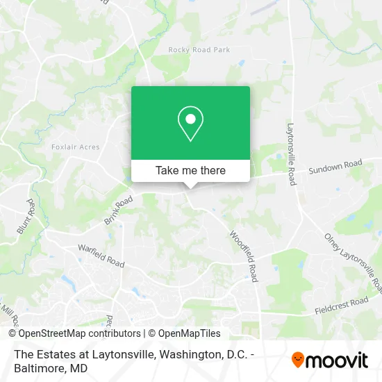
See The Estates at Laytonsville, Montgomery County, on the map
Public Transit to The Estates at Laytonsville in Montgomery County
Wondering how to get to The Estates at Laytonsville in Montgomery County? Moovit helps you find the best way to get to The Estates at Laytonsville with step-by-step directions from the nearest public transit station.
Moovit provides free maps and live directions to help you navigate through your city. View schedules, routes, timetables, and find out how long does it take to get to The Estates at Laytonsville in real time.
Looking for the nearest stop or station to The Estates at Laytonsville? Check out this list of stops closest to your destination: Woodfield Rd & Brink Rd.
Bus: 90.
Want to see if there’s another route that gets you there at an earlier time? Moovit helps you find alternative routes or times. Get directions from and directions to The Estates at Laytonsville easily from the Moovit App or Website.
We make riding to The Estates at Laytonsville easy, which is why over 1.7 million users, including users in Montgomery County, trust Moovit as the best app for public transit. You don’t need to download an individual bus app or train app, Moovit is your all-in-one transit app that helps you find the best bus time or train time available.
For information on prices of bus, costs and ride fares to The Estates at Laytonsville, please check the Moovit app.
Use the app to navigate to popular places including to the airport, hospital, stadium, grocery store, mall, coffee shop, school, college, and university.
The Estates at Laytonsville Address: 8212 Brink Rd street in Montgomery County
- Goshen Elementary,
- Sjn Women's Ministry,
- Karmi Wellness,
- Byzantine Catholic Mission,
- Penny Tax, Llc,
- Dinky's Child Care,
- The White Cleaning Corporation,
- Slice Works,
- Jdt Financial Group Llc,
- Truist - Atm,
- Quest Diagnostics - Inside Gaithersburg Safeway Store - Employer Drug Testing Not Offered,
- Rubber Ducky Daycare,
- Lc4 Cleaning,
- Keyme Locksmiths,
- Montgomery Village Foundation,
- Abc,
- Lavender Rose Boutiques, Llc,
- Starterblox Foundation Inc,
- Ynars Respite Care Home,
- Shelleys Wagging Tails Dog Services
Places Near The Estates at Laytonsville (Montgomery County)
- Georgetown, Washington,
- National Zoo, Washington,
- Museum Of The Bible, Washington,
- Amazon Hq2, Arlington County,
- Westfield Montgomery Mall, Montgomery County,
- M&T Bank Stadium, Baltimore,
- Warner Theatre, Washington,
- Rock Creek Tennis Center, Washington,
- Washington DC VA Medical Center, Washington,
- National Museum of African American History and Culture, Washington,
- Sibley Memorial Hospital, Washington,
- Camden Yards, Baltimore,
- Capital One Arena, Washington,
- The Anthem, Washington,
- Basilica of the National Shrine, Washington,
- Marriott Marquis Washington, DC, Washington,
- Washington National Cathedral, Washington,
- National Theatre, Washington,
- PG Mall, Prince George's County,
- Pennsylvania Ave NW (3rd st and pennsylvania), Washington
How to get to popular places in Washington, D.C. - Baltimore, MD with public transit
Get around Montgomery County by public transit!
Traveling around Montgomery County has never been so easy. See step by step directions as you travel to any attraction, street or major public transit station. View bus and train schedules, arrival times, service alerts and detailed routes on a map, so you know exactly how to get to anywhere in Montgomery County.
When traveling to any destination around Montgomery County use Moovit's Live Directions with Get Off Notifications to know exactly where and how far to walk, how long to wait for your line, and how many stops are left. Moovit will alert you when it's time to get off — no need to constantly re-check whether yours is the next stop.
Wondering how to use public transit in Montgomery County or how to pay for public transit in Montgomery County? Moovit public transit app can help you navigate your way with public transit easily, and at minimum cost. It includes public transit fees, ticket prices, and costs. Looking for a map of Montgomery County public transit lines? Moovit public transit app shows all public transit maps in Montgomery County with all Bus, Train, Metro, Light Rail and Ferry routes and stops on an interactive map.
Washington, D.C. - Baltimore, MD has 5 transit type(s), including: Bus, Train, Metro, Light Rail and Ferry, operated by several transit agencies, including WMATA, Montgomery County Ride On, Fairfax Connector, TheBus, PRTC, DASH - Alexandria, Arlington Transit (ART), RTA of Central Maryland, MDOT MTA, MDOT MTA Light RailLink, MDOT MTA Commuter Bus, MDOT MTA Local Bus, FXBGO!, Virginia Railway Express (VRE) and MARC