How to get to The Festival Center by bus?
Click on the bus route to see step by step directions with maps, line arrival times and updated time schedules.
From Amazon Was14, Arlington County
63 minFrom Washington DC Temple, Montgomery County
56 minFrom Ballou High School, Washington
75 minFrom Shirlington, Arlington County
58 minFrom National Hall / Reagan National Airport (DCA), Arlington County
81 minFrom Coast Guard HQ & Bus Bay D, Washington
80 minFrom Hilton Arlington National Landing, Arlington County
69 minFrom St Elizabeths Hospital, Washington
81 minFrom Marine Barracks Washington, Washington
44 minFrom Suburban Hospital, Montgomery County
67 min
How to get to The Festival Center by metro?
Click on the metro route to see step by step directions with maps, line arrival times and updated time schedules.
From Amazon Was14, Arlington County
29 minFrom Ballou High School, Washington
56 minFrom National Hall / Reagan National Airport (DCA), Arlington County
31 minFrom Coast Guard HQ & Bus Bay D, Washington
49 minFrom Hilton Arlington National Landing, Arlington County
42 minFrom St Elizabeths Hospital, Washington
45 minFrom Marine Barracks Washington, Washington
38 minFrom Suburban Hospital, Montgomery County
54 min
Bus stops near The Festival Center in Washington
Metro stations near The Festival Center in Washington
Bus lines to The Festival Center in Washington
What are the closest stations to The Festival Center?
The closest stations to The Festival Center are:
- 16th St & Harvard St NW Sb is 148 yards away, 2 min walk.
- Mt Pleasant St Nw+Harvard St NW is 175 yards away, 3 min walk.
- 16 St Nw+Euclid St NW is 406 yards away, 6 min walk.
- Irving St Nw+16 St NW is 477 yards away, 6 min walk.
- Nw Columbia Rd & Nw Ontario Rd is 576 yards away, 7 min walk.
- Columbia Heights is 1173 yards away, 14 min walk.
- Woodley Park - SW Corner Connecticut Ave. &Amp; 24th St. NW is 1378 yards away, 17 min walk.
Which bus lines stop near The Festival Center?
These bus lines stop near The Festival Center: 325, C53, D50, D60, D72.
Which metro lines stop near The Festival Center?
These metro lines stop near The Festival Center: GREEN, RED, YELLOW.
What’s the nearest metro station to The Festival Center in Washington?
The nearest metro station to The Festival Center in Washington is Columbia Heights. It’s a 14 min walk away.
What’s the nearest bus station to The Festival Center in Washington?
The nearest bus station to The Festival Center in Washington is 16th St & Harvard St NW Sb. It’s a 2 min walk away.
What time is the first metro to The Festival Center in Washington?
The GREEN is the first metro that goes to The Festival Center in Washington. It stops nearby at 5:14 AM.
What time is the last metro to The Festival Center in Washington?
The GREEN is the last metro that goes to The Festival Center in Washington. It stops nearby at 12:27 AM.
What time is the first bus to The Festival Center in Washington?
The D60 is the first bus that goes to The Festival Center in Washington. It stops nearby at 3:00 AM.
What time is the last bus to The Festival Center in Washington?
The D60 is the last bus that goes to The Festival Center in Washington. It stops nearby at 3:07 AM.
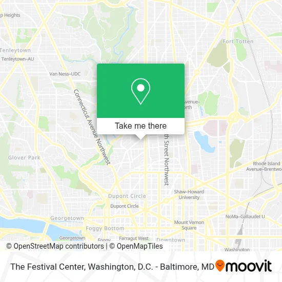
See The Festival Center, Washington, on the map
Public Transit to The Festival Center in Washington
Wondering how to get to The Festival Center in Washington? Moovit helps you find the best way to get to The Festival Center with step-by-step directions from the nearest public transit station.
Moovit provides free maps and live directions to help you navigate through your city. View schedules, routes, timetables, and find out how long does it take to get to The Festival Center in real time.
Looking for the nearest stop or station to The Festival Center? Check out this list of stops closest to your destination: 16th St & Harvard St NW Sb; Mt Pleasant St Nw+Harvard St NW; 16 St Nw+Euclid St NW; Irving St Nw+16 St NW; Nw Columbia Rd & Nw Ontario Rd; Columbia Heights; Woodley Park - SW Corner Connecticut Ave. &Amp; 24th St. NW.
Bus: 325, C53, D50, D60, D72, 305, D6X.Metro: GREEN, RED, YELLOW.
Want to see if there’s another route that gets you there at an earlier time? Moovit helps you find alternative routes or times. Get directions from and directions to The Festival Center easily from the Moovit App or Website.
We make riding to The Festival Center easy, which is why over 1.7 million users, including users in Washington, trust Moovit as the best app for public transit. You don’t need to download an individual bus app or train app, Moovit is your all-in-one transit app that helps you find the best bus time or train time available.
For information on prices of bus and metro, costs and ride fares to The Festival Center, please check the Moovit app.
Use the app to navigate to popular places including to the airport, hospital, stadium, grocery store, mall, coffee shop, school, college, and university.
The Festival Center Address: 1640 Columbia Rd NW street in Washington
- Festival Center (DC Jazz Festival Production Office),
- Federalist Pig,
- The Church Of Jesus Christ Of Latter-Day Saints,
- Embassy Of Poland,
- Embassy Of the Republic Of Cuba,
- Mexican Consulate,
- Mexican Cultural Institute,
- Embassy Of Lithuania,
- Christ House,
- Consulate of Mexico,
- Embassy Cuba,
- Consulado General de Mexico,
- 16th St & Euclid St,
- All Souls Church Unitarian (All Souls Housing),
- Trim Salon (Trim Hair Salon),
- Children's Hospital,
- Kalorama Rd NW (16th and kalorama),
- Embassy Tattoo,
- Frugalista,
- La Clinica Del Pueblo
Places Near The Festival Center (Washington)
- Basilica of the National Shrine, Washington,
- National Zoo, Washington,
- National Museum of African American History and Culture, Washington,
- Pennsylvania Ave NW (3rd st and pennsylvania), Washington,
- Sibley Memorial Hospital, Washington,
- Westfield Montgomery Mall, Montgomery County,
- The Anthem, Washington,
- National Theatre, Washington,
- M&T Bank Stadium, Baltimore,
- Warner Theatre, Washington,
- Museum Of The Bible, Washington,
- Washington National Cathedral, Washington,
- Georgetown, Washington,
- PG Mall, Prince George's County,
- Capital One Arena, Washington,
- Camden Yards, Baltimore,
- Marriott Marquis Washington, DC, Washington,
- Amazon Hq2, Arlington County,
- Rock Creek Tennis Center, Washington,
- Washington DC VA Medical Center, Washington
How to get to popular places in Washington, D.C. - Baltimore, MD with public transit
Get around Washington by public transit!
Traveling around Washington has never been so easy. See step by step directions as you travel to any attraction, street or major public transit station. View bus and train schedules, arrival times, service alerts and detailed routes on a map, so you know exactly how to get to anywhere in Washington.
When traveling to any destination around Washington use Moovit's Live Directions with Get Off Notifications to know exactly where and how far to walk, how long to wait for your line, and how many stops are left. Moovit will alert you when it's time to get off — no need to constantly re-check whether yours is the next stop.
Wondering how to use public transit in Washington or how to pay for public transit in Washington? Moovit public transit app can help you navigate your way with public transit easily, and at minimum cost. It includes public transit fees, ticket prices, and costs. Looking for a map of Washington public transit lines? Moovit public transit app shows all public transit maps in Washington with all Bus, Train, Metro, Light Rail and Ferry routes and stops on an interactive map.
Washington, D.C. - Baltimore, MD has 5 transit type(s), including: Bus, Train, Metro, Light Rail and Ferry, operated by several transit agencies, including WMATA, Montgomery County Ride On, Fairfax Connector, TheBus, PRTC, DASH - Alexandria, Arlington Transit (ART), RTA of Central Maryland, MDOT MTA, MDOT MTA Light RailLink, MDOT MTA Commuter Bus, MDOT MTA Local Bus, FXBGO!, Virginia Railway Express (VRE) and MARC