How to get to The Financial Planning Group by bus?
Click on the bus route to see step by step directions with maps, line arrival times and updated time schedules.
From Lake Fairfax Park, Fairfax County
46 minFrom King's Dominion, Fairfax County
68 minFrom Northern Virginia Community College - Annandale Campus, Fairfax County
74 minFrom Eden Center, Falls Church
60 minFrom Inova employee Shuttle, Fairfax County
53 minFrom Exit 39 - MD 190 (River Road) / Potomac, Washington, Montgomery County
130 minFrom Seven Corners Center (Seven Corners Shopping Center Falls Church VA), Fairfax County
65 minFrom Defense Health Agency Headquarters, Fairfax County
78 minFrom Fairfax County Courthouse, Fairfax County
77 min
How to get to The Financial Planning Group by metro?
Click on the metro route to see step by step directions with maps, line arrival times and updated time schedules.
Bus stops near The Financial Planning Group in Fairfax County
Metro station near The Financial Planning Group in Fairfax County
- Mclean, 41 min walk,VIEW
Bus lines to The Financial Planning Group in Fairfax County
What are the closest stations to The Financial Planning Group?
The closest stations to The Financial Planning Group are:
- Tyco Rd @ Leesburg Pike is 401 yards away, 6 min walk.
- Spring Hill Station + Bus Bay B is 460 yards away, 6 min walk.
- Gosnell Rd @ Tyspring St is 892 yards away, 11 min walk.
- Greensboro Dr @ Spring Hill Rd is 934 yards away, 12 min walk.
- Tysons Corner is 1189 yards away, 15 min walk.
- Mclean is 3448 yards away, 41 min walk.
Which bus lines stop near The Financial Planning Group?
These bus lines stop near The Financial Planning Group: 401, 463, 574, 798.
Which metro line stops near The Financial Planning Group?
SILVER (Ashburn)
What’s the nearest bus station to The Financial Planning Group in Fairfax County?
The nearest bus stations to The Financial Planning Group in Fairfax County are Tyco Rd @ Leesburg Pike and Spring Hill Station + Bus Bay B. The closest one is a 6 min walk away.
What time is the first metro to The Financial Planning Group in Fairfax County?
The SILVER is the first metro that goes to The Financial Planning Group in Fairfax County. It stops nearby at 5:07 AM.
What time is the last metro to The Financial Planning Group in Fairfax County?
The SILVER is the last metro that goes to The Financial Planning Group in Fairfax County. It stops nearby at 12:43 AM.
What time is the first bus to The Financial Planning Group in Fairfax County?
The 402 is the first bus that goes to The Financial Planning Group in Fairfax County. It stops nearby at 4:47 AM.
What time is the last bus to The Financial Planning Group in Fairfax County?
The 463 is the last bus that goes to The Financial Planning Group in Fairfax County. It stops nearby at 11:34 PM.
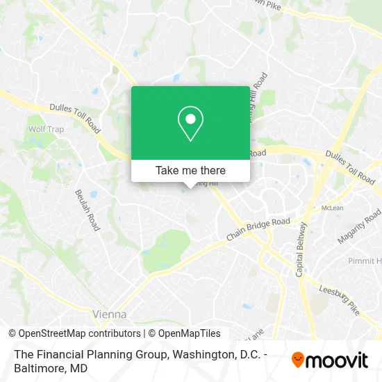
See The Financial Planning Group, Fairfax County, on the map
Public Transit to The Financial Planning Group in Fairfax County
Wondering how to get to The Financial Planning Group in Fairfax County? Moovit helps you find the best way to get to The Financial Planning Group with step-by-step directions from the nearest public transit station.
Moovit provides free maps and live directions to help you navigate through your city. View schedules, routes, timetables, and find out how long does it take to get to The Financial Planning Group in real time.
Looking for the nearest stop or station to The Financial Planning Group? Check out this list of stops closest to your destination: Tyco Rd @ Leesburg Pike; Spring Hill Station + Bus Bay B; Gosnell Rd @ Tyspring St; Greensboro Dr @ Spring Hill Rd; Tysons Corner; Mclean.
Bus: 401, 463, 574, 798, 427, 432, 402, FLIXBUS 2601, FLIXBUS 2605.Metro: SILVER.
Want to see if there’s another route that gets you there at an earlier time? Moovit helps you find alternative routes or times. Get directions from and directions to The Financial Planning Group easily from the Moovit App or Website.
We make riding to The Financial Planning Group easy, which is why over 1.7 million users, including users in Fairfax County, trust Moovit as the best app for public transit. You don’t need to download an individual bus app or train app, Moovit is your all-in-one transit app that helps you find the best bus time or train time available.
For information on prices of bus and metro, costs and ride fares to The Financial Planning Group, please check the Moovit app.
Use the app to navigate to popular places including to the airport, hospital, stadium, grocery store, mall, coffee shop, school, college, and university.
The Financial Planning Group Address: 1593 Spring Hill Rd street in Fairfax County
- Fsi Strategies,
- Shamshiry Chelo Kabob,
- Honda of Tysons Corner,
- Mercedes-Benz of Tysons Corner,
- G4 by Golpa,
- T.J. Maxx,
- Walmart,
- Embassy Suites Tysons Corner,
- Leesburg VA-684,
- Embassy Suites by Hilton Tysons Corner,
- Bwi,
- Goddard School,
- Best Buy,
- Tysons Condos,
- 8421 Broad,
- Audi Tysons Corner,
- Koons Tysons Toyota,
- Rock Steady Boxing Nova,
- Stanley Martin Homes,
- Vienna VA
Places Near The Financial Planning Group (Fairfax County)
- Georgetown, Washington,
- Camden Yards, Baltimore,
- Capital One Arena, Washington,
- Pennsylvania Ave NW (3rd st and pennsylvania), Washington,
- Warner Theatre, Washington,
- M&T Bank Stadium, Baltimore,
- Westfield Montgomery Mall, Montgomery County,
- Marriott Marquis Washington, DC, Washington,
- Rock Creek Tennis Center, Washington,
- Sibley Memorial Hospital, Washington,
- Basilica of the National Shrine, Washington,
- National Museum of African American History and Culture, Washington,
- The Anthem, Washington,
- Washington National Cathedral, Washington,
- Washington DC VA Medical Center, Washington,
- PG Mall, Prince George's County,
- Amazon Hq2, Arlington County,
- Museum Of The Bible, Washington,
- National Zoo, Washington,
- National Theatre, Washington
How to get to popular places in Washington, D.C. - Baltimore, MD with public transit
Get around Fairfax County by public transit!
Traveling around Fairfax County has never been so easy. See step by step directions as you travel to any attraction, street or major public transit station. View bus and train schedules, arrival times, service alerts and detailed routes on a map, so you know exactly how to get to anywhere in Fairfax County.
When traveling to any destination around Fairfax County use Moovit's Live Directions with Get Off Notifications to know exactly where and how far to walk, how long to wait for your line, and how many stops are left. Moovit will alert you when it's time to get off — no need to constantly re-check whether yours is the next stop.
Wondering how to use public transit in Fairfax County or how to pay for public transit in Fairfax County? Moovit public transit app can help you navigate your way with public transit easily, and at minimum cost. It includes public transit fees, ticket prices, and costs. Looking for a map of Fairfax County public transit lines? Moovit public transit app shows all public transit maps in Fairfax County with all Bus, Train, Metro, Light Rail and Ferry routes and stops on an interactive map.
Washington, D.C. - Baltimore, MD has 5 transit type(s), including: Bus, Train, Metro, Light Rail and Ferry, operated by several transit agencies, including WMATA, Montgomery County Ride On, Fairfax Connector, TheBus, PRTC, DASH - Alexandria, Arlington Transit (ART), RTA of Central Maryland, MDOT MTA, MDOT MTA Light RailLink, MDOT MTA Commuter Bus, MDOT MTA Local Bus, FXBGO!, Virginia Railway Express (VRE) and MARC