Directions to The Fort (Grafton) with public transportation
The following transit lines have routes that pass near The Fort
 Bus: 72, BLUE ROUTE, RIVER ROUTE, BLUE-RED ROUTE, 71.
How to get to The Fort by bus?
Click on the bus route to see step by step directions with maps, line arrival times and updated time schedules.
From White River Junction, Windsor
42 minFrom The Uncommon Home, Windsor
42 minFrom White River Junction Station, Windsor
42 minFrom King Arthur Flour Baker's Store, Windsor
40 minFrom EV Charging Station, Windsor
22 minFrom Hartland/Windsor Park and Ride, Windsor
22 minFrom Maynard Parking Lot, Grafton
31 min
Bus stops near The Fort in Grafton
Bus lines to The Fort in Grafton
What are the closest stations to The Fort?
The closest stations to The Fort are:
- Heater Rd, Dhmc, Opp. is 519 yards away, 7 min walk.
- Heater Rd. Bus Shelter is 524 yards away, 7 min walk.
- Dmhc Heater Road Westward at Road is 527 yards away, 7 min walk.
- Dhmc Heater Rd. is 720 yards away, 9 min walk.
- Elm To Canaan is 829 yards away, 10 min walk.
Which bus lines stop near The Fort?
These bus lines stop near The Fort: 72, BLUE ROUTE, RIVER ROUTE.
What’s the nearest bus station to The Fort in Grafton?
The nearest bus stations to The Fort in Grafton are Heater Rd, Dhmc, Opp., Heater Rd. Bus Shelter and Dmhc Heater Road Westward at Road. The closest one is a 7 min walk away.
What time is the first bus to The Fort in Grafton?
The ENFIELD-CANAAN is the first bus that goes to The Fort in Grafton. It stops nearby at 5:15 AM.
What time is the last bus to The Fort in Grafton?
The BLUE ROUTE is the last bus that goes to The Fort in Grafton. It stops nearby at 8:46 PM.
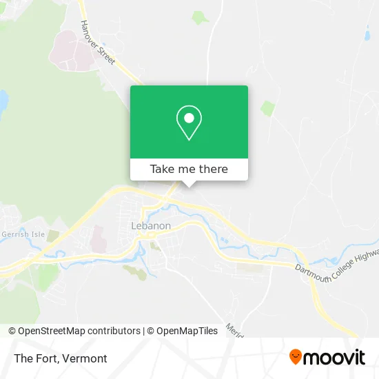
See The Fort, Grafton, on the map
Public Transit to The Fort in Grafton
Wondering how to get to The Fort in Grafton? Moovit helps you find the best way to get to The Fort with step-by-step directions from the nearest public transit station.
Moovit provides free maps and live directions to help you navigate through your city. View schedules, routes, timetables, and find out how long does it take to get to The Fort in real time.
Looking for the nearest stop or station to The Fort? Check out this list of stops closest to your destination: Heater Rd; Heater Rd. Bus Shelter; Dmhc Heater Road Westward at Road; Dhmc Heater Rd.; Elm To Canaan.
Bus: 72, BLUE ROUTE, RIVER ROUTE, BLUE-RED ROUTE, 71, 89ER SOUTH, ENFIELD-CANAAN.
Want to see if there’s another route that gets you there at an earlier time? Moovit helps you find alternative routes or times. Get directions from and directions to The Fort easily from the Moovit App or Website.
We make riding to The Fort easy, which is why over 1.5 million users, including users in Grafton, trust Moovit as the best app for public transit. You don’t need to download an individual bus app or train app, Moovit is your all-in-one transit app that helps you find the best bus time or train time available.
For information on prices of bus and train, costs and ride fares to The Fort, please check the Moovit app.
Use the app to navigate to popular places including to the airport, hospital, stadium, grocery store, mall, coffee shop, school, college, and university.
The Fort Address: Heater Road street in Grafton
- Fort,
- ATM,
- Irving,
- Freightliner of New Hampshire,
- Decato Bros Trucking,
- Groundskeepers,
- Miller Automotive Group,
- Exit 18/Lebanon/N,
- Entrance I-89 S,
- A Community in Motion,
- Fitness Centre,
- Stonecliff Animal Clinic,
- Paws 4 Training Website,
- Dartmouth-Hitchcock Heater Road Internal Medicine,
- Matthew B. Mackwood MD MPH,
- Manuel Iriondo, MD,
- Primary Care at Dartmouth-Hitchcock Heater Road,
- Tricia L. Groff, MD,
- Sadhanasree Chandramouli, MD,
- Dartmouth-Hitchcock Medical Center – Heater Road
Places Near The Fort (Grafton)
- Dartmouth-Hitchcock Medical Center, Clinical Systems, Grafton,
- Castleton University, Rutland,
- Ecco,
- WXXX, Chittenden,
- Barre, VT,
- University of Vermont Medical Center - Fanny Allen Campus, Chittenden,
- Sugarbush Resort,
- Rutland, VT, Rutland,
- Missisquoi River Basin Association,
- Castleton, VT, Rutland,
- Xxxxxxxxxxxxx, Chittenden,
- Champlain Valley Exposition, Chittenden,
- GLOBALFOUNDRIES, Chittenden,
- Hannaford, Rutland,
- Richford Auto,
- Springfield, VT, Windsor,
- MVU,
- Derby Line Stanstead Border Crossing,
- Spring Step,
- Waterbury, VT
How to get to popular places in Vermont with public transit
Get around Grafton by public transit!
Traveling around Grafton has never been so easy. See step by step directions as you travel to any attraction, street or major public transit station. View bus and train schedules, arrival times, service alerts and detailed routes on a map, so you know exactly how to get to anywhere in Grafton.
When traveling to any destination around Grafton use Moovit's Live Directions with Get Off Notifications to know exactly where and how far to walk, how long to wait for your line, and how many stops are left. Moovit will alert you when it's time to get off — no need to constantly re-check whether yours is the next stop.
Wondering how to use public transit in Grafton or how to pay for public transit in Grafton? Moovit public transit app can help you navigate your way with public transit easily, and at minimum cost. It includes public transit fees, ticket prices, and costs. Looking for a map of Grafton public transit lines? Moovit public transit app shows all public transit maps in Grafton with all Bus, Train and Ferry routes and stops on an interactive map.
Vermont has 3 transit type(s), including: Bus, Train and Ferry, operated by several transit agencies, including Green Mountain Transit, Wilmington MOOver, Advance Transit, Vermont Translines, Rockingham MOOver, The Bus (Marble Valley Regional Transit District), Green Mountain Express, Rural Community Transportation, Addison County Transit Resources, Stagecoach Transportation Services, Amtrak, Greyhound-us, Dartmouth Campus Connector and Lake Champlain Ferries