Directions to The Image Farm (Addison) with public transportation
The following transit lines have routes that pass near The Image Farm
 Bus: 116 COMMUTER.
How to get to The Image Farm by bus?
Click on the bus route to see step by step directions with maps, line arrival times and updated time schedules.
From Vermont FCU, Addison
73 minFrom Middlebury College Recycling Center, Addison
34 minFrom Leicester, VT, Addison
208 minFrom Addison Residential, Addison
210 minFrom Bristol Municipal, Addison
26 minFrom Chabad of Addison County, Addison
24 minFrom WW Weight Watchers, Addison
84 minFrom Scott Center for Spiritual & Religious Life at Middlebury College, Addison
29 minFrom Malabar, Addison
80 minFrom Vermont's Own Gifts & Goods, Addison
22 min
Bus stop near The Image Farm in Addison
- Middlebury Lindale, 2 min walk,VIEW
Bus lines to The Image Farm in Addison
- 116 COMMUTER, Academy Street,VIEW
What are the closest stations to The Image Farm?
The closest stations to The Image Farm are:
- Middlebury Lindale is 141 yards away, 2 min walk.
Which bus line stops near The Image Farm?
116 COMMUTER (Academy Street→Downtown Transit Center)
What’s the nearest bus station to The Image Farm in Addison?
The nearest bus station to The Image Farm in Addison is Middlebury Lindale. It’s a 2 min walk away.
What time is the first bus to The Image Farm in Addison?
The 116 COMMUTER is the first bus that goes to The Image Farm in Addison. It stops nearby at 6:18 AM.
What time is the last bus to The Image Farm in Addison?
The 116 COMMUTER is the last bus that goes to The Image Farm in Addison. It stops nearby at 6:36 PM.
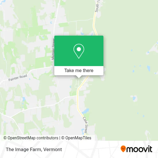
See The Image Farm, Addison, on the map
Public Transit to The Image Farm in Addison
Wondering how to get to The Image Farm in Addison? Moovit helps you find the best way to get to The Image Farm with step-by-step directions from the nearest public transit station.
Moovit provides free maps and live directions to help you navigate through your city. View schedules, routes, timetables, and find out how long does it take to get to The Image Farm in real time.
Looking for the nearest stop or station to The Image Farm? Check out this list of stops closest to your destination: Middlebury Lindale.
Bus: 116 COMMUTER.
Want to see if there’s another route that gets you there at an earlier time? Moovit helps you find alternative routes or times. Get directions from and directions to The Image Farm easily from the Moovit App or Website.
We make riding to The Image Farm easy, which is why over 1.5 million users, including users in Addison, trust Moovit as the best app for public transit. You don’t need to download an individual bus app or train app, Moovit is your all-in-one transit app that helps you find the best bus time or train time available.
For information on prices of bus, costs and ride fares to The Image Farm, please check the Moovit app.
Use the app to navigate to popular places including to the airport, hospital, stadium, grocery store, mall, coffee shop, school, college, and university.
The Image Farm Address: 308 Mead Ln street in Addison
- The Real Estate Company of Vermont,
- Bellows-Nichols Agency,
- United Way of Addison County,
- Pete's Tire Barns,
- Aubuchon Hardware,
- American Brewers Guild,
- The Glen Hay Falconer Foundation,
- G Stone Motors,
- Radioshack,
- Counseling Services of Addison County,
- John Deere,
- Time Zero,
- Advanced Hearing Technologies,
- Ciderstock,
- Luc H. Dupuis, Pa-C, Physician Assistant,
- Middhandyman,
- Hasty Solutions,
- Suburban Propane,
- Friends of Middlebury Hockey,
- Caron's Crocheting
Places Near The Image Farm (Addison)
- Sugarbush Resort,
- Waterbury, VT,
- Ecco,
- MVU,
- WXXX, Chittenden,
- Richford Auto,
- GLOBALFOUNDRIES, Chittenden,
- Champlain Valley Exposition, Chittenden,
- Missisquoi River Basin Association,
- University of Vermont Medical Center - Fanny Allen Campus, Chittenden,
- Castleton University, Rutland,
- Springfield, VT, Windsor,
- Xxxxxxxxxxxxx, Chittenden,
- Barre, VT,
- Spring Step,
- Dartmouth-Hitchcock Medical Center, Clinical Systems, Grafton,
- Hannaford, Rutland,
- Castleton, VT, Rutland,
- Rutland, VT, Rutland,
- Derby Line Stanstead Border Crossing
How to get to popular places in Vermont with public transit
Get around Addison by public transit!
Traveling around Addison has never been so easy. See step by step directions as you travel to any attraction, street or major public transit station. View bus and train schedules, arrival times, service alerts and detailed routes on a map, so you know exactly how to get to anywhere in Addison.
When traveling to any destination around Addison use Moovit's Live Directions with Get Off Notifications to know exactly where and how far to walk, how long to wait for your line, and how many stops are left. Moovit will alert you when it's time to get off — no need to constantly re-check whether yours is the next stop.
Wondering how to use public transit in Addison or how to pay for public transit in Addison? Moovit public transit app can help you navigate your way with public transit easily, and at minimum cost. It includes public transit fees, ticket prices, and costs. Looking for a map of Addison public transit lines? Moovit public transit app shows all public transit maps in Addison with all Bus, Train and Ferry routes and stops on an interactive map.
Vermont has 3 transit type(s), including: Bus, Train and Ferry, operated by several transit agencies, including Green Mountain Transit, Wilmington MOOver, Advance Transit, Vermont Translines, Rockingham MOOver, The Bus (Marble Valley Regional Transit District), Green Mountain Express, Rural Community Transportation, Addison County Transit Resources, Stagecoach Transportation Services, Amtrak, Greyhound-us, Dartmouth Campus Connector and Lake Champlain Ferries