Directions to The Johns Hopkins Scleroderma Center (Baltimore) with public transportation
The following transit lines have routes that pass near The Johns Hopkins Scleroderma Center
 Bus: 22, 59, CITYLINK ORANGE, CITYLINK BLUE, CITYLINK NAVY.
- Metro: METRO.
- Ferry: HC2, HC1.
How to get to The Johns Hopkins Scleroderma Center by bus?
Click on the bus route to see step by step directions with maps, line arrival times and updated time schedules.
From Walmart, Baltimore
46 minFrom Baltimore City Community College (BCCC) - Liberty Campus, Baltimore
56 minFrom Giant Food Stores, Baltimore
38 minFrom Baltimore Poly Tech High School, Baltimore
60 minFrom Baltimore Penn Station, Baltimore
51 minFrom Mitchell Court House, Baltimore
28 minFrom Western High School, Baltimore
60 minFrom Baltimore Arena, Baltimore
29 minFrom Baltimore Polytechnic Institute, Baltimore
58 minFrom Medstar Franklin Square Medical Center, Baltimore County
51 min
Bus stops near The Johns Hopkins Scleroderma Center in Baltimore
Metro station near The Johns Hopkins Scleroderma Center in Baltimore
- Johns Hopkins Metro, 60 min walk,VIEW
Ferry stations near The Johns Hopkins Scleroderma Center in Baltimore
Bus lines to The Johns Hopkins Scleroderma Center in Baltimore
What are the closest stations to The Johns Hopkins Scleroderma Center?
The closest stations to The Johns Hopkins Scleroderma Center are:
- Eastern Ave & Rappolla St Opp Wb is 215 yards away, 3 min walk.
- Bayview Blvd & Hopkins-Bayview Dr Sb is 687 yards away, 9 min walk.
- Johns Hopkins Metro is 5059 yards away, 60 min walk.
- Canton Waterfront Park is 5168 yards away, 61 min walk.
- Maritime Park is 5183 yards away, 61 min walk.
Which bus lines stop near The Johns Hopkins Scleroderma Center?
These bus lines stop near The Johns Hopkins Scleroderma Center: 22, 59, CITYLINK ORANGE.
What’s the nearest bus station to The Johns Hopkins Scleroderma Center in Baltimore?
The nearest bus station to The Johns Hopkins Scleroderma Center in Baltimore is Eastern Ave & Rappolla St Opp Wb. It’s a 3 min walk away.
What time is the first metro to The Johns Hopkins Scleroderma Center in Baltimore?
The METRO is the first metro that goes to The Johns Hopkins Scleroderma Center in Baltimore. It stops nearby at 4:21 AM.
What time is the last metro to The Johns Hopkins Scleroderma Center in Baltimore?
The METRO is the last metro that goes to The Johns Hopkins Scleroderma Center in Baltimore. It stops nearby at 12:29 AM.
What time is the first bus to The Johns Hopkins Scleroderma Center in Baltimore?
The CITYLINK BLUE is the first bus that goes to The Johns Hopkins Scleroderma Center in Baltimore. It stops nearby at 3:29 AM.
What time is the last bus to The Johns Hopkins Scleroderma Center in Baltimore?
The CITYLINK BLUE is the last bus that goes to The Johns Hopkins Scleroderma Center in Baltimore. It stops nearby at 3:33 AM.
What time is the first ferry to The Johns Hopkins Scleroderma Center in Baltimore?
The HC1 is the first ferry that goes to The Johns Hopkins Scleroderma Center in Baltimore. It stops nearby at 6:00 AM.
What time is the last ferry to The Johns Hopkins Scleroderma Center in Baltimore?
The HC1 is the last ferry that goes to The Johns Hopkins Scleroderma Center in Baltimore. It stops nearby at 8:00 PM.
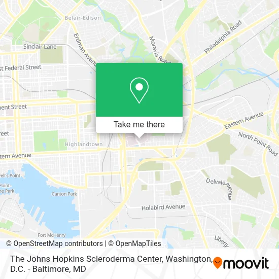
See The Johns Hopkins Scleroderma Center, Baltimore, on the map
Public Transit to The Johns Hopkins Scleroderma Center in Baltimore
Wondering how to get to The Johns Hopkins Scleroderma Center in Baltimore? Moovit helps you find the best way to get to The Johns Hopkins Scleroderma Center with step-by-step directions from the nearest public transit station.
Moovit provides free maps and live directions to help you navigate through your city. View schedules, routes, timetables, and find out how long does it take to get to The Johns Hopkins Scleroderma Center in real time.
Looking for the nearest stop or station to The Johns Hopkins Scleroderma Center? Check out this list of stops closest to your destination: Eastern Ave & Rappolla St Opp Wb; Bayview Blvd & Hopkins-Bayview Dr Sb; Johns Hopkins Metro; Canton Waterfront Park; Maritime Park.
Bus: 22, 59, CITYLINK ORANGE, CITYLINK BLUE, CITYLINK NAVY, 40, 63.Metro: METRO.Ferry: HC2, HC1.
Want to see if there’s another route that gets you there at an earlier time? Moovit helps you find alternative routes or times. Get directions from and directions to The Johns Hopkins Scleroderma Center easily from the Moovit App or Website.
We make riding to The Johns Hopkins Scleroderma Center easy, which is why over 1.7 million users, including users in Baltimore, trust Moovit as the best app for public transit. You don’t need to download an individual bus app or train app, Moovit is your all-in-one transit app that helps you find the best bus time or train time available.
For information on prices of bus, costs and ride fares to The Johns Hopkins Scleroderma Center, please check the Moovit app.
Use the app to navigate to popular places including to the airport, hospital, stadium, grocery store, mall, coffee shop, school, college, and university.
The Johns Hopkins Scleroderma Center Address: 5501 Hopkins Bayview Cir # B32 street in Baltimore
- Johns Hopkins Bayview Medical Center,
- John R Burton Pavillion - JHBMC,
- Francis Scott Key Pavilion,
- Johns Hopkins Medicine Johns Hopkins Bayview Medical Center (Johns Hopkins Bayview Med Ctr),
- John Hopkins Bayview - Labor & Delivery,
- John Hopkins Bayview Blue Awning,
- Mason F. Lord Building - Johns Hopkins Bayview,
- Johns Hopkins Bayview Campus,
- Alpha Commons Building - Johns Hopkins Bayview,
- Johns Hopkins ASC Building,
- John Hopkins Bayview Medical Center - Nephrology Clinic,
- 301 Building - Johns Hopkins Bayview,
- Royal Farms,
- Dundalk Ave (eastern avenue and dundalk avenue),
- Johns Hopkins Bayview Medical Center,
- Koko Market,
- Eastern Ave (eastern avenue and dundalk av),
- I-895 at Exit 12 (Lombard St),
- Flixbus Baltimore,
- Pine Tree Fitness Center (Pinetree Massage)
Places Near The Johns Hopkins Scleroderma Center (Baltimore)
- Warner Theatre, Washington,
- Pennsylvania Ave NW (3rd st and pennsylvania), Washington,
- National Theatre, Washington,
- PG Mall, Prince George's County,
- National Zoo, Washington,
- Amazon Hq2, Arlington County,
- Basilica of the National Shrine, Washington,
- Museum Of The Bible, Washington,
- Camden Yards, Baltimore,
- Capital One Arena, Washington,
- Sibley Memorial Hospital, Washington,
- Washington DC VA Medical Center, Washington,
- Washington National Cathedral, Washington,
- National Museum of African American History and Culture, Washington,
- Marriott Marquis Washington, DC, Washington,
- Georgetown, Washington,
- Westfield Montgomery Mall, Montgomery County,
- The Anthem, Washington,
- M&T Bank Stadium, Baltimore,
- Rock Creek Tennis Center, Washington
How to get to popular places in Washington, D.C. - Baltimore, MD with public transit
Get around Baltimore by public transit!
Traveling around Baltimore has never been so easy. See step by step directions as you travel to any attraction, street or major public transit station. View bus and train schedules, arrival times, service alerts and detailed routes on a map, so you know exactly how to get to anywhere in Baltimore.
When traveling to any destination around Baltimore use Moovit's Live Directions with Get Off Notifications to know exactly where and how far to walk, how long to wait for your line, and how many stops are left. Moovit will alert you when it's time to get off — no need to constantly re-check whether yours is the next stop.
Wondering how to use public transit in Baltimore or how to pay for public transit in Baltimore? Moovit public transit app can help you navigate your way with public transit easily, and at minimum cost. It includes public transit fees, ticket prices, and costs. Looking for a map of Baltimore public transit lines? Moovit public transit app shows all public transit maps in Baltimore with all Bus, Train, Metro, Light Rail and Ferry routes and stops on an interactive map.
Washington, D.C. - Baltimore, MD has 5 transit type(s), including: Bus, Train, Metro, Light Rail and Ferry, operated by several transit agencies, including WMATA, Montgomery County Ride On, Fairfax Connector, TheBus, PRTC, DASH - Alexandria, Arlington Transit (ART), RTA of Central Maryland, MDOT MTA, MDOT MTA Light RailLink, MDOT MTA Commuter Bus, MDOT MTA Local Bus, FXBGO!, Virginia Railway Express (VRE) and MARC