How to get to The Kids Zone by bus?
Click on the bus route to see step by step directions with maps, line arrival times and updated time schedules.
From Baileys Crossroads, Fairfax County
84 minFrom [I-495] Exit 54 - Braddock Road, Fairfax County
95 minFrom George H.W. Bush Center For Intelligence (CIA Headquarters), Fairfax County
111 minFrom Eden Center, Falls Church
67 minFrom Lake Fairfax Park, Fairfax County
66 minFrom Oakton, Virginia, Fairfax County
55 minFrom Carderock Division of the Naval Surface Warfare Center, Montgomery County
147 minFrom George Mason University, Fairfax County
79 minFrom Office of the Director of National Intelligence (DNI), Fairfax County
68 minFrom Thomas Jefferson High School for Science and Technology, Fairfax County
80 min
How to get to The Kids Zone by metro?
Click on the metro route to see step by step directions with maps, line arrival times and updated time schedules.
Bus stops near The Kids Zone in Fairfax County
Metro stations near The Kids Zone in Fairfax County
Bus lines to The Kids Zone in Fairfax County
What are the closest stations to The Kids Zone?
The closest stations to The Kids Zone are:
- Cedar La @ Wedderburn Station Dr is 317 yards away, 4 min walk.
- Cedar Ln @ Desale St is 343 yards away, 4 min walk.
- Dunn Loring Merrifield Metro Station is 1877 yards away, 23 min walk.
- Tysons Corner Metro is 3965 yards away, 47 min walk.
Which bus lines stop near The Kids Zone?
These bus lines stop near The Kids Zone: 401, 402, 462, 467.
Which metro line stops near The Kids Zone?
ORANGE (Vienna)
What’s the nearest metro station to The Kids Zone in Fairfax County?
The nearest metro station to The Kids Zone in Fairfax County is Dunn Loring Merrifield Metro Station. It’s a 23 min walk away.
What’s the nearest bus station to The Kids Zone in Fairfax County?
The nearest bus stations to The Kids Zone in Fairfax County are Cedar La @ Wedderburn Station Dr and Cedar Ln @ Desale St. The closest one is a 4 min walk away.
What time is the first metro to The Kids Zone in Fairfax County?
The ORANGE is the first metro that goes to The Kids Zone in Fairfax County. It stops nearby at 5:00 AM.
What time is the last metro to The Kids Zone in Fairfax County?
The SILVER is the last metro that goes to The Kids Zone in Fairfax County. It stops nearby at 12:41 AM.
What time is the first bus to The Kids Zone in Fairfax County?
The 462 is the first bus that goes to The Kids Zone in Fairfax County. It stops nearby at 5:20 AM.
What time is the last bus to The Kids Zone in Fairfax County?
The 467 is the last bus that goes to The Kids Zone in Fairfax County. It stops nearby at 11:39 PM.
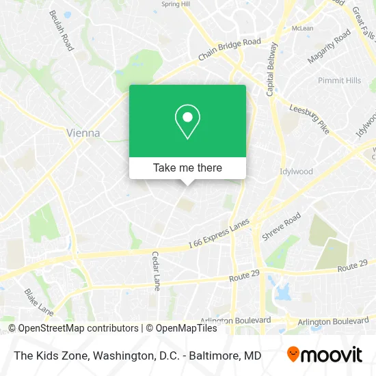
See The Kids Zone, Fairfax County, on the map
Public Transit to The Kids Zone in Fairfax County
Wondering how to get to The Kids Zone in Fairfax County? Moovit helps you find the best way to get to The Kids Zone with step-by-step directions from the nearest public transit station.
Moovit provides free maps and live directions to help you navigate through your city. View schedules, routes, timetables, and find out how long does it take to get to The Kids Zone in real time.
Looking for the nearest stop or station to The Kids Zone? Check out this list of stops closest to your destination: Cedar La @ Wedderburn Station Dr; Cedar Ln @ Desale St; Dunn Loring Merrifield Metro Station; Tysons Corner Metro.
Bus: 401, 402, 462, 467.Metro: ORANGE, SILVER.
Want to see if there’s another route that gets you there at an earlier time? Moovit helps you find alternative routes or times. Get directions from and directions to The Kids Zone easily from the Moovit App or Website.
We make riding to The Kids Zone easy, which is why over 1.7 million users, including users in Fairfax County, trust Moovit as the best app for public transit. You don’t need to download an individual bus app or train app, Moovit is your all-in-one transit app that helps you find the best bus time or train time available.
For information on prices of bus and metro, costs and ride fares to The Kids Zone, please check the Moovit app.
Use the app to navigate to popular places including to the airport, hospital, stadium, grocery store, mall, coffee shop, school, college, and university.
The Kids Zone Address: 2423 Cedar Ln street in Fairfax County
- Thoreau Middle School,
- Cedar Park,
- Cunningham Park Softball Fields,
- Navy Federal Credit Union,
- Eagle Hr, Inc.,
- Schooley Mitchell Telecom,
- Dunhill Builders,
- DUNN LORING MERRIFIELD station,
- Bare Skin Waxing – Vienna,
- Salon Lofts Dunn Loring Metro,
- Massage Heights Vienna,
- Saint Athanasius Lutheran Church,
- Vienna Spanish Seventh-Day Adventist Church,
- 2672-A Avenir Pl Parking,
- Navy Federal Credit Union,
- Metro Bus Fairfax Connector 401,
- Dunn Loring-Merrifield Station Metro Parking Garage,
- Fairfax Connector Bus 401 402,
- Queva,
- Red Bird Hot Chicken & Fries
Places Near The Kids Zone (Fairfax County)
- Westfield Montgomery Mall, Montgomery County,
- Georgetown, Washington,
- M&T Bank Stadium, Baltimore,
- Pennsylvania Ave NW (3rd st and pennsylvania), Washington,
- Rock Creek Tennis Center, Washington,
- PG Mall, Prince George's County,
- National Theatre, Washington,
- Capital One Arena, Washington,
- Washington National Cathedral, Washington,
- Sibley Memorial Hospital, Washington,
- Marriott Marquis Washington, DC, Washington,
- Warner Theatre, Washington,
- Camden Yards, Baltimore,
- Washington DC VA Medical Center, Washington,
- National Museum of African American History and Culture, Washington,
- National Zoo, Washington,
- The Anthem, Washington,
- Amazon Hq2, Arlington County,
- Museum Of The Bible, Washington,
- Basilica of the National Shrine, Washington
How to get to popular places in Washington, D.C. - Baltimore, MD with public transit
Get around Fairfax County by public transit!
Traveling around Fairfax County has never been so easy. See step by step directions as you travel to any attraction, street or major public transit station. View bus and train schedules, arrival times, service alerts and detailed routes on a map, so you know exactly how to get to anywhere in Fairfax County.
When traveling to any destination around Fairfax County use Moovit's Live Directions with Get Off Notifications to know exactly where and how far to walk, how long to wait for your line, and how many stops are left. Moovit will alert you when it's time to get off — no need to constantly re-check whether yours is the next stop.
Wondering how to use public transit in Fairfax County or how to pay for public transit in Fairfax County? Moovit public transit app can help you navigate your way with public transit easily, and at minimum cost. It includes public transit fees, ticket prices, and costs. Looking for a map of Fairfax County public transit lines? Moovit public transit app shows all public transit maps in Fairfax County with all Bus, Train, Metro, Light Rail and Ferry routes and stops on an interactive map.
Washington, D.C. - Baltimore, MD has 5 transit type(s), including: Bus, Train, Metro, Light Rail and Ferry, operated by several transit agencies, including WMATA, Montgomery County Ride On, Fairfax Connector, TheBus, PRTC, DASH - Alexandria, Arlington Transit (ART), RTA of Central Maryland, MDOT MTA, MDOT MTA Light RailLink, MDOT MTA Commuter Bus, MDOT MTA Local Bus, FXBGO!, Virginia Railway Express (VRE) and MARC