How to get to The Lab by bus?
Click on the bus route to see step by step directions with maps, line arrival times and updated time schedules.
From Washington Heights, Manhattan
66 minFrom NY Lottery Center, Manhattan
62 minFrom Baruch College, Manhattan
47 minFrom 250 Broadway - NYC Council, Manhattan
53 minFrom Broadway and 168th St, Manhattan
66 minFrom 168 St, Manhattan
66 minFrom Moxy NYC Downtown, Manhattan
56 minFrom Armory Track & Field, Manhattan
68 min
How to get to The Lab by train?
Click on the train route to see step by step directions with maps, line arrival times and updated time schedules.
How to get to The Lab by subway?
Click on the subway route to see step by step directions with maps, line arrival times and updated time schedules.
From Washington Heights, Manhattan
28 minFrom NY Lottery Center, Manhattan
29 minFrom Baruch College, Manhattan
23 minFrom 250 Broadway - NYC Council, Manhattan
21 minFrom Broadway and 168th St, Manhattan
29 minFrom 168 St, Manhattan
29 minFrom Moxy NYC Downtown, Manhattan
24 minFrom Armory Track & Field, Manhattan
31 min
Bus stops near The Lab in Manhattan
Subway stations near The Lab in Manhattan
Bus lines to The Lab in Manhattan
- M11, 133 St-Broadway,VIEW
- M34A-SBS, Select Bus Pa Bus Trm Via 34 St Via 8 Av,VIEW
- 42ND ST, E 42nd St & 3rd Ave,VIEW
- M42, East Side U N-1 Av Crosstown,VIEW
- 101, West Orange - Montclair - New York,VIEW
- 105, West Caldwell - Cedar Grove - New York,VIEW
- 107, Irvington - New York,VIEW
- 108, Newark - New York,VIEW
- 111, New York - IKEA - Jersey Gardens,VIEW
- 112, Clark - New York,VIEW
- 113, Dunellen - New York,VIEW
- 114, Bridgewater - New York,VIEW
- 115, Rahway - New York,VIEW
- 116, Perth Amboy - New York,VIEW
- 117, Somerville - New York Express,VIEW
- 119, Bayonne - Jersey City - New York,VIEW
- 121, North Bergen - New York,VIEW
- 122, Secaucus - New York,VIEW
- 123, Jersey City - Union City - New York,VIEW
- 124, Secaucus - New York,VIEW
What are the closest stations to The Lab?
The closest stations to The Lab are:
- 9 Av/W 42 St is 97 yards away, 2 min walk.
- W 42nd St & 9th Ave (Westbound) is 137 yards away, 2 min walk.
- Times Sq-42 St is 233 yards away, 3 min walk.
- Port Authority Bus Terminal is 293 yards away, 4 min walk.
- W 42nd St & 9th Ave is 330 yards away, 4 min walk.
- W 44th St & 9th Ave is 335 yards away, 4 min walk.
- 42 St-Port Authority Bus Terminal is 348 yards away, 5 min walk.
Which bus lines stop near The Lab?
These bus lines stop near The Lab: 42ND ST, M11, M20, M34A-SBS, M42.
Which train lines stop near The Lab?
These train lines stop near The Lab: 2, RONKONKOMA BRANCH, YEL.
Which subway lines stop near The Lab?
These subway lines stop near The Lab: 2, A, Q.
What’s the nearest subway station to The Lab in Manhattan?
The nearest subway station to The Lab in Manhattan is Times Sq-42 St. It’s a 3 min walk away.
What’s the nearest bus station to The Lab in Manhattan?
The nearest bus stations to The Lab in Manhattan are 9 Av/W 42 St and W 42nd St & 9th Ave (Westbound). The closest one is a 2 min walk away.
What time is the first subway to The Lab in Manhattan?
The 2 is the first subway that goes to The Lab in Manhattan. It stops nearby at 3:00 AM.
What time is the last subway to The Lab in Manhattan?
The N is the last subway that goes to The Lab in Manhattan. It stops nearby at 4:01 AM.
What time is the first bus to The Lab in Manhattan?
The M42 is the first bus that goes to The Lab in Manhattan. It stops nearby at 3:05 AM.
What time is the last bus to The Lab in Manhattan?
The 190 is the last bus that goes to The Lab in Manhattan. It stops nearby at 3:27 AM.
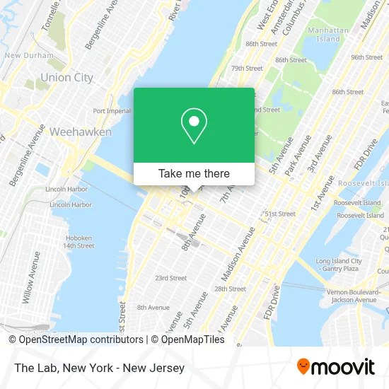
See The Lab, Manhattan, on the map
Public Transit to The Lab in Manhattan
Wondering how to get to The Lab in Manhattan? Moovit helps you find the best way to get to The Lab with step-by-step directions from the nearest public transit station.
Moovit provides free maps and live directions to help you navigate through your city. View schedules, routes, timetables, and find out how long does it take to get to The Lab in real time.
Looking for the nearest stop or station to The Lab? Check out this list of stops closest to your destination: 9 Av/W 42 St; W 42nd St & 9th Ave (Westbound); Times Sq-42 St; Port Authority Bus Terminal; W 42nd St & 9th Ave; W 44th St & 9th Ave; 42 St-Port Authority Bus Terminal.
Bus: 42ND ST, M11, M20, M34A-SBS, M42, 101, 105, 107, 108, 111, 59TH ST.Train: 2, RONKONKOMA BRANCH, YEL.Subway: 2, A, Q, N, R, S, W, C, E.
Want to see if there’s another route that gets you there at an earlier time? Moovit helps you find alternative routes or times. Get directions from and directions to The Lab easily from the Moovit App or Website.
We make riding to The Lab easy, which is why over 1.5 million users, including users in Manhattan, trust Moovit as the best app for public transit. You don’t need to download an individual bus app or train app, Moovit is your all-in-one transit app that helps you find the best bus time or train time available.
For information on prices of subway, bus and train, costs and ride fares to The Lab, please check the Moovit app.
Use the app to navigate to popular places including to the airport, hospital, stadium, grocery store, mall, coffee shop, school, college, and university.
The Lab Address: 400 W 43rd St street in Manhattan
- The Westside Theater,
- Stockwell Photography,
- Jan Horvath Vocal Studio,
- Bea Restaurant & Bar,
- Westside Theatre,
- Mushnik & Son Flower Shop,
- Morning Star News Corporation,
- Mostly Modern Projects,
- Adella Wine Bar,
- Little Shop Of Horrors (Westside Theatre),
- National Health Survey,
- manhattan plaza package room,
- Leon St Adolph S,
- Viktoria's Balance,
- Psychic Readings by Nicole,
- 414 W 44 St,
- Gotta Dance,
- Monkey Sushi & 3 Chick Sushi,
- Sticky's,
- Peter Jay Sharp Theater @ Playwrights Horizons
Places Near The Lab (Manhattan)
- 111 Centre New York City Supreme Court, Manhattan,
- 3 Stone St, Manhattan,
- qqqq, Manhattan,
- Times Square, Manhattan,
- Wall Street, Manhattan,
- SoHo, Manhattan,
- 1 Police Plaza, Manhattan,
- Mountainside Hospital, Glen Ridge,
- Katz's Deli, Manhattan,
- Rockefeller Center, Manhattan,
- Bellevue Hospital, Manhattan,
- San Gennaro Feast, Manhattan,
- Chinatown, Manhattan,
- 66 John Street, Manhattan,
- Pier 83, Manhattan,
- 911 Memorial, Manhattan,
- Hudson Yards, Manhattan,
- 26 Federal Plaza, Manhattan,
- Queens Center Mall, Queens,
- 376 Hudson Street, Manhattan
How to get to popular places in New York - New Jersey with public transit
Get around Manhattan by public transit!
Traveling around Manhattan has never been so easy. See step by step directions as you travel to any attraction, street or major public transit station. View bus and train schedules, arrival times, service alerts and detailed routes on a map, so you know exactly how to get to anywhere in Manhattan.
When traveling to any destination around Manhattan use Moovit's Live Directions with Get Off Notifications to know exactly where and how far to walk, how long to wait for your line, and how many stops are left. Moovit will alert you when it's time to get off — no need to constantly re-check whether yours is the next stop.
Wondering how to use public transit in Manhattan or how to pay for public transit in Manhattan? Moovit public transit app can help you navigate your way with public transit easily, and at minimum cost. It includes public transit fees, ticket prices, and costs. Looking for a map of Manhattan public transit lines? Moovit public transit app shows all public transit maps in Manhattan with all Bus, Train, Subway, Light Rail, Ferry and Cable Car routes and stops on an interactive map.
New York - New Jersey has 6 transit type(s), including: Bus, Train, Subway, Light Rail, Ferry and Cable Car, operated by several transit agencies, including MTA Subway, Metro-North Railroad, LIRR, PATH, MTA New York City Transit - Express routes, MTA Bus, NJ Transit, NYC Ferry, NICE bus, Bee-Line Bus, NJ Transit Rail, Norwalk Transit District, Hartford Line, River Valley Transit and HART