How to get to The Learning Center by bus?
Click on the bus route to see step by step directions with maps, line arrival times and updated time schedules.
From Broad Street, Manhattan
75 minFrom Printemps, Manhattan
77 minFrom 180 Maiden Lane, Manhattan
72 minFrom George Washington Bridge, Manhattan
54 minFrom 4 World Trade Center, Manhattan
89 minFrom Empire City Casino Yonkers, Bronx
55 minFrom Consulado Ecuatoriano en Queens, Queens
77 minFrom Pier 35, Manhattan
74 minFrom Hudson Street, Jersey City
82 min
How to get to The Learning Center by train?
Click on the train route to see step by step directions with maps, line arrival times and updated time schedules.
How to get to The Learning Center by subway?
Click on the subway route to see step by step directions with maps, line arrival times and updated time schedules.
From Broad Street, Manhattan
39 minFrom Printemps, Manhattan
39 minFrom 180 Maiden Lane, Manhattan
42 minFrom George Washington Bridge, Manhattan
29 minFrom 4 World Trade Center, Manhattan
39 minFrom Empire City Casino Yonkers, Bronx
34 minFrom Consulado Ecuatoriano en Queens, Queens
43 minFrom Pier 35, Manhattan
45 min
Bus stops near The Learning Center in Manhattan
Bus lines to The Learning Center in Manhattan
What are the closest stations to The Learning Center?
The closest stations to The Learning Center are:
- Central Park West/W 94 St is 63 yards away, 1 min walk.
- W 96 St/Central Park West is 150 yards away, 2 min walk.
- 96 St is 154 yards away, 2 min walk.
- Columbus Av/W 97 St. is 352 yards away, 5 min walk.
- 86 St is 503 yards away, 6 min walk.
Which bus lines stop near The Learning Center?
These bus lines stop near The Learning Center: M10, M104, M7, M96.
Which train lines stop near The Learning Center?
These train lines stop near The Learning Center: 1, 2, 3.
Which subway lines stop near The Learning Center?
These subway lines stop near The Learning Center: B, C.
What’s the nearest subway station to The Learning Center in Manhattan?
The nearest subway station to The Learning Center in Manhattan is 96 St. It’s a 2 min walk away.
What’s the nearest bus station to The Learning Center in Manhattan?
The nearest bus station to The Learning Center in Manhattan is Central Park West/W 94 St. It’s a 1 min walk away.
What time is the first subway to The Learning Center in Manhattan?
The 1 is the first subway that goes to The Learning Center in Manhattan. It stops nearby at 3:01 AM.
What time is the last subway to The Learning Center in Manhattan?
The A is the last subway that goes to The Learning Center in Manhattan. It stops nearby at 4:09 AM.
What time is the first bus to The Learning Center in Manhattan?
The M96 is the first bus that goes to The Learning Center in Manhattan. It stops nearby at 3:03 AM.
What time is the last bus to The Learning Center in Manhattan?
The M7 is the last bus that goes to The Learning Center in Manhattan. It stops nearby at 2:58 AM.
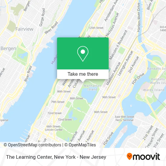
See The Learning Center, Manhattan, on the map
Public Transit to The Learning Center in Manhattan
Wondering how to get to The Learning Center in Manhattan? Moovit helps you find the best way to get to The Learning Center with step-by-step directions from the nearest public transit station.
Moovit provides free maps and live directions to help you navigate through your city. View schedules, routes, timetables, and find out how long does it take to get to The Learning Center in real time.
Looking for the nearest stop or station to The Learning Center? Check out this list of stops closest to your destination: Central Park West/W 94 St; W 96 St/Central Park West; 96 St; Columbus Av/W 97 St.; 86 St.
Bus: M10, M104, M7, M96, M106, M11.Train: 1, 2, 3.Subway: B, C, A, 1, 2, 3.
Want to see if there’s another route that gets you there at an earlier time? Moovit helps you find alternative routes or times. Get directions from and directions to The Learning Center easily from the Moovit App or Website.
We make riding to The Learning Center easy, which is why over 1.5 million users, including users in Manhattan, trust Moovit as the best app for public transit. You don’t need to download an individual bus app or train app, Moovit is your all-in-one transit app that helps you find the best bus time or train time available.
For information on prices of subway, bus and train, costs and ride fares to The Learning Center, please check the Moovit app.
Use the app to navigate to popular places including to the airport, hospital, stadium, grocery store, mall, coffee shop, school, college, and university.
The Learning Center Address: 350 Central Park W street in Manhattan
- Web Design Experts,
- Joseph A. Adler,
- Dr Fiona Graham,
- Central Park West Dental Studio,
- Blue Anchor Psychology,
- The Learning Center,
- Integrated Moment Psychotherapy, Lcsw, P.C.,
- Dr. Hagit Levinson,
- Juris Pro,
- W. 94th St Canine Congregation,
- Twyla Tharp Productions,
- Central Park Regimen Solution,
- The Turin,
- Passover Oasis,
- Playa Associates,
- Wild West Playground,
- Cgps Theatre,
- Columbia Grammar and Preparatory School,
- Billy's Hot Dog Cart,
- 93rd St and Central Park
Places Near The Learning Center (Manhattan)
- 3 Stone St, Manhattan,
- 111 Centre New York City Supreme Court, Manhattan,
- San Gennaro Feast, Manhattan,
- Katz's Deli, Manhattan,
- Wall Street, Manhattan,
- 1 Police Plaza, Manhattan,
- qqqq, Manhattan,
- Chinatown, Manhattan,
- 26 Federal Plaza, Manhattan,
- SoHo, Manhattan,
- Queens Center Mall, Queens,
- 911 Memorial, Manhattan,
- Times Square, Manhattan,
- Pier 83, Manhattan,
- Bellevue Hospital, Manhattan,
- 376 Hudson Street, Manhattan,
- Mountainside Hospital, Glen Ridge,
- 66 John Street, Manhattan,
- Rockefeller Center, Manhattan,
- Hudson Yards, Manhattan
How to get to popular places in New York - New Jersey with public transit
Get around Manhattan by public transit!
Traveling around Manhattan has never been so easy. See step by step directions as you travel to any attraction, street or major public transit station. View bus and train schedules, arrival times, service alerts and detailed routes on a map, so you know exactly how to get to anywhere in Manhattan.
When traveling to any destination around Manhattan use Moovit's Live Directions with Get Off Notifications to know exactly where and how far to walk, how long to wait for your line, and how many stops are left. Moovit will alert you when it's time to get off — no need to constantly re-check whether yours is the next stop.
Wondering how to use public transit in Manhattan or how to pay for public transit in Manhattan? Moovit public transit app can help you navigate your way with public transit easily, and at minimum cost. It includes public transit fees, ticket prices, and costs. Looking for a map of Manhattan public transit lines? Moovit public transit app shows all public transit maps in Manhattan with all Bus, Train, Subway, Light Rail, Ferry and Cable Car routes and stops on an interactive map.
New York - New Jersey has 6 transit type(s), including: Bus, Train, Subway, Light Rail, Ferry and Cable Car, operated by several transit agencies, including MTA Subway, Metro-North Railroad, LIRR, PATH, MTA New York City Transit - Express routes, MTA Bus, NJ Transit, NYC Ferry, NICE bus, Bee-Line Bus, NJ Transit Rail, Norwalk Transit District, Hartford Line, River Valley Transit and HART