How to get to The Learning Center of Key West by bus?
Click on the bus route to see step by step directions with maps, line arrival times and updated time schedules.
From Orlando Florida
259 minFrom Florida City
258 minFrom Florida Keys Outlet Center
265 minFrom Florida Keys Outlet Marketplace
265 minFrom Walmart (Walmart Florida City)
259 minFrom SW 187th Ave / SW 344th St
270 minFrom Florida City, FL
260 minFrom Hyatt Residence Club-Key West Windward Pointe
57 minFrom Fairfield Inn & Suites by Marriott Key West at the Keys Collection
33 min
Bus stops near The Learning Center of Key West
Bus lines to The Learning Center of Key West
What are the closest stations to The Learning Center of Key West?
The closest stations to The Learning Center of Key West are:
- Emma & Truman is 69 yards away, 2 min walk.
- Whitehead & Julia Street is 425 yards away, 6 min walk.
- Whitehead & Southard is 837 yards away, 11 min walk.
Which bus lines stop near The Learning Center of Key West?
These bus lines stop near The Learning Center of Key West: LKS, WFX.
What’s the nearest bus station to The Learning Center of Key West?
The nearest bus station to The Learning Center of Key West is Emma & Truman. It’s a 2 min walk away.
What time is the first bus to The Learning Center of Key West?
The LKS is the first bus that goes to The Learning Center of Key West. It stops nearby at 5:40 AM.
What time is the last bus to The Learning Center of Key West?
The DL is the last bus that goes to The Learning Center of Key West. It stops nearby at 10:29 PM.
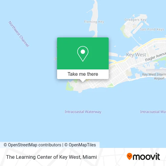
See The Learning Center of Key West on the map
Public Transportation to The Learning Center of Key West
Wondering how to get to The Learning Center of Key West? Moovit helps you find the best way to get to The Learning Center of Key West with step-by-step directions from the nearest public transit station.
Moovit provides free maps and live directions to help you navigate through your city. View schedules, routes, timetables, and find out how long does it take to get to The Learning Center of Key West in real time.
Looking for the nearest stop or station to The Learning Center of Key West? Check out this list of stops closest to your destination: Emma & Truman; Whitehead & Julia Street; Whitehead & Southard.
Bus: LKS, WFX, DL.
Want to see if there’s another route that gets you there at an earlier time? Moovit helps you find alternative routes or times. Get directions from and directions to The Learning Center of Key West easily from the Moovit App or Website.
We make riding to The Learning Center of Key West easy, which is why over 1.5 million users, including users in Key West, trust Moovit as the best app for public transit. You don’t need to download an individual bus app or train app, Moovit is your all-in-one transit app that helps you find the best bus time or train time available.
For information on prices of bus, costs and ride fares to The Learning Center of Key West, please check the Moovit app.
Use the app to navigate to popular places including to the airport, hospital, stadium, grocery store, mall, coffee shop, school, college, and university.
The Learning Center of Key West Address: 201 Truman Ave Key West, FL 33040 street in Key West
- Naval Air Station Truman Annex,
- Matthew L. Gilleran Field,
- Bethel Ame Church Parsonage,
- Ft. Zachary Taylor,
- William Weech American Legion Post 168,
- Bahama Village Music Program,
- Fort Zachary Athletic Fields,
- Olives Mediterranean Grill,
- Isabel's,
- S T S,
- Blue Heaven,
- Mangrove,
- Naval Air Station Key West Truman Annex,
- Wisteria Island,
- Cuban's Corner,
- Lemonade Stand Gallery,
- Key West Vacation Rentals by Vacasa,
- The Hemingway Home and Museum,
- The Hemingway Home and Museum (Hemingway House),
- Key West Little Pantry
Places Near The Learning Center of Key West
- Sawgrass mall ( FL ), Miami Beach,
- Hard Rock Stadium, Miami Gardens,
- Marlins Park, Miami,
- Sawgrass Mall, Miami,
- Dolphin Mall Bus, Miami,
- Zoo Miami, Miami,
- Dolphin Mall, Miami,
- Aventura Mall, Miami Beach,
- Miami Freedom Park, Miami,
- Wynwood, Miami,
- Bayside Marketplace, Miami,
- Miami VA Hospital, Miami,
- Port of Miami Cruise Terminal, Miami,
- Miami-Dade County Courthouse, Miami,
- Richard E. Gerstein Justice Building, Miami,
- Keiser University Flagship Campus, West Palm Beach,
- Brickell City Centre, Miami,
- Little Havana, Miami,
- Miami Design District, Miami,
- Aventura Mall, Miami
How to get to popular places in Miami with public transit
Get around Key West by public transit!
Traveling around Key West has never been so easy. See step by step directions as you travel to any attraction, street or major public transit station. View bus and train schedules, arrival times, service alerts and detailed routes on a map, so you know exactly how to get to anywhere in Key West.
When traveling to any destination around Key West use Moovit's Live Directions with Get Off Notifications to know exactly where and how far to walk, how long to wait for your line, and how many stops are left. Moovit will alert you when it's time to get off — no need to constantly re-check whether yours is the next stop.
Wondering how to use public transit in Key West or how to pay for public transit in Key West? Moovit public transit app can help you navigate your way with public transit easily, and at minimum cost. It includes public transit fees, ticket prices, and costs. Looking for a map of Key West public transit lines? Moovit public transit app shows all public transit maps in Key West with all Bus, Train, Light Rail and Ferry routes and stops on an interactive map.
Miami has 4 transit type(s), including: Bus, Train, Light Rail and Ferry, operated by several transit agencies, including Broward County Transit, Miami-Dade Transit, Metrorail, Palm Tran, Tri-Rail, Brightline, MARTY, City of Homestead Trolley, Key West Transit, Treasure Coast Connector, GoLine IRT, Amtrak, Greyhound-us, FlixBus-us and Aventura Express Shuttle Bus