How to get to The Learning Store - Outreach Programs by bus?
Click on the bus route to see step by step directions with maps, line arrival times and updated time schedules.
From Insight West End Medical Imaging, Edmonton
48 minFrom 520 a Rivercrest Crescent Parking, St. Albert
39 minFrom St. Albert Centre Transit Station, St. Albert
40 minFrom Local Jasper Ave, Edmonton
36 minFrom Scona High School, Edmonton
41 minFrom Nait, Edmonton
43 minFrom Earth & Atmospheric Science Building (ESB), Edmonton
49 minFrom T5J, Edmonton
27 minFrom Sun Life Place, Edmonton
26 min
Bus stops near The Learning Store - Outreach Programs in Edmonton
Light Rail stations near The Learning Store - Outreach Programs in Edmonton
Bus lines to The Learning Store - Outreach Programs in Edmonton
- 127, White Oaks Square,VIEW
- 009, Southgate - Eaux Claires,VIEW
- 052, Northgate - West Edmonton Mall,VIEW
- 054, West Edmonton Mall - West Clareview,VIEW
- 106, Dunvegan - Northgate - Belvedere,VIEW
- 109, Northgate - Castle Downs - Hudson,VIEW
- 110X, Eaux Claires - Downtown,VIEW
- 113, West Clareview - Northgate,VIEW
- 114, West Clareview - Coliseum,VIEW
- 120X, Eaux Claires - Government Centre,VIEW
- 128, Northgate - Londonderry,VIEW
- 684, Archbishop Macdonald - Ross Sheppard - Lago Lindo,VIEW
- 905, Northgate - Westmount,VIEW
- 614, 90 Street & 132 Avenue,VIEW
- 130X, Government Transit Centre,VIEW
What are the closest stations to The Learning Store - Outreach Programs?
The closest stations to The Learning Store - Outreach Programs are:
- Northgate Mall Entrance is 136 meters away, 2 min walk.
- Northgate Transit Centre is 170 meters away, 3 min walk.
- 94 Street & 135 Avenue is 453 meters away, 6 min walk.
- 97 Street & 135 Avenue is 481 meters away, 7 min walk.
- Nait-Blatchford Market Station is 1480 meters away, 19 min walk.
- Dl Macdonald Platform is 3053 meters away, 40 min walk.
Which bus lines stop near The Learning Store - Outreach Programs?
These bus lines stop near The Learning Store - Outreach Programs: 009, 052.
What’s the nearest light rail station to The Learning Store - Outreach Programs in Edmonton?
The nearest light rail station to The Learning Store - Outreach Programs in Edmonton is Nait-Blatchford Market Station. It’s a 19 min walk away.
What’s the nearest bus station to The Learning Store - Outreach Programs in Edmonton?
The nearest bus station to The Learning Store - Outreach Programs in Edmonton is Northgate Mall Entrance. It’s a 2 min walk away.
What time is the first light rail to The Learning Store - Outreach Programs in Edmonton?
The METRO is the first light rail that goes to The Learning Store - Outreach Programs in Edmonton. It stops nearby at 6:11 AM.
What time is the last light rail to The Learning Store - Outreach Programs in Edmonton?
The METRO is the last light rail that goes to The Learning Store - Outreach Programs in Edmonton. It stops nearby at 12:41 AM.
What time is the first bus to The Learning Store - Outreach Programs in Edmonton?
The 009 is the first bus that goes to The Learning Store - Outreach Programs in Edmonton. It stops nearby at 3:17 AM.
What time is the last bus to The Learning Store - Outreach Programs in Edmonton?
The 009 is the last bus that goes to The Learning Store - Outreach Programs in Edmonton. It stops nearby at 3:19 AM.
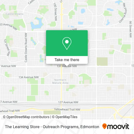
See The Learning Store - Outreach Programs, Edmonton, on the map
Public Transit to The Learning Store - Outreach Programs in Edmonton
Wondering how to get to The Learning Store - Outreach Programs in Edmonton? Moovit helps you find the best way to get to The Learning Store - Outreach Programs with step-by-step directions from the nearest public transit station.
Moovit provides free maps and live directions to help you navigate through your city. View schedules, routes, timetables, and find out how long does it take to get to The Learning Store - Outreach Programs in real time.
Looking for the nearest stop or station to The Learning Store - Outreach Programs? Check out this list of stops closest to your destination: Northgate Mall Entrance; Northgate Transit Centre; 94 Street & 135 Avenue; 97 Street & 135 Avenue; Nait-Blatchford Market Station; Dl Macdonald Platform.
Bus: 009, 052, 127, 054, 106, 109, 614, 130X.
Want to see if there’s another route that gets you there at an earlier time? Moovit helps you find alternative routes or times. Get directions from and directions to The Learning Store - Outreach Programs easily from the Moovit App or Website.
We make riding to The Learning Store - Outreach Programs easy, which is why over 1.5 million users, including users in Edmonton, trust Moovit as the best app for public transit. You don’t need to download an individual bus app or train app, Moovit is your all-in-one transit app that helps you find the best bus time or train time available.
For information on prices of bus and light rail, costs and ride fares to The Learning Store - Outreach Programs, please check the Moovit app.
Use the app to navigate to popular places including to the airport, hospital, stadium, grocery store, mall, coffee shop, school, college, and university.
The Learning Store - Outreach Programs Address: 9499 137 Ave NW Edmonton, AB T5E street in Edmonton
- Spa Lady,
- Mcdonald's,
- Shirley S Gee Professional,
- Xing Fu Tang,
- Hearcanada,
- North Town Centre Dent,
- Spirit Halloween,
- North Town Mall,
- Shell,
- Regal Nails,
- Boardomshop,
- Q Mobile,
- INDIGO,
- Bieniak Arcuri Karonlina,
- Northern Lung Function,
- Horizon Denture Center & Implant Solutions,
- Unnamed,
- Sunrise Records,
- BMO Bank of Montreal,
- Service Canada
Places Near The Learning Store - Outreach Programs (Edmonton)
- Edmonton VIA Rail Station, Edmonton,
- Borden Park, Edmonton,
- Alberta Legislature Building, Edmonton,
- Fort Edmonton Park, Edmonton,
- Kingsway Mall, Edmonton,
- Kaye Edmonton Clinic, Edmonton,
- Grey Nuns Community Hospital, Edmonton,
- MacEwan University, Edmonton,
- Royal Alexandra Hospital, Edmonton,
- Canada Place Service Canada Centre, Edmonton,
- West Edmonton Mall, Edmonton,
- Edmonton Valley Zoo, Edmonton,
- Rogers Place, Edmonton,
- Edmonton Commonwealth Stadium, Edmonton,
- Londonderry Mall, Edmonton,
- Whyte Avenue, Edmonton,
- University of Alberta, Edmonton,
- Edmonton EXPO Centre, Edmonton,
- Northgate Centre, Edmonton,
- Cross Cancer Institute, Edmonton
How to get to popular places in Edmonton with public transit
Get around Edmonton by public transit!
Traveling around Edmonton has never been so easy. See step by step directions as you travel to any attraction, street or major public transit station. View bus and train schedules, arrival times, service alerts and detailed routes on a map, so you know exactly how to get to anywhere in Edmonton.
When traveling to any destination around Edmonton use Moovit's Live Directions with Get Off Notifications to know exactly where and how far to walk, how long to wait for your line, and how many stops are left. Moovit will alert you when it's time to get off — no need to constantly re-check whether yours is the next stop.
Wondering how to use public transit in Edmonton or how to pay for public transit in Edmonton? Moovit public transit app can help you navigate your way with public transit easily, and at minimum cost. It includes public transit fees, ticket prices, and costs. Looking for a map of Edmonton public transit lines? Moovit public transit app shows all public transit maps in Edmonton with all Bus and Light Rail routes and stops on an interactive map.
Edmonton has 2 transit type(s), including: Bus and Light Rail, operated by several transit agencies, including ETS LRT, ETS, Strathcona County Transit, St. Albert Transit, Spruce Grove Transit, Fort Saskatchewan Transit, Beaumont Transit and Leduc Transit