Directions to The Learning Tree Childcare Center (Vermont) with public transportation
The following transit lines have routes that pass near The Learning Tree Childcare Center
 Bus: 116.
How to get to The Learning Tree Childcare Center by bus?
Click on the bus route to see step by step directions with maps, line arrival times and updated time schedules.
Bus stop near The Learning Tree Childcare Center in Vermont
- Jolley Short Stop, 8 min walk,VIEW
Bus lines to The Learning Tree Childcare Center in Vermont
- 116, St. Albans Industrial Park (Peerless),VIEW
What are the closest stations to The Learning Tree Childcare Center?
The closest stations to The Learning Tree Childcare Center are:
- Jolley Short Stop is 596 yards away, 8 min walk.
Which bus line stops near The Learning Tree Childcare Center?
116 (Wetherby'S/Mac's Richford→St. Albans Industrial Park (Peerless))
What’s the nearest bus station to The Learning Tree Childcare Center in Vermont?
The nearest bus station to The Learning Tree Childcare Center in Vermont is Jolley Short Stop. It’s a 8 min walk away.
What time is the first bus to The Learning Tree Childcare Center in Vermont?
The 116 is the first bus that goes to The Learning Tree Childcare Center in Vermont. It stops nearby at 5:40 AM.
What time is the last bus to The Learning Tree Childcare Center in Vermont?
The 116 is the last bus that goes to The Learning Tree Childcare Center in Vermont. It stops nearby at 4:57 PM.
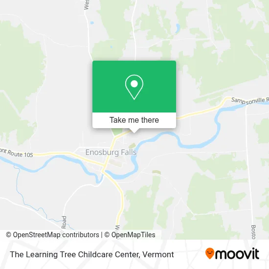
See The Learning Tree Childcare Center, Vermont, on the map
Public Transit to The Learning Tree Childcare Center in Vermont
Wondering how to get to The Learning Tree Childcare Center in Vermont? Moovit helps you find the best way to get to The Learning Tree Childcare Center with step-by-step directions from the nearest public transit station.
Moovit provides free maps and live directions to help you navigate through your city. View schedules, routes, timetables, and find out how long does it take to get to The Learning Tree Childcare Center in real time.
Looking for the nearest stop or station to The Learning Tree Childcare Center? Check out this list of stops closest to your destination: Jolley Short Stop.
Bus: 116.
Want to see if there’s another route that gets you there at an earlier time? Moovit helps you find alternative routes or times. Get directions from and directions to The Learning Tree Childcare Center easily from the Moovit App or Website.
We make riding to The Learning Tree Childcare Center easy, which is why over 1.5 million users, including users in Vermont, trust Moovit as the best app for public transit. You don’t need to download an individual bus app or train app, Moovit is your all-in-one transit app that helps you find the best bus time or train time available.
For information on prices of bus, costs and ride fares to The Learning Tree Childcare Center, please check the Moovit app.
Use the app to navigate to popular places including to the airport, hospital, stadium, grocery store, mall, coffee shop, school, college, and university.
The Learning Tree Childcare Center Address: 59 Jay View Dr street in Vermont
- Hannaford,
- R&R Construction,
- St John's Parish Council,
- Big al's Roofing,
- Address Keepers smart Technologies,
- Blue Rhino,
- Kathy's Tavern,
- K&J Trucking,
- Blouin Bros Oil,
- Enosburg Falls, VT,
- Franklin Northeast Supervisory,
- Flagstar Bank Atm,
- Garcias Bistro,
- Bible Central of Enosburg,
- Mad Ox Designs,
- Flower To Flour Bakery LLC,
- Abundant Life Fellowship of Northern Vermont,
- Enosburg Inn & Suites,
- Noodoe EV,
- Country Charm Furniture Gallery
Places Near The Learning Tree Childcare Center (Vermont)
- Xxxxxxxxxxxxx, Chittenden,
- Waterbury, VT,
- Castleton, VT, Rutland,
- Sugarbush Resort,
- Derby Line Stanstead Border Crossing,
- University of Vermont Medical Center - Fanny Allen Campus, Chittenden,
- Champlain Valley Exposition, Chittenden,
- Ecco,
- Rutland, VT, Rutland,
- MVU,
- Barre, VT,
- WXXX, Chittenden,
- Missisquoi River Basin Association,
- GLOBALFOUNDRIES, Chittenden,
- Castleton University, Rutland,
- Richford Auto,
- Springfield, VT, Windsor,
- Dartmouth-Hitchcock Medical Center, Clinical Systems, Grafton,
- Hannaford, Rutland,
- Spring Step
How to get to popular places in Vermont with public transit
Get around Vermont by public transit!
Traveling around Vermont has never been so easy. See step by step directions as you travel to any attraction, street or major public transit station. View bus and train schedules, arrival times, service alerts and detailed routes on a map, so you know exactly how to get to anywhere in Vermont.
When traveling to any destination around Vermont use Moovit's Live Directions with Get Off Notifications to know exactly where and how far to walk, how long to wait for your line, and how many stops are left. Moovit will alert you when it's time to get off — no need to constantly re-check whether yours is the next stop.
Wondering how to use public transit in Vermont or how to pay for public transit in Vermont? Moovit public transit app can help you navigate your way with public transit easily, and at minimum cost. It includes public transit fees, ticket prices, and costs. Looking for a map of Vermont public transit lines? Moovit public transit app shows all public transit maps in Vermont with all Bus, Train and Ferry routes and stops on an interactive map.
Vermont has 3 transit type(s), including: Bus, Train and Ferry, operated by several transit agencies, including Green Mountain Transit, Wilmington MOOver, Advance Transit, Vermont Translines, Rockingham MOOver, The Bus (Marble Valley Regional Transit District), Green Mountain Express, Rural Community Transportation, Addison County Transit Resources, Stagecoach Transportation Services, Amtrak, Greyhound-us, Dartmouth Campus Connector and Lake Champlain Ferries