Directions to The Library (Manhattan) with public transportation
The following transit lines have routes that pass near The Library
 Bus: M1, M20, X27, SHORTLINE HUDSON, SHORTLINE HUDSON.
- Train: BLU, PORT WASHINGTON BRANCH, YEL.
- Subway: 1, C, E, 2, A.
How to get to The Library by bus?
Click on the bus route to see step by step directions with maps, line arrival times and updated time schedules.
From Naumburg Bandshell, Manhattan
49 minFrom Randall's Island, Manhattan
96 minFrom Riverside Church, Manhattan
73 minFrom Costco, Manhattan
84 minFrom 125 Worth Street, Manhattan
63 minFrom Amc Loews Lincoln Square 13, Manhattan
45 minFrom Frick Collection, Manhattan
44 minFrom 23rd Street & 6th Ave., Manhattan
76 minFrom Queens Center Mall, Queens
76 min
How to get to The Library by train?
Click on the train route to see step by step directions with maps, line arrival times and updated time schedules.
How to get to The Library by subway?
Click on the subway route to see step by step directions with maps, line arrival times and updated time schedules.
From Naumburg Bandshell, Manhattan
29 minFrom Randall's Island, Manhattan
66 minFrom Riverside Church, Manhattan
39 minFrom Costco, Manhattan
58 minFrom 125 Worth Street, Manhattan
25 minFrom Amc Loews Lincoln Square 13, Manhattan
26 minFrom Frick Collection, Manhattan
39 minFrom 23rd Street & 6th Ave., Manhattan
47 minFrom Queens Center Mall, Queens
44 min
Bus stops near The Library in Manhattan
Subway stations near The Library in Manhattan
Bus lines to The Library in Manhattan
- SHORTLINE HUDSON, Nanuet,VIEW
- SHORTLINE HUDSON, Circleville,VIEW
- M21, Soho Washington St Crosstown,VIEW
- M55, 44 St 6 Av,VIEW
- M20, Lincoln Center 66 St Via 8 Av,VIEW
- X27, Bay Ridge - Manhattan Express,VIEW
- X28, Sea Gate / Bensonhurst - Manhattan Express,VIEW
- SIM7, Greenwich Village Via West St Via 6 Av,VIEW
- SIM9, Greenwich Vill Via West St Via 6 Av,VIEW
- SIM1C, Eltingville - Manhattan Express,VIEW
- SIM3C, Pt. Richmond - Manhattan Express,VIEW
- SIM4C, Huguenot - Manhattan Express,VIEW
- SIM33, Mariners Harbor - Manhattan Express,VIEW
- SIM33C, Mariners Harbor - Greenwich Village Express,VIEW
What are the closest stations to The Library?
The closest stations to The Library are:
- 6th Ave & Spring St is 147 yards away, 2 min walk.
- Spring St/Hudson St is 157 yards away, 2 min walk.
- 6 Av/Spring St is 171 yards away, 3 min walk.
- Varick St/Charlton St is 187 yards away, 3 min walk.
- Spring St/Greenwich St is 302 yards away, 4 min walk.
- Canal St is 360 yards away, 5 min walk.
- 6 Av/Prince St is 495 yards away, 6 min walk.
- Spring St is 589 yards away, 8 min walk.
- Prince St is 708 yards away, 9 min walk.
Which bus lines stop near The Library?
These bus lines stop near The Library: M1, M20, X27.
Which train lines stop near The Library?
These train lines stop near The Library: BLU, PORT WASHINGTON BRANCH, YEL.
Which subway lines stop near The Library?
These subway lines stop near The Library: 1, C, E.
What’s the nearest subway station to The Library in Manhattan?
The nearest subway station to The Library in Manhattan is Canal St. It’s a 5 min walk away.
What’s the nearest bus station to The Library in Manhattan?
The nearest bus stations to The Library in Manhattan are 6th Ave & Spring St and Spring St/Hudson St. The closest one is a 2 min walk away.
What time is the first subway to The Library in Manhattan?
The N is the first subway that goes to The Library in Manhattan. It stops nearby at 3:00 AM.
What time is the last subway to The Library in Manhattan?
The 2 is the last subway that goes to The Library in Manhattan. It stops nearby at 4:05 AM.
What time is the first bus to The Library in Manhattan?
The SIM1C is the first bus that goes to The Library in Manhattan. It stops nearby at 3:53 AM.
What time is the last bus to The Library in Manhattan?
The SIM1C is the last bus that goes to The Library in Manhattan. It stops nearby at 2:53 AM.
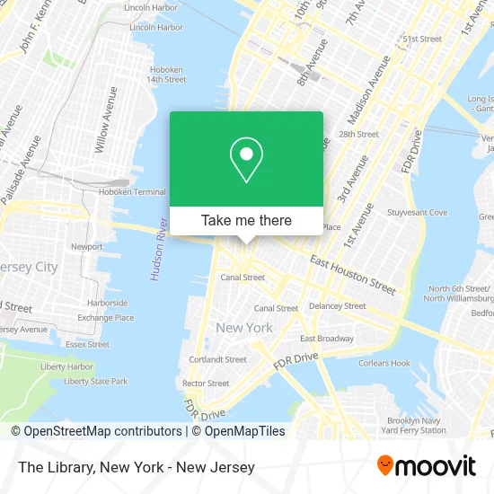
See The Library, Manhattan, on the map
Public Transit to The Library in Manhattan
Wondering how to get to The Library in Manhattan? Moovit helps you find the best way to get to The Library with step-by-step directions from the nearest public transit station.
Moovit provides free maps and live directions to help you navigate through your city. View schedules, routes, timetables, and find out how long does it take to get to The Library in real time.
Looking for the nearest stop or station to The Library? Check out this list of stops closest to your destination: 6th Ave & Spring St; Spring St/Hudson St; 6 Av/Spring St; Varick St/Charlton St; Spring St/Greenwich St; Canal St; 6 Av/Prince St; Spring St; Prince St.
Bus: M1, M20, X27, SHORTLINE HUDSON, SHORTLINE HUDSON, M21, M55.Train: BLU, PORT WASHINGTON BRANCH, YEL.Subway: 1, C, E, 2, A, N, Q, R, W.
Want to see if there’s another route that gets you there at an earlier time? Moovit helps you find alternative routes or times. Get directions from and directions to The Library easily from the Moovit App or Website.
We make riding to The Library easy, which is why over 1.5 million users, including users in Manhattan, trust Moovit as the best app for public transit. You don’t need to download an individual bus app or train app, Moovit is your all-in-one transit app that helps you find the best bus time or train time available.
For information on prices of subway, bus and train, costs and ride fares to The Library, please check the Moovit app.
Use the app to navigate to popular places including to the airport, hospital, stadium, grocery store, mall, coffee shop, school, college, and university.
The Library Address: 246 Spring St street in Manhattan
- Spring & Varick,
- The Dominick Hotel New York,
- Dominick (The Dominick),
- The Dominick,
- Starbucks,
- Color Factory,
- Prudence C - New York,
- Geminii Cleaning Services,
- Kidigital,
- Consulate Film Editing Co,
- Trader Joe's,
- Vandam St And Varick,
- Notary Public,
- Aveda Institute New York,
- Stalle Studios,
- Ives Acupuncture,
- Bernar Venet Studio,
- Moving Pictures,
- Me&Friends,
- Grainger Industrial Supply
Places Near The Library (Manhattan)
- Wall Street, Manhattan,
- Queens Center Mall, Queens,
- 911 Memorial, Manhattan,
- SoHo, Manhattan,
- Times Square, Manhattan,
- 26 Federal Plaza, Manhattan,
- Katz's Deli, Manhattan,
- qqqq, Manhattan,
- 376 Hudson Street, Manhattan,
- Mountainside Hospital, Glen Ridge,
- 111 Centre New York City Supreme Court, Manhattan,
- San Gennaro Feast, Manhattan,
- Pier 83, Manhattan,
- 66 John Street, Manhattan,
- 3 Stone St, Manhattan,
- Chinatown, Manhattan,
- Hudson Yards, Manhattan,
- 1 Police Plaza, Manhattan,
- Rockefeller Center, Manhattan,
- Bellevue Hospital, Manhattan
How to get to popular places in New York - New Jersey with public transit
Get around Manhattan by public transit!
Traveling around Manhattan has never been so easy. See step by step directions as you travel to any attraction, street or major public transit station. View bus and train schedules, arrival times, service alerts and detailed routes on a map, so you know exactly how to get to anywhere in Manhattan.
When traveling to any destination around Manhattan use Moovit's Live Directions with Get Off Notifications to know exactly where and how far to walk, how long to wait for your line, and how many stops are left. Moovit will alert you when it's time to get off — no need to constantly re-check whether yours is the next stop.
Wondering how to use public transit in Manhattan or how to pay for public transit in Manhattan? Moovit public transit app can help you navigate your way with public transit easily, and at minimum cost. It includes public transit fees, ticket prices, and costs. Looking for a map of Manhattan public transit lines? Moovit public transit app shows all public transit maps in Manhattan with all Bus, Train, Subway, Light Rail, Ferry and Cable Car routes and stops on an interactive map.
New York - New Jersey has 6 transit type(s), including: Bus, Train, Subway, Light Rail, Ferry and Cable Car, operated by several transit agencies, including MTA Subway, Metro-North Railroad, LIRR, PATH, MTA New York City Transit - Express routes, MTA Bus, NJ Transit, NYC Ferry, NICE bus, Bee-Line Bus, NJ Transit Rail, Norwalk Transit District, Hartford Line, River Valley Transit and HART