How to get to The Long Fetch by bus?
Click on the bus route to see step by step directions with maps, line arrival times and updated time schedules.
From Central Park SummerStage, Manhattan
45 minFrom Upper West Side, Manhattan
56 minFrom Maspeth, NY, Queens
71 minFrom East 90th Street Ferry Terminal, Manhattan
78 minFrom 290, Manhattan
69 minFrom Weill Cornell Greenberg Center 1305 York Avenue, Manhattan
58 minFrom Gracie Mansion, Manhattan
75 minFrom Warwick Hotel, Manhattan
41 minFrom E 89th St, Manhattan
78 minFrom Secaucus, NJ, Secaucus
78 min
How to get to The Long Fetch by train?
Click on the train route to see step by step directions with maps, line arrival times and updated time schedules.
How to get to The Long Fetch by subway?
Click on the subway route to see step by step directions with maps, line arrival times and updated time schedules.
From Central Park SummerStage, Manhattan
44 minFrom Upper West Side, Manhattan
35 minFrom East 90th Street Ferry Terminal, Manhattan
52 minFrom 290, Manhattan
37 minFrom Weill Cornell Greenberg Center 1305 York Avenue, Manhattan
42 minFrom Gracie Mansion, Manhattan
50 minFrom Warwick Hotel, Manhattan
34 minFrom E 89th St, Manhattan
37 min
Bus stops near The Long Fetch in Manhattan
Subway stations near The Long Fetch in Manhattan
Ferry stations near The Long Fetch in Manhattan
Bus lines to The Long Fetch in Manhattan
- QM7, Fresh Meadows - Downtown Express,VIEW
- QM8, Glen Oaks - Downtown Express,VIEW
- QM11, Forest Hills - Downtown Express,VIEW
- QM25, Glendale - Downtown Express,VIEW
- QM65, Laurelton,VIEW
- DOWNTOWN CONNECTION, Chambers Street,VIEW
- M15, East Harlem 125 St Via 1 Av,VIEW
- BM1, Mill Basin - Downtown/Midtown,VIEW
- BM2, Canarsie/Spring Creek - Downtown/Midtown,VIEW
- BM3, Sheepshead Bay - Downtown/Midtown,VIEW
- BM4, Gerritsen Beach - Downtown/Midtown,VIEW
- SIM5, Eltingville - Lower Manhattan Express,VIEW
- SIM35, Port Richmond - Lower Manhattan Express,VIEW
- M20, Lincoln Center 66 St Via 8 Av,VIEW
- M55, South Ferry,VIEW
- M15-SBS, Select Bus Service 125 St Via 1 Av,VIEW
What are the closest stations to The Long Fetch?
The closest stations to The Long Fetch are:
- Water St/Broad St is 109 yards away, 2 min walk.
- Water St & Broad St is 131 yards away, 2 min walk.
- South St/Whitehall St is 141 yards away, 2 min walk.
- Whitehall St-South Ferry is 142 yards away, 2 min walk.
- Water St / Coenties Slip East is 166 yards away, 3 min walk.
- State St/Whitehall St is 236 yards away, 3 min walk.
- Bowling Green is 246 yards away, 4 min walk.
- South Ferry Term/South Ferry Term is 326 yards away, 4 min walk.
- Whitehall Ferry Terminal is 408 yards away, 6 min walk.
- Battery Maritime Building Slip 5 is 491 yards away, 7 min walk.
- Wall St/Pier 11 is 495 yards away, 7 min walk.
Which bus lines stop near The Long Fetch?
These bus lines stop near The Long Fetch: BXM18, M15, M15-SBS, M20, QM25.
Which train line stops near The Long Fetch?
GRE (Hoboken - World Trade Center)
Which subway lines stop near The Long Fetch?
These subway lines stop near The Long Fetch: 1, 4, R.
Which ferry line stops near The Long Fetch?
RS (Rockaway)
What’s the nearest subway station to The Long Fetch in Manhattan?
The nearest subway station to The Long Fetch in Manhattan is Whitehall St-South Ferry. It’s a 2 min walk away.
What’s the nearest bus station to The Long Fetch in Manhattan?
The nearest bus stations to The Long Fetch in Manhattan are Water St/Broad St, Water St & Broad St and South St/Whitehall St. The closest one is a 2 min walk away.
What’s the nearest ferry station to The Long Fetch in Manhattan?
The nearest ferry station to The Long Fetch in Manhattan is Whitehall Ferry Terminal. It’s a 6 min walk away.
What time is the first subway to The Long Fetch in Manhattan?
The 1 is the first subway that goes to The Long Fetch in Manhattan. It stops nearby at 3:02 AM.
What time is the last subway to The Long Fetch in Manhattan?
The 4 is the last subway that goes to The Long Fetch in Manhattan. It stops nearby at 3:57 AM.
What time is the first bus to The Long Fetch in Manhattan?
The M15 is the first bus that goes to The Long Fetch in Manhattan. It stops nearby at 3:00 AM.
What time is the last bus to The Long Fetch in Manhattan?
The M15 is the last bus that goes to The Long Fetch in Manhattan. It stops nearby at 3:16 AM.
What time is the first ferry to The Long Fetch in Manhattan?
The STATEN ISLAND FERRY is the first ferry that goes to The Long Fetch in Manhattan. It stops nearby at 3:00 AM.
What time is the last ferry to The Long Fetch in Manhattan?
The STATEN ISLAND FERRY is the last ferry that goes to The Long Fetch in Manhattan. It stops nearby at 2:55 AM.
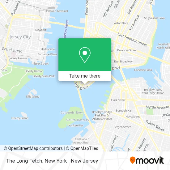
See The Long Fetch, Manhattan, on the map
Public Transit to The Long Fetch in Manhattan
Wondering how to get to The Long Fetch in Manhattan? Moovit helps you find the best way to get to The Long Fetch with step-by-step directions from the nearest public transit station.
Moovit provides free maps and live directions to help you navigate through your city. View schedules, routes, timetables, and find out how long does it take to get to The Long Fetch in real time.
Looking for the nearest stop or station to The Long Fetch? Check out this list of stops closest to your destination: Water St/Broad St; Water St & Broad St; South St/Whitehall St; Whitehall St-South Ferry; Water St / Coenties Slip East; State St/Whitehall St; Bowling Green; South Ferry Term/South Ferry Term; Whitehall Ferry Terminal; Battery Maritime Building Slip 5; Wall St/Pier 11.
Bus: BXM18, M15, M15-SBS, M20, QM25, QM7, QM8, QM11, QM65, DOWNTOWN CONNECTION.Train: GRE.Subway: 1, 4, R, N, W, 5.Ferry: RS, STATEN ISLAND FERRY.
Want to see if there’s another route that gets you there at an earlier time? Moovit helps you find alternative routes or times. Get directions from and directions to The Long Fetch easily from the Moovit App or Website.
We make riding to The Long Fetch easy, which is why over 1.5 million users, including users in Manhattan, trust Moovit as the best app for public transit. You don’t need to download an individual bus app or train app, Moovit is your all-in-one transit app that helps you find the best bus time or train time available.
For information on prices of subway, bus, ferry and train, costs and ride fares to The Long Fetch, please check the Moovit app.
Use the app to navigate to popular places including to the airport, hospital, stadium, grocery store, mall, coffee shop, school, college, and university.
The Long Fetch Address: 1 New York Plz street in Manhattan
- Mercedes Benz,
- Sport,
- Inday,
- 1nyp Coffee Bar,
- STARBUCKS,
- Café 1nyp,
- Loacker,
- Teazerttea,
- Mound Cotton Wollan & Greengrass,
- MTA - Bus M15 (Water St & Broad St),
- Crypto Restore,
- 125 Broad Street,
- American Media Inc,
- New York Tower,
- Siegel Charles J Law Office,
- Honorary Consulate Of the Republic Of Moldova In New York,
- SunTrust Bank,
- 125 Broad St,
- 1 New York Plaza,
- Bian Dang
Places Near The Long Fetch (Manhattan)
- 376 Hudson Street, Manhattan,
- Bellevue Hospital, Manhattan,
- 1 Police Plaza, Manhattan,
- 66 John Street, Manhattan,
- qqqq, Manhattan,
- Pier 83, Manhattan,
- Queens Center Mall, Queens,
- San Gennaro Feast, Manhattan,
- Chinatown, Manhattan,
- Times Square, Manhattan,
- Mountainside Hospital, Glen Ridge,
- 111 Centre New York City Supreme Court, Manhattan,
- Rockefeller Center, Manhattan,
- Wall Street, Manhattan,
- Katz's Deli, Manhattan,
- 3 Stone St, Manhattan,
- Hudson Yards, Manhattan,
- 26 Federal Plaza, Manhattan,
- SoHo, Manhattan,
- 911 Memorial, Manhattan
How to get to popular places in New York - New Jersey with public transit
Get around Manhattan by public transit!
Traveling around Manhattan has never been so easy. See step by step directions as you travel to any attraction, street or major public transit station. View bus and train schedules, arrival times, service alerts and detailed routes on a map, so you know exactly how to get to anywhere in Manhattan.
When traveling to any destination around Manhattan use Moovit's Live Directions with Get Off Notifications to know exactly where and how far to walk, how long to wait for your line, and how many stops are left. Moovit will alert you when it's time to get off — no need to constantly re-check whether yours is the next stop.
Wondering how to use public transit in Manhattan or how to pay for public transit in Manhattan? Moovit public transit app can help you navigate your way with public transit easily, and at minimum cost. It includes public transit fees, ticket prices, and costs. Looking for a map of Manhattan public transit lines? Moovit public transit app shows all public transit maps in Manhattan with all Bus, Train, Subway, Light Rail, Ferry and Cable Car routes and stops on an interactive map.
New York - New Jersey has 6 transit type(s), including: Bus, Train, Subway, Light Rail, Ferry and Cable Car, operated by several transit agencies, including MTA Subway, Metro-North Railroad, LIRR, PATH, MTA New York City Transit - Express routes, MTA Bus, NJ Transit, NYC Ferry, NICE bus, Bee-Line Bus, NJ Transit Rail, Norwalk Transit District, Hartford Line, River Valley Transit and HART