Directions to The Multimedia Factory (Baltimore) with public transportation
The following transit lines have routes that pass near The Multimedia Factory
 Bus: 40, 71, 94, CITYLINK NAVY, CITYLINK SILVER.
- Train: MARC.
- Metro: METRO.
- Light Rail: LIGHT RAILLINK.
- Ferry: HC3.
How to get to The Multimedia Factory by bus?
Click on the bus route to see step by step directions with maps, line arrival times and updated time schedules.
From Hampden, Baltimore
30 minFrom Eastern Ave (eastern avenue and dundalk av), Baltimore
41 minFrom Glen Burnie, MD, Anne Arundel County
45 minFrom Mva, Baltimore
65 minFrom Reisterstown Road Plaza, Baltimore
64 minFrom MVA Glen Burnie, Anne Arundel County
30 minFrom Johns Hopkins Bayview Medical Center, Baltimore
31 minFrom I-695 @ Exit 17 (Security Blvd/MD 122), Baltimore County
45 minFrom NSA Friendship Annex (FANX), Anne Arundel County
67 minFrom Walmart, Baltimore County
60 min
How to get to The Multimedia Factory by metro?
Click on the metro route to see step by step directions with maps, line arrival times and updated time schedules.
Bus stops near The Multimedia Factory in Baltimore
Train station near The Multimedia Factory in Baltimore
- Camden Station Marc, 12 min walk,VIEW
Light Rail stations near The Multimedia Factory in Baltimore
- Convention Center, 12 min walk,VIEW
Ferry station near The Multimedia Factory in Baltimore
- Federal Hill, 17 min walk,VIEW
Bus lines to The Multimedia Factory in Baltimore
What are the closest stations to The Multimedia Factory?
The closest stations to The Multimedia Factory are:
- Light St & Lee St FS Sb is 117 yards away, 2 min walk.
- Light St & Lee St is 117 yards away, 2 min walk.
- Charles St & Lee St is 128 yards away, 2 min walk.
- Baltimore Visitor Center (Nb) is 238 yards away, 3 min walk.
- Camden Station Marc is 953 yards away, 12 min walk.
- Convention Center is 994 yards away, 12 min walk.
- Federal Hill is 1430 yards away, 17 min walk.
Which bus lines stop near The Multimedia Factory?
These bus lines stop near The Multimedia Factory: 40, 71, 94, CITYLINK NAVY, CITYLINK SILVER.
Which metro line stops near The Multimedia Factory?
METRO (Towards John Hopkins)
Which light rail line stops near The Multimedia Factory?
LIGHT RAILLINK (Northbound)
What’s the nearest light rail station to The Multimedia Factory in Baltimore?
The nearest light rail station to The Multimedia Factory in Baltimore is Convention Center. It’s a 12 min walk away.
What’s the nearest train station to The Multimedia Factory in Baltimore?
The nearest train station to The Multimedia Factory in Baltimore is Camden Station Marc. It’s a 12 min walk away.
What’s the nearest bus station to The Multimedia Factory in Baltimore?
The nearest bus stations to The Multimedia Factory in Baltimore are Light St & Lee St FS Sb, Light St & Lee St and Charles St & Lee St. The closest one is a 2 min walk away.
What’s the nearest ferry station to The Multimedia Factory in Baltimore?
The nearest ferry station to The Multimedia Factory in Baltimore is Federal Hill. It’s a 17 min walk away.
What time is the first light rail to The Multimedia Factory in Baltimore?
The LIGHT RAILLINK is the first light rail that goes to The Multimedia Factory in Baltimore. It stops nearby at 4:01 AM.
What time is the last light rail to The Multimedia Factory in Baltimore?
The LIGHT RAILLINK is the last light rail that goes to The Multimedia Factory in Baltimore. It stops nearby at 1:15 AM.
What time is the first train to The Multimedia Factory in Baltimore?
The MARC is the first train that goes to The Multimedia Factory in Baltimore. It stops nearby at 5:00 AM.
What time is the last train to The Multimedia Factory in Baltimore?
The MARC is the last train that goes to The Multimedia Factory in Baltimore. It stops nearby at 8:55 PM.
What time is the first bus to The Multimedia Factory in Baltimore?
The 94 is the first bus that goes to The Multimedia Factory in Baltimore. It stops nearby at 4:04 AM.
What time is the last bus to The Multimedia Factory in Baltimore?
The CITYLINK SILVER is the last bus that goes to The Multimedia Factory in Baltimore. It stops nearby at 3:24 AM.
What time is the first ferry to The Multimedia Factory in Baltimore?
The HC3 is the first ferry that goes to The Multimedia Factory in Baltimore. It stops nearby at 6:00 AM.
What time is the last ferry to The Multimedia Factory in Baltimore?
The HC3 is the last ferry that goes to The Multimedia Factory in Baltimore. It stops nearby at 8:00 PM.
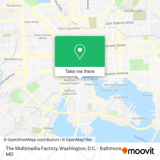
See The Multimedia Factory, Baltimore, on the map
Public Transit to The Multimedia Factory in Baltimore
Wondering how to get to The Multimedia Factory in Baltimore? Moovit helps you find the best way to get to The Multimedia Factory with step-by-step directions from the nearest public transit station.
Moovit provides free maps and live directions to help you navigate through your city. View schedules, routes, timetables, and find out how long does it take to get to The Multimedia Factory in real time.
Looking for the nearest stop or station to The Multimedia Factory? Check out this list of stops closest to your destination: Light St & Lee St FS Sb; Light St & Lee St; Charles St & Lee St; Baltimore Visitor Center (Nb); Camden Station Marc; Convention Center; Federal Hill.
Bus: 40, 71, 94, CITYLINK NAVY, CITYLINK SILVER, 67, BANNER ROUTE, CHERRY ROUTE, PURPLE ROUTE.Train: MARC.Metro: METRO.Light Rail: LIGHT RAILLINK.Ferry: HC3.
Want to see if there’s another route that gets you there at an earlier time? Moovit helps you find alternative routes or times. Get directions from and directions to The Multimedia Factory easily from the Moovit App or Website.
We make riding to The Multimedia Factory easy, which is why over 1.5 million users, including users in Baltimore, trust Moovit as the best app for public transit. You don’t need to download an individual bus app or train app, Moovit is your all-in-one transit app that helps you find the best bus time or train time available.
For information on prices of bus, metro and light rail, costs and ride fares to The Multimedia Factory, please check the Moovit app.
Use the app to navigate to popular places including to the airport, hospital, stadium, grocery store, mall, coffee shop, school, college, and university.
The Multimedia Factory Address: 26 E Lee St Baltimore, MD 21202 street in Baltimore
- Bright and Beautiful Carpet Cleaning Carpet Cleani,
- The Royal Sonesta-the Royal Sonesta Harbor Court Baltimore,
- Nursing Home Solutions,
- Amazing Client Reviews,
- Expresso Etc,
- Royal Sonesta Harbor Court Baltimore,
- SONESTA Hotel (Royal Sonesta),
- Ceo Club of Baltimore,
- Insightful Life Therapeutic Services,
- Gerner Financial Services LLC,
- Federal Hill Cleaners,
- Braden,
- City Cruises Baltimore,
- Charles Light Garage,
- Charles Barre St,
- Inner Harbor MTV,
- Feastival,
- Harbor Liquors,
- Strategies Inc Aba,
- Interim Homes
Places Near The Multimedia Factory (Baltimore)
- Museum Of The Bible, Washington,
- Washington DC VA Medical Center, Washington,
- Rock Creek Tennis Center, Washington,
- Basilica of the National Shrine, Washington,
- Amazon Hq2, Arlington County,
- Sibley Memorial Hospital, Washington,
- Washington National Cathedral, Washington,
- Camden Yards, Baltimore,
- Capital One Arena, Washington,
- National Museum of African American History and Culture, Washington,
- National Mall, Washington,
- PG Mall, Prince George's County,
- Georgetown, Washington,
- The Anthem, Washington,
- Marriott Marquis Washington, DC, Washington,
- M&T Bank Stadium, Baltimore,
- Pennsylvania Ave NW (3rd st and pennsylvania), Washington,
- National Zoo, Washington,
- Westfield Montgomery Mall, Montgomery County,
- Warner Theatre, Washington
How to get to popular places in Washington, D.C. - Baltimore, MD with public transit
Get around Baltimore by public transit!
Traveling around Baltimore has never been so easy. See step by step directions as you travel to any attraction, street or major public transit station. View bus and train schedules, arrival times, service alerts and detailed routes on a map, so you know exactly how to get to anywhere in Baltimore.
When traveling to any destination around Baltimore use Moovit's Live Directions with Get Off Notifications to know exactly where and how far to walk, how long to wait for your line, and how many stops are left. Moovit will alert you when it's time to get off — no need to constantly re-check whether yours is the next stop.
Wondering how to use public transit in Baltimore or how to pay for public transit in Baltimore? Moovit public transit app can help you navigate your way with public transit easily, and at minimum cost. It includes public transit fees, ticket prices, and costs. Looking for a map of Baltimore public transit lines? Moovit public transit app shows all public transit maps in Baltimore with all Bus, Train, Metro, Light Rail and Ferry routes and stops on an interactive map.
Washington, D.C. - Baltimore, MD has 5 transit type(s), including: Bus, Train, Metro, Light Rail and Ferry, operated by several transit agencies, including WMATA, Montgomery County Ride On, Fairfax Connector, TheBus, PRTC, DASH - Alexandria, Arlington Transit (ART), RTA of Central Maryland, MDOT MTA, MDOT MTA Light RailLink, MDOT MTA Commuter Bus, MDOT MTA Local Bus, FXBGO!, Virginia Railway Express (VRE) and MARC