How to get to The Musical Notes by bus?
Click on the bus route to see step by step directions with maps, line arrival times and updated time schedules.
From Road from Vegas to Pahrump, Las Vegas
16 minFrom Area 51, Las Vegas
72 minFrom Imperial Sushi & Seafood Buffet, Spring Valley
54 minFrom Rainbow & Alta, Las Vegas
37 minFrom Dryvent, Spring Valley
48 minFrom Zentopia Spa, Las Vegas
41 minFrom RTC Centennial Hills TRANSIT Center Park & Ride, Las Vegas
91 minFrom Lake Mead @ Super Walmart (W), North Las Vegas
33 minFrom Mount Charleston, Las Vegas
84 min
Bus stops near The Musical Notes in Las Vegas
Bus lines to The Musical Notes in Las Vegas
What are the closest stations to The Musical Notes?
The closest stations to The Musical Notes are:
- Wb Lake Mead After Harbor Island is 1088 yards away, 13 min walk.
- Nb Rampart After Lake Mead is 1251 yards away, 15 min walk.
Which bus lines stop near The Musical Notes?
These bus lines stop near The Musical Notes: 120, 210.
What’s the nearest bus station to The Musical Notes in Las Vegas?
The nearest bus station to The Musical Notes in Las Vegas is Wb Lake Mead After Harbor Island. It’s a 13 min walk away.
What time is the first bus to The Musical Notes in Las Vegas?
The 210 is the first bus that goes to The Musical Notes in Las Vegas. It stops nearby at 3:24 AM.
What time is the last bus to The Musical Notes in Las Vegas?
The 210 is the last bus that goes to The Musical Notes in Las Vegas. It stops nearby at 2:57 AM.
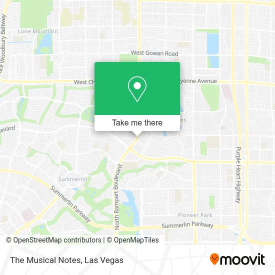
See The Musical Notes, Las Vegas, on the map
Public Transit to The Musical Notes in Las Vegas
Wondering how to get to The Musical Notes in Las Vegas? Moovit helps you find the best way to get to The Musical Notes with step-by-step directions from the nearest public transit station.
Moovit provides free maps and live directions to help you navigate through your city. View schedules, routes, timetables, and find out how long does it take to get to The Musical Notes in real time.
Looking for the nearest stop or station to The Musical Notes? Check out this list of stops closest to your destination: Wb Lake Mead After Harbor Island; Nb Rampart After Lake Mead.
Bus: 120, 210.
Want to see if there’s another route that gets you there at an earlier time? Moovit helps you find alternative routes or times. Get directions from and directions to The Musical Notes easily from the Moovit App or Website.
We make riding to The Musical Notes easy, which is why over 1.7 million users, including users in Las Vegas, trust Moovit as the best app for public transit. You don’t need to download an individual bus app or train app, Moovit is your all-in-one transit app that helps you find the best bus time or train time available.
For information on prices of bus, costs and ride fares to The Musical Notes, please check the Moovit app.
Use the app to navigate to popular places including to the airport, hospital, stadium, grocery store, mall, coffee shop, school, college, and university.
The Musical Notes Address: 2251 N Rampart Blvd #440 street in Las Vegas
- GPS,
- Lake Mead/Rampart,
- Claire M. Christy, DDS,
- The Meadows School,
- Sun City Summerlin,
- Village Pub,
- Anna Marie Mendoza Massage,
- Ernest Becker Middle School,
- Becker Middle School,
- Desert Shores Lake,
- St Elizabeth Ann Seton Catholic Church ,
- Saint Elizabeth Ann Seton Catholic Church,
- Revolution Retreat,
- Lake Mead And Buffalo,
- Cheyenne And Rampart/ Durango,
- TACO BELL,
- Chick-fil-A,
- Cheyenne @ Cimarron (W),
- Doreen Devine, Washington National Agent,
- Eos Fitness
Places Near The Musical Notes (Las Vegas)
- Walmart Supercenter, Las Vegas,
- Walmart, Las Vegas,
- Allegiant Stadium, Paradise,
- Zak Bagans Haunted Museum, Las Vegas,
- Welcome To Fabulous Las Vegas Sign, Paradise,
- Las Vegas Premium Outlets-North, Enterprise,
- Koolsville Tattoos, Las Vegas,
- Meow Wolf - Las Vegas (Meow Wolf's Omega Mart), Las Vegas,
- The Neon Museum, Las Vegas,
- Las Vegas South Premium Outlets, Enterprise,
- Omega Mart, Las Vegas,
- The Palms Casino Resort, Paradise,
- Trump International Hotel Las Vegas, Paradise,
- Las Vegas North Premium Outlets, Las Vegas,
- The Deuce Bus Stop at Fremont St, Las Vegas,
- Arte Museum Las Vegas, Paradise,
- Area15, Las Vegas,
- Lee Canyon, Las Vegas,
- Town Square, Enterprise,
- Gold & Silver Pawn Shop, Las Vegas
How to get to popular places in Las Vegas with public transit
Get around Las Vegas by public transit!
Traveling around Las Vegas has never been so easy. See step by step directions as you travel to any attraction, street or major public transit station. View bus and train schedules, arrival times, service alerts and detailed routes on a map, so you know exactly how to get to anywhere in Las Vegas.
When traveling to any destination around Las Vegas use Moovit's Live Directions with Get Off Notifications to know exactly where and how far to walk, how long to wait for your line, and how many stops are left. Moovit will alert you when it's time to get off — no need to constantly re-check whether yours is the next stop.
Wondering how to use public transit in Las Vegas or how to pay for public transit in Las Vegas? Moovit public transit app can help you navigate your way with public transit easily, and at minimum cost. It includes public transit fees, ticket prices, and costs. Looking for a map of Las Vegas public transit lines? Moovit public transit app shows all public transit maps in Las Vegas with all Bus and Monorail routes and stops on an interactive map.
Las Vegas has 2 transit type(s), including: Bus and Monorail, operated by several transit agencies, including RTCSNV, City of Las Vegas, Alvand Transportation, Vegas Airporter, Las Vegas Monorail, FlixBus-us and Greyhound-us