How to get to The Network by bus?
Click on the bus route to see step by step directions with maps, line arrival times and updated time schedules.
From The Cheesecake Factory, Washington
81 minFrom Montgomery College-Takoma Park/Silver Spring, Montgomery County
73 minFrom Comet Ping Pong, Washington
93 minFrom Brookside Gardens, Montgomery County
32 minFrom Consulado General de El Salvador en El Dmv, Montgomery County
52 minFrom Silver Spring Civic Building (Silver Spring Civic Center), Montgomery County
50 minFrom Walter Reed National Military Medical Center, Montgomery County
28 minFrom Chevy Chase Metro Plaza, Washington
89 minFrom St John's College High School, Washington
92 min
How to get to The Network by train?
Click on the train route to see step by step directions with maps, line arrival times and updated time schedules.
How to get to The Network by metro?
Click on the metro route to see step by step directions with maps, line arrival times and updated time schedules.
From The Cheesecake Factory, Washington
33 minFrom Montgomery College-Takoma Park/Silver Spring, Montgomery County
75 minFrom Comet Ping Pong, Washington
52 minFrom Brookside Gardens, Montgomery County
97 minFrom Consulado General de El Salvador en El Dmv, Montgomery County
77 minFrom Silver Spring Civic Building (Silver Spring Civic Center), Montgomery County
74 minFrom Walter Reed National Military Medical Center, Montgomery County
34 minFrom Chevy Chase Metro Plaza, Washington
34 min
Bus stops near The Network in Montgomery County
Train station near The Network in Montgomery County
- Kensington Marc Wb, 35 min walk,VIEW
Bus lines to The Network in Montgomery County
What are the closest stations to The Network?
The closest stations to The Network are:
- Parklawn Dr+Boiling Brook Pkwy is 231 yards away, 3 min walk.
- Parklawn Dr & Boiling Brook Pkwy is 336 yards away, 5 min walk.
- Randolph Rd & Putnam Rd is 1041 yards away, 13 min walk.
- Citadel Ave & Old Georgetown Rd is 1551 yards away, 19 min walk.
- Kensington Marc Wb is 2963 yards away, 35 min walk.
Which bus lines stop near The Network?
These bus lines stop near The Network: 38, M42, M44.
Which train line stops near The Network?
MARC (Inbound - Brunswick)
Which metro line stops near The Network?
RED (Shady Grove)
What’s the nearest bus station to The Network in Montgomery County?
The nearest bus station to The Network in Montgomery County is Parklawn Dr+Boiling Brook Pkwy. It’s a 3 min walk away.
What time is the first metro to The Network in Montgomery County?
The RED is the first metro that goes to The Network in Montgomery County. It stops nearby at 5:07 AM.
What time is the last metro to The Network in Montgomery County?
The RED is the last metro that goes to The Network in Montgomery County. It stops nearby at 12:35 AM.
What time is the first train to The Network in Montgomery County?
The MARC is the first train that goes to The Network in Montgomery County. It stops nearby at 5:45 AM.
What time is the last train to The Network in Montgomery County?
The MARC is the last train that goes to The Network in Montgomery County. It stops nearby at 7:45 PM.
What time is the first bus to The Network in Montgomery County?
The M12 is the first bus that goes to The Network in Montgomery County. It stops nearby at 4:18 AM.
What time is the last bus to The Network in Montgomery County?
The M12 is the last bus that goes to The Network in Montgomery County. It stops nearby at 2:04 AM.
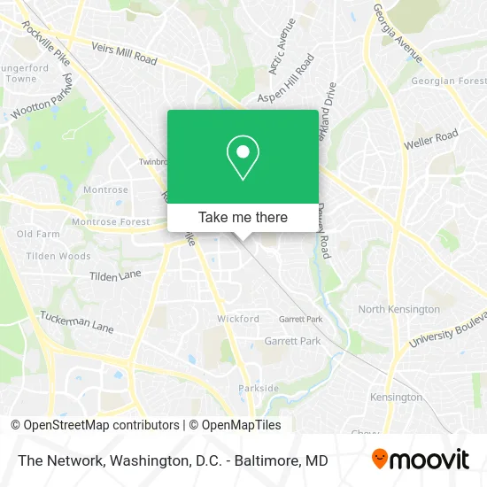
See The Network, Montgomery County, on the map
Public Transit to The Network in Montgomery County
Wondering how to get to The Network in Montgomery County? Moovit helps you find the best way to get to The Network with step-by-step directions from the nearest public transit station.
Moovit provides free maps and live directions to help you navigate through your city. View schedules, routes, timetables, and find out how long does it take to get to The Network in real time.
Looking for the nearest stop or station to The Network? Check out this list of stops closest to your destination: Parklawn Dr+Boiling Brook Pkwy; Parklawn Dr & Boiling Brook Pkwy; Randolph Rd & Putnam Rd; Citadel Ave & Old Georgetown Rd; Kensington Marc Wb.
Bus: 38, M42, M44, M12, 42.Train: MARC.Metro: RED.
Want to see if there’s another route that gets you there at an earlier time? Moovit helps you find alternative routes or times. Get directions from and directions to The Network easily from the Moovit App or Website.
We make riding to The Network easy, which is why over 1.5 million users, including users in Montgomery County, trust Moovit as the best app for public transit. You don’t need to download an individual bus app or train app, Moovit is your all-in-one transit app that helps you find the best bus time or train time available.
For information on prices of bus, metro and train, costs and ride fares to The Network, please check the Moovit app.
Use the app to navigate to popular places including to the airport, hospital, stadium, grocery store, mall, coffee shop, school, college, and university.
The Network Address: 11800 Coakley Cir Rockville, MD 20852 street in Montgomery County
- Bradyl Storage Solutions,
- White Flint Creations,
- Terra Site Co,
- Smolen-Emr-Ilkovitch,
- State Farm,
- Dpa Contractors LLC,
- Kos Johns,
- Center for Depression, Trauma, & Anxiety at Sandstone Care,
- Beber Camp,
- US-Colombia International Chamber of Commerce,
- Olympia Title LLC,
- Braude Law Group,
- Trans Time Express Team,
- Rockville Mental Health Center at Sandstone Care,
- Dr Johnson,
- Asap Graphics,
- Gallery 209,
- Hirsh Studio,
- Authentically U,
- SPT Wheels & Tires
Places Near The Network (Montgomery County)
- Warner Theatre, Washington,
- Museum Of The Bible, Washington,
- Rock Creek Tennis Center, Washington,
- Capital One Arena, Washington,
- Camden Yards, Baltimore,
- Washington National Cathedral, Washington,
- Amazon Hq2, Arlington County,
- Marriott Marquis Washington, DC, Washington,
- M&T Bank Stadium, Baltimore,
- National Zoo, Washington,
- Washington DC VA Medical Center, Washington,
- Basilica of the National Shrine, Washington,
- The Anthem, Washington,
- National Mall, Washington,
- Georgetown, Washington,
- Sibley Memorial Hospital, Washington,
- Pennsylvania Ave NW (3rd st and pennsylvania), Washington,
- Westfield Montgomery Mall, Montgomery County,
- National Museum of African American History and Culture, Washington,
- PG Mall, Prince George's County
How to get to popular places in Washington, D.C. - Baltimore, MD with public transit
Get around Montgomery County by public transit!
Traveling around Montgomery County has never been so easy. See step by step directions as you travel to any attraction, street or major public transit station. View bus and train schedules, arrival times, service alerts and detailed routes on a map, so you know exactly how to get to anywhere in Montgomery County.
When traveling to any destination around Montgomery County use Moovit's Live Directions with Get Off Notifications to know exactly where and how far to walk, how long to wait for your line, and how many stops are left. Moovit will alert you when it's time to get off — no need to constantly re-check whether yours is the next stop.
Wondering how to use public transit in Montgomery County or how to pay for public transit in Montgomery County? Moovit public transit app can help you navigate your way with public transit easily, and at minimum cost. It includes public transit fees, ticket prices, and costs. Looking for a map of Montgomery County public transit lines? Moovit public transit app shows all public transit maps in Montgomery County with all Bus, Train, Metro, Light Rail and Ferry routes and stops on an interactive map.
Washington, D.C. - Baltimore, MD has 5 transit type(s), including: Bus, Train, Metro, Light Rail and Ferry, operated by several transit agencies, including WMATA, Montgomery County Ride On, Fairfax Connector, TheBus, PRTC, DASH - Alexandria, Arlington Transit (ART), RTA of Central Maryland, MDOT MTA, MDOT MTA Light RailLink, MDOT MTA Commuter Bus, MDOT MTA Local Bus, FXBGO!, Virginia Railway Express (VRE) and MARC