How to get to The Oped Project by bus?
Click on the bus route to see step by step directions with maps, line arrival times and updated time schedules.
From Macy's, Queens
35 minFrom Red Rooster Harlem, Manhattan
66 minFrom Metro North Station, Yankee Stadium, Bronx
69 minFrom SeaGlass Carousel, Manhattan
41 minFrom 92nd Street Y, Manhattan
48 minFrom Fraunces Tavern, Manhattan
42 minFrom Rucker Park, Manhattan
76 minFrom MetLife Stadium, East Rutherford
59 minFrom Community Lines, Jersey City
77 min
How to get to The Oped Project by train?
Click on the train route to see step by step directions with maps, line arrival times and updated time schedules.
How to get to The Oped Project by subway?
Click on the subway route to see step by step directions with maps, line arrival times and updated time schedules.
Bus stops near The Oped Project in Manhattan
Train station near The Oped Project in Manhattan
- 23rd Street, 5 min walk,VIEW
Bus lines to The Oped Project in Manhattan
- M7, 14 St Via Columbus Via 7 Av,VIEW
- M20, South Ferry Via 7 Av Via Bat Pk City,VIEW
- SHORTLINE HUDSON, 500 - Monroe - Chester - Goshen,VIEW
- SHORTLINE HUDSON, 200 - Northern District – Nanuet,VIEW
- SHORTLINE HUDSON, 800 - Pennsylvania,VIEW
- SHORTLINE HUDSON, 700 - Newburgh - Poughkeepsie,VIEW
- SHORTLINE HUDSON, 300 - NYC - Middletown,VIEW
- DOWNTOWN LOCAL, W Houston & Mercer St,VIEW
- M23-SBS, Select Bus East Side Avenue C Crosstown,VIEW
- M55, 44 St 6 Av,VIEW
- SIM1C, Eltingville - Manhattan Express,VIEW
- SIM3, Pt. Richmond - Midtown Manhattan Express,VIEW
- SIM3C, Pt. Richmond - Manhattan Express,VIEW
- SIM10, Eltingville - Midtown Manhattan Express,VIEW
- Q32, Jackson Heights,VIEW
- M5, Limited Washington Heights Gw Bridge,VIEW
What are the closest stations to The Oped Project?
The closest stations to The Oped Project are:
- 7 Av/W 28 St is 89 yards away, 2 min walk.
- W 26th St & 7th Ave is 276 yards away, 4 min walk.
- W 23rd St & 6th Ave is 292 yards away, 4 min walk.
- 28 St is 355 yards away, 5 min walk.
- 6 Av/W 29 St is 358 yards away, 5 min walk.
- 23 St is 360 yards away, 5 min walk.
- 23rd Street is 374 yards away, 5 min walk.
- 6 Av/W 23 St is 384 yards away, 5 min walk.
- W 32 St/7 Av is 401 yards away, 5 min walk.
- W 31 St/6 Av is 474 yards away, 7 min walk.
Which bus lines stop near The Oped Project?
These bus lines stop near The Oped Project: BXM4, M20, M3, M55, M7, QM12, X37.
Which train lines stop near The Oped Project?
These train lines stop near The Oped Project: 2, EMPIRE SERVICE, YEL.
Which subway lines stop near The Oped Project?
These subway lines stop near The Oped Project: 1, B, N, Q, R.
What’s the nearest subway station to The Oped Project in Manhattan?
The nearest subway stations to The Oped Project in Manhattan are 28 St and 23 St. The closest one is a 5 min walk away.
What’s the nearest train station to The Oped Project in Manhattan?
The nearest train station to The Oped Project in Manhattan is 23rd Street. It’s a 5 min walk away.
What’s the nearest bus station to The Oped Project in Manhattan?
The nearest bus station to The Oped Project in Manhattan is 7 Av/W 28 St. It’s a 2 min walk away.
What time is the first subway to The Oped Project in Manhattan?
The Q is the first subway that goes to The Oped Project in Manhattan. It stops nearby at 3:00 AM.
What time is the last subway to The Oped Project in Manhattan?
The N is the last subway that goes to The Oped Project in Manhattan. It stops nearby at 3:58 AM.
What time is the first train to The Oped Project in Manhattan?
The ATW is the first train that goes to The Oped Project in Manhattan. It stops nearby at 3:18 AM.
What time is the last train to The Oped Project in Manhattan?
The ATW is the last train that goes to The Oped Project in Manhattan. It stops nearby at 3:18 AM.
What time is the first bus to The Oped Project in Manhattan?
The M23-SBS is the first bus that goes to The Oped Project in Manhattan. It stops nearby at 3:11 AM.
What time is the last bus to The Oped Project in Manhattan?
The M7 is the last bus that goes to The Oped Project in Manhattan. It stops nearby at 3:16 AM.
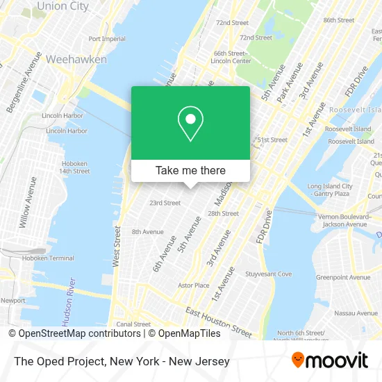
See The Oped Project, Manhattan, on the map
Public Transit to The Oped Project in Manhattan
Wondering how to get to The Oped Project in Manhattan? Moovit helps you find the best way to get to The Oped Project with step-by-step directions from the nearest public transit station.
Moovit provides free maps and live directions to help you navigate through your city. View schedules, routes, timetables, and find out how long does it take to get to The Oped Project in real time.
Looking for the nearest stop or station to The Oped Project? Check out this list of stops closest to your destination: 7 Av/W 28 St; W 26th St & 7th Ave; W 23rd St & 6th Ave; 28 St; 6 Av/W 29 St; 23 St; 23rd Street; 6 Av/W 23 St; W 32 St/7 Av; W 31 St/6 Av.
Bus: BXM4, M20, M3, M55, M7, QM12, X37, SHORTLINE HUDSON, SHORTLINE HUDSON, SHORTLINE HUDSON, SHORTLINE HUDSON, SHORTLINE HUDSON.Train: 2, EMPIRE SERVICE, YEL, ATW, BLU.Subway: 1, B, N, Q, R, D, F, FX, M, W, 2.
Want to see if there’s another route that gets you there at an earlier time? Moovit helps you find alternative routes or times. Get directions from and directions to The Oped Project easily from the Moovit App or Website.
We make riding to The Oped Project easy, which is why over 1.5 million users, including users in Manhattan, trust Moovit as the best app for public transit. You don’t need to download an individual bus app or train app, Moovit is your all-in-one transit app that helps you find the best bus time or train time available.
For information on prices of subway, bus and train, costs and ride fares to The Oped Project, please check the Moovit app.
Use the app to navigate to popular places including to the airport, hospital, stadium, grocery store, mall, coffee shop, school, college, and university.
The Oped Project Address: 121 W 27th St street in Manhattan
- Maid Marines,
- Post Lab One,
- Bhb Pest Elimination, Llc,
- A P A Sales Corp,
- Urban Studio Llc,
- Cult,
- Federal Loan Discharge,
- Iowa Sports Management,
- Hand Held Films Inc,
- Titmouse,
- Opus Virtual Offices,
- Advantage Cleaning Llc,
- New York Arts Program,
- Aaron Skinner,
- In•Glo Face and Body Sculpting Med Spa,
- Ode A La Rose,
- Fit Hit,
- DC Connect,
- Pure Moving Company Nyc Movers Local & Long Distance,
- Hana Kitchen
Places Near The Oped Project (Manhattan)
- Wall Street, Manhattan,
- 26 Federal Plaza, Manhattan,
- Rockefeller Center, Manhattan,
- SoHo, Manhattan,
- 3 Stone St, Manhattan,
- Times Square, Manhattan,
- Katz's Deli, Manhattan,
- Queens Center Mall, Queens,
- San Gennaro Feast, Manhattan,
- qqqq, Manhattan,
- 911 Memorial, Manhattan,
- Mountainside Hospital, Glen Ridge,
- 66 John Street, Manhattan,
- Hudson Yards, Manhattan,
- 1 Police Plaza, Manhattan,
- 111 Centre New York City Supreme Court, Manhattan,
- Chinatown, Manhattan,
- Pier 83, Manhattan,
- Bellevue Hospital, Manhattan,
- 376 Hudson Street, Manhattan
How to get to popular places in New York - New Jersey with public transit
Get around Manhattan by public transit!
Traveling around Manhattan has never been so easy. See step by step directions as you travel to any attraction, street or major public transit station. View bus and train schedules, arrival times, service alerts and detailed routes on a map, so you know exactly how to get to anywhere in Manhattan.
When traveling to any destination around Manhattan use Moovit's Live Directions with Get Off Notifications to know exactly where and how far to walk, how long to wait for your line, and how many stops are left. Moovit will alert you when it's time to get off — no need to constantly re-check whether yours is the next stop.
Wondering how to use public transit in Manhattan or how to pay for public transit in Manhattan? Moovit public transit app can help you navigate your way with public transit easily, and at minimum cost. It includes public transit fees, ticket prices, and costs. Looking for a map of Manhattan public transit lines? Moovit public transit app shows all public transit maps in Manhattan with all Bus, Train, Subway, Light Rail, Ferry and Cable Car routes and stops on an interactive map.
New York - New Jersey has 6 transit type(s), including: Bus, Train, Subway, Light Rail, Ferry and Cable Car, operated by several transit agencies, including MTA Subway, Metro-North Railroad, LIRR, PATH, MTA New York City Transit - Express routes, MTA Bus, NJ Transit, NYC Ferry, NICE bus, Bee-Line Bus, NJ Transit Rail, Norwalk Transit District, Hartford Line, River Valley Transit and HART