Directions to The Paper Store (Ramsey) with public transportation
The following transit lines have routes that pass near The Paper Store
 Bus: SHORTLINE HUDSON.
- Train: MCL, PJL.
How to get to The Paper Store by bus?
Click on the bus route to see step by step directions with maps, line arrival times and updated time schedules.
From Rockland #45 Express Bus to Port Authority Bus Terminal, NYC, Spring Valley
78 minFrom Bergen Community College, Paramus
117 minFrom Wayne, NJ, Wayne
165 minFrom Palisades mall, West Nyack
77 minFrom IKEA Paramus, Paramus
96 minFrom Paterson, NJ, Paterson
133 minFrom Paramus, NJ, Paramus
69 minFrom 11A Bus to Port Authority, Spring Valley
78 minFrom Garden State Plaza, Paramus
81 min
How to get to The Paper Store by train?
Click on the train route to see step by step directions with maps, line arrival times and updated time schedules.
Train station near The Paper Store in Ramsey
- Ramsey Main Street, 28 min walk,VIEW
What are the closest stations to The Paper Store?
The closest stations to The Paper Store are:
- Ramsey Main Street is 2350 yards away, 28 min walk.
Which bus line stops near The Paper Store?
SHORTLINE HUDSON (Mahwah)
Which train lines stop near The Paper Store?
These train lines stop near The Paper Store: MCL, PJL.
What’s the nearest train station to The Paper Store in Ramsey?
The nearest train station to The Paper Store in Ramsey is Ramsey Main Street. It’s a 28 min walk away.
What time is the first train to The Paper Store in Ramsey?
The MCL is the first train that goes to The Paper Store in Ramsey. It stops nearby at 4:55 AM.
What time is the last train to The Paper Store in Ramsey?
The MCL is the last train that goes to The Paper Store in Ramsey. It stops nearby at 2:36 AM.
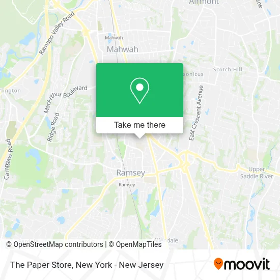
See The Paper Store, Ramsey, on the map
Public Transit to The Paper Store in Ramsey
Wondering how to get to The Paper Store in Ramsey? Moovit helps you find the best way to get to The Paper Store with step-by-step directions from the nearest public transit station.
Moovit provides free maps and live directions to help you navigate through your city. View schedules, routes, timetables, and find out how long does it take to get to The Paper Store in real time.
Looking for the nearest stop or station to The Paper Store? Check out this list of stops closest to your destination: Ramsey Main Street.
Bus: SHORTLINE HUDSON.Train: MCL, PJL.
Want to see if there’s another route that gets you there at an earlier time? Moovit helps you find alternative routes or times. Get directions from and directions to The Paper Store easily from the Moovit App or Website.
We make riding to The Paper Store easy, which is why over 1.5 million users, including users in Ramsey, trust Moovit as the best app for public transit. You don’t need to download an individual bus app or train app, Moovit is your all-in-one transit app that helps you find the best bus time or train time available.
For information on prices of bus and train, costs and ride fares to The Paper Store, please check the Moovit app.
Use the app to navigate to popular places including to the airport, hospital, stadium, grocery store, mall, coffee shop, school, college, and university.
The Paper Store Address: 36 Interstate Shop Ctr street in Ramsey
- European Wax Center,
- Shoprite Of Ramsey,
- Atm Cvs,
- Gnc,
- J.Crew Factory,
- Jo-Ann Fabric and Craft,
- Sprint,
- New York Pizza and Restaurant,
- Tropical Smoothie Cafe,
- Nothing Bundt Cakes,
- J.Crew Factory,
- 4ever Young Med Spa & Wellness Center -Ramsey,
- T-Mobile,
- Carter's,
- Chocolates With Love,
- Sprint Store,
- European Wax Center,
- Trinity Rehab - Ramsey, NJ,
- The Eyeglass Place,
- Belle Nail Ramsey
Places Near The Paper Store (Ramsey)
- SoHo, Manhattan,
- qqqq, Manhattan,
- 66 John Street, Manhattan,
- Katz's Deli, Manhattan,
- Hudson Yards, Manhattan,
- 111 Centre New York City Supreme Court, Manhattan,
- Wall Street, Manhattan,
- Chinatown, Manhattan,
- 3 Stone St, Manhattan,
- Bellevue Hospital, Manhattan,
- San Gennaro Feast, Manhattan,
- Mountainside Hospital, Glen Ridge,
- 911 Memorial, Manhattan,
- Times Square, Manhattan,
- 26 Federal Plaza, Manhattan,
- Queens Center Mall, Queens,
- Pier 83, Manhattan,
- Rockefeller Center, Manhattan,
- 376 Hudson Street, Manhattan,
- 1 Police Plaza, Manhattan
How to get to popular places in New York - New Jersey with public transit
Get around Ramsey by public transit!
Traveling around Ramsey has never been so easy. See step by step directions as you travel to any attraction, street or major public transit station. View bus and train schedules, arrival times, service alerts and detailed routes on a map, so you know exactly how to get to anywhere in Ramsey.
When traveling to any destination around Ramsey use Moovit's Live Directions with Get Off Notifications to know exactly where and how far to walk, how long to wait for your line, and how many stops are left. Moovit will alert you when it's time to get off — no need to constantly re-check whether yours is the next stop.
Wondering how to use public transit in Ramsey or how to pay for public transit in Ramsey? Moovit public transit app can help you navigate your way with public transit easily, and at minimum cost. It includes public transit fees, ticket prices, and costs. Looking for a map of Ramsey public transit lines? Moovit public transit app shows all public transit maps in Ramsey with all Bus, Train, Subway, Light Rail, Ferry and Cable Car routes and stops on an interactive map.
New York - New Jersey has 6 transit type(s), including: Bus, Train, Subway, Light Rail, Ferry and Cable Car, operated by several transit agencies, including MTA Subway, Metro-North Railroad, LIRR, PATH, MTA New York City Transit - Express routes, MTA Bus, NJ Transit, NYC Ferry, NICE bus, Bee-Line Bus, NJ Transit Rail, Norwalk Transit District, Hartford Line, River Valley Transit and HART