Directions to The Pink Plug (Norfolk) with public transportation
The following transit lines have routes that pass near The Pink Plug
 Bus: 015, 967, FLIXBUS N2601, 023, 020.
How to get to The Pink Plug by bus?
Click on the bus route to see step by step directions with maps, line arrival times and updated time schedules.
From Busch Gardens Williamsburg (Employee Parking Lot), James City County
252 minFrom Rose Gaming Resort, Prince William County
645 minFrom Hampton University, Hampton
80 minFrom Potomac Mills Mall, Prince William County
620 minFrom Amazon Fulfillment Center-Ric3, Richmond
234 minFrom Woodbridge, VA, Prince William County
570 min
Bus stops near The Pink Plug in Norfolk
Light Rail stations near The Pink Plug in Norfolk
- Military Highway Station, 35 min walk,VIEW
Bus lines to The Pink Plug in Norfolk
What are the closest stations to The Pink Plug?
The closest stations to The Pink Plug are:
- Janaf Shopping Center is 309 yards away, 5 min walk.
- Virginia Beach & Military is 697 yards away, 9 min walk.
- Glenrock & Virginia Beach is 1020 yards away, 13 min walk.
- Military Highway Station is 2900 yards away, 35 min walk.
Which bus lines stop near The Pink Plug?
These bus lines stop near The Pink Plug: 015, 967, FLIXBUS N2601.
What’s the nearest bus station to The Pink Plug in Norfolk?
The nearest bus station to The Pink Plug in Norfolk is Janaf Shopping Center. It’s a 5 min walk away.
What time is the first light rail to The Pink Plug in Norfolk?
The 800 is the first light rail that goes to The Pink Plug in Norfolk. It stops nearby at 5:27 AM.
What time is the last light rail to The Pink Plug in Norfolk?
The 800 is the last light rail that goes to The Pink Plug in Norfolk. It stops nearby at 11:54 PM.
What time is the first bus to The Pink Plug in Norfolk?
The 015 is the first bus that goes to The Pink Plug in Norfolk. It stops nearby at 5:19 AM.
What time is the last bus to The Pink Plug in Norfolk?
The 015 is the last bus that goes to The Pink Plug in Norfolk. It stops nearby at 1:00 AM.
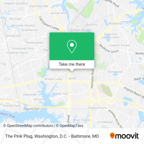
See The Pink Plug, Norfolk, on the map
Public Transit to The Pink Plug in Norfolk
Wondering how to get to The Pink Plug in Norfolk? Moovit helps you find the best way to get to The Pink Plug with step-by-step directions from the nearest public transit station.
Moovit provides free maps and live directions to help you navigate through your city. View schedules, routes, timetables, and find out how long does it take to get to The Pink Plug in real time.
Looking for the nearest stop or station to The Pink Plug? Check out this list of stops closest to your destination: Janaf Shopping Center; Virginia Beach & Military; Glenrock & Virginia Beach; Military Highway Station.
Bus: 015, 967, FLIXBUS N2601, 023, 020, 025.
Want to see if there’s another route that gets you there at an earlier time? Moovit helps you find alternative routes or times. Get directions from and directions to The Pink Plug easily from the Moovit App or Website.
We make riding to The Pink Plug easy, which is why over 1.5 million users, including users in Norfolk, trust Moovit as the best app for public transit. You don’t need to download an individual bus app or train app, Moovit is your all-in-one transit app that helps you find the best bus time or train time available.
For information on prices of bus, costs and ride fares to The Pink Plug, please check the Moovit app.
Use the app to navigate to popular places including to the airport, hospital, stadium, grocery store, mall, coffee shop, school, college, and university.
The Pink Plug Address: 1140 N Military Hwy Norfolk, VA 23502 street in Norfolk
- The Bounce House,
- Pioneer Services Military Loans - Hampton Roads,
- Panera Bread,
- Sprint,
- Janaf Crossing,
- Nail Ink,
- Wings N Things,
- Qdoba,
- Navy Federal Credit Union,
- Tesla,
- EVgo,
- Northern Tool + Equipment,
- PTR Investments,
- VIP Security,
- Little Caesars,
- BURGER KING,
- Chuck Norris Karate Studio,
- Credit Union 1,
- Kangaroo Express 3702,
- PNC Bank
Places Near The Pink Plug (Norfolk)
- Amazon Hq2, Arlington County,
- National Theatre, Washington,
- Camden Yards, Baltimore,
- Marriott Marquis Washington, DC, Washington,
- Georgetown, Washington,
- Pennsylvania Ave NW (3rd st and pennsylvania), Washington,
- Washington DC VA Medical Center, Washington,
- The Anthem, Washington,
- M&T Bank Stadium, Baltimore,
- Museum Of The Bible, Washington,
- Sibley Memorial Hospital, Washington,
- National Museum of African American History and Culture, Washington,
- Washington National Cathedral, Washington,
- Basilica of the National Shrine, Washington,
- Warner Theatre, Washington,
- National Zoo, Washington,
- Capital One Arena, Washington,
- Westfield Montgomery Mall, Montgomery County,
- PG Mall, Prince George's County,
- Rock Creek Tennis Center, Washington
How to get to popular places in Washington, D.C. - Baltimore, MD with public transit
Get around Norfolk by public transit!
Traveling around Norfolk has never been so easy. See step by step directions as you travel to any attraction, street or major public transit station. View bus and train schedules, arrival times, service alerts and detailed routes on a map, so you know exactly how to get to anywhere in Norfolk.
When traveling to any destination around Norfolk use Moovit's Live Directions with Get Off Notifications to know exactly where and how far to walk, how long to wait for your line, and how many stops are left. Moovit will alert you when it's time to get off — no need to constantly re-check whether yours is the next stop.
Wondering how to use public transit in Norfolk or how to pay for public transit in Norfolk? Moovit public transit app can help you navigate your way with public transit easily, and at minimum cost. It includes public transit fees, ticket prices, and costs. Looking for a map of Norfolk public transit lines? Moovit public transit app shows all public transit maps in Norfolk with all Bus, Train, Metro, Light Rail and Ferry routes and stops on an interactive map.
Washington, D.C. - Baltimore, MD has 5 transit type(s), including: Bus, Train, Metro, Light Rail and Ferry, operated by several transit agencies, including WMATA, Montgomery County Ride On, Fairfax Connector, TheBus, PRTC, DASH - Alexandria, Arlington Transit (ART), RTA of Central Maryland, MDOT MTA, MDOT MTA Light RailLink, MDOT MTA Commuter Bus, MDOT MTA Local Bus, FXBGO!, Virginia Railway Express (VRE) and MARC